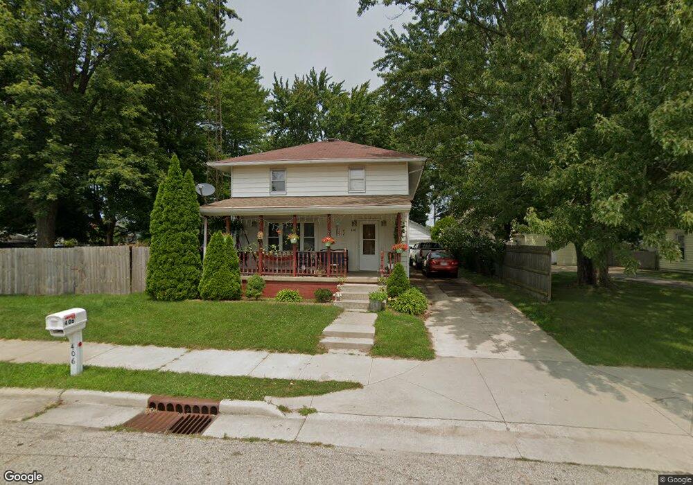
406 W North St Bourbon, IN 46504
Estimated Value: $201,000 - $224,000
3
Beds
2
Baths
2,775
Sq Ft
$76/Sq Ft
Est. Value
About This Home
This home is located at 406 W North St, Bourbon, IN 46504 and is currently estimated at $211,361, approximately $76 per square foot. 406 W North St is a home located in Marshall County with nearby schools including Triton Elementary School, Triton Junior-Senior High School, and Bourbon Christian School.
Ownership History
Date
Name
Owned For
Owner Type
Purchase Details
Closed on
May 5, 2008
Sold by
Federal Home Loan Mortgage Corporation
Bought by
Ulloa Aguinaldo A
Current Estimated Value
Home Financials for this Owner
Home Financials are based on the most recent Mortgage that was taken out on this home.
Original Mortgage
$78,764
Outstanding Balance
$48,534
Interest Rate
5.88%
Mortgage Type
FHA
Estimated Equity
$162,827
Purchase Details
Closed on
Jan 24, 2008
Sold by
Ward B Charlene
Bought by
Federal Home Loan Mortgage Corporation
Create a Home Valuation Report for This Property
The Home Valuation Report is an in-depth analysis detailing your home's value as well as a comparison with similar homes in the area
Purchase History
| Date | Buyer | Sale Price | Title Company |
|---|---|---|---|
| Ulloa Aguinaldo A | -- | None Available | |
| Federal Home Loan Mortgage Corporation | $93,833 | None Available |
Source: Public Records
Mortgage History
| Date | Status | Borrower | Loan Amount |
|---|---|---|---|
| Open | Ulloa Aguinaldo A | $78,764 |
Source: Public Records
Tax History
| Year | Tax Paid | Tax Assessment Tax Assessment Total Assessment is a certain percentage of the fair market value that is determined by local assessors to be the total taxable value of land and additions on the property. | Land | Improvement |
|---|---|---|---|---|
| 2025 | $1,678 | $205,100 | $19,100 | $186,000 |
| 2024 | $1,623 | $167,800 | $20,700 | $147,100 |
| 2022 | $1,623 | $157,800 | $19,500 | $138,300 |
| 2021 | $1,138 | $113,800 | $14,000 | $99,800 |
| 2020 | $1,125 | $112,500 | $14,000 | $98,500 |
| 2019 | $1,093 | $109,300 | $13,500 | $95,800 |
| 2018 | $1,124 | $112,400 | $13,000 | $99,400 |
| 2017 | $1,080 | $108,000 | $12,600 | $95,400 |
| 2016 | $1,080 | $108,000 | $12,600 | $95,400 |
| 2014 | $1,009 | $100,900 | $11,900 | $89,000 |
Source: Public Records
Map
Nearby Homes
- 600 W Liberty Ave
- 301 E Center St
- 516 S Main St
- 116 S Walnut St
- 6974 Lincoln Hwy
- 10682 Hawthorn Rd Unit 14
- 10647 Hawthorn Rd
- 29 State Road 10
- 9135 W 750 N
- 3303 Blackford Dr
- 11557 Jute Rd
- 2777 6th Rd
- 14229 Juniper Rd
- 3179 Center St
- *** S Juniper Rd
- 2983 N Murphy Ln
- 413 E Albert St
- 10595 Oriole Ln
- 10680 Robin Ln
- 7335 W 850 N
- 406 N Bourbon St
- 208 W Sunset Dr
- 408 N Bourbon St
- 405 N Thompson St
- 403 N Thompson St
- 403 N Bourbon St
- 407 N Bourbon St
- 409 N Bourbon St
- 401 N Thompson St
- 309 N Bourbon St
- 207 W Sunset Dr
- 208 W Liberty Ave
- 206 W Liberty Ave
- 501 N Bourbon St
- 501 N Thompson St
- 407 N Thompson St
- TBD N Thompson St
- 307 N Thompson St
- 107 W Liberty Ave
- 305 W North St
Your Personal Tour Guide
Ask me questions while you tour the home.