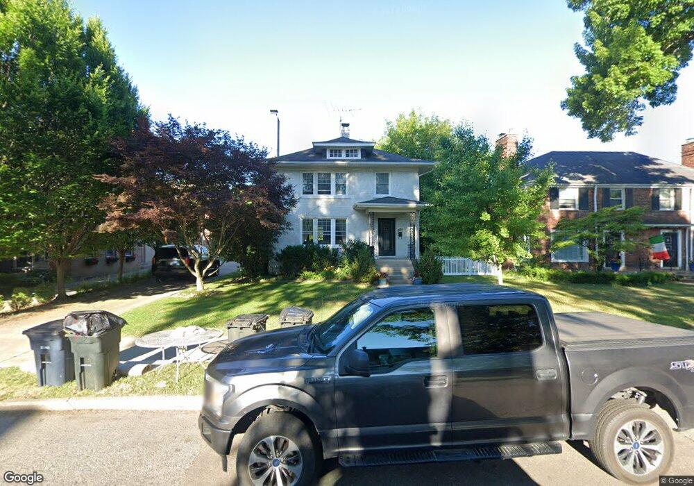
407 Neff Rd Grosse Pointe, MI 48230
Estimated Value: $388,000 - $558,000
Studio
--
Bath
1,932
Sq Ft
$229/Sq Ft
Est. Value
About This Home
This home is located at 407 Neff Rd, Grosse Pointe, MI 48230 and is currently estimated at $443,366, approximately $229 per square foot. 407 Neff Rd is a home located in Wayne County with nearby schools including Lewis Maire Elementary School, Pierce Middle School, and Grosse Pointe South High School.
Ownership History
Date
Name
Owned For
Owner Type
Purchase Details
Closed on
Jul 16, 2007
Sold by
Prophit Malcolm T
Bought by
Dely Mark C
Current Estimated Value
Purchase Details
Closed on
Feb 28, 2002
Sold by
Prophit Malcolm P and Prophit Nancy K
Bought by
Prophit Malcolm P
Create a Home Valuation Report for This Property
The Home Valuation Report is an in-depth analysis detailing your home's value as well as a comparison with similar homes in the area
Home Values in the Area
Average Home Value in this Area
Purchase History
| Date | Buyer | Sale Price | Title Company |
|---|---|---|---|
| Dely Mark C | $192,500 | Metropolitan Title Company | |
| Prophit Malcolm P | -- | None Available |
Source: Public Records
Tax History
| Year | Tax Paid | Tax Assessment Tax Assessment Total Assessment is a certain percentage of the fair market value that is determined by local assessors to be the total taxable value of land and additions on the property. | Land | Improvement |
|---|---|---|---|---|
| 2025 | $4,386 | $222,900 | $0 | $0 |
| 2024 | $4,239 | $207,200 | $0 | $0 |
| 2023 | $4,042 | $193,000 | $0 | $0 |
| 2022 | $7,409 | $192,100 | $0 | $0 |
| 2021 | $6,991 | $176,700 | $0 | $0 |
| 2019 | $6,881 | $136,300 | $0 | $0 |
| 2018 | $3,400 | $117,300 | $0 | $0 |
| 2017 | $5,907 | $116,100 | $0 | $0 |
| 2016 | $6,231 | $126,600 | $0 | $0 |
| 2015 | $9,703 | $125,800 | $0 | $0 |
| 2013 | $9,400 | $95,900 | $0 | $0 |
| 2012 | -- | $92,700 | $0 | $0 |
Source: Public Records
Map
Nearby Homes
- 379 Lakeland St
- 386 Notre Dame St
- 516 Neff Ln
- 42 Cranford Ln
- 47 Cranford Ln
- 11 Wellington Place
- 30 Cranford Ln
- 25 Village Ln
- 450 University Place
- 467 University Place
- 345 Roosevelt Place
- 296 Rivard Blvd
- 16761 E Jefferson Ave
- 1030 Bishop Rd
- 612 Cadieux Rd
- 277 Lincoln Rd
- 355 Lincoln Rd
- 29 Fisher Rd
- 11 Dodge Place
- 693 Saint Clair Ave
- 397 Neff Rd
- 399 Neff Rd
- 411 Neff Rd
- 411 Neff Rd
- 393 Neff Rd
- 413 Neff Rd
- 417 Neff Rd
- 389 Neff Rd Unit Bldg-Unit
- 389 Neff Rd
- 434 Saint Clair St
- 387 Neff Rd
- 422 Saint Clair St
- 422 St Clair
- 438 Saint Clair St
- 426 Saint Clair St
- 418 Saint Clair St
- 442 Saint Clair St
- 381 Neff Rd
- 379 Neff Rd
- 379 Neff Rd Unit 381
Your Personal Tour Guide
Ask me questions while you tour the home.