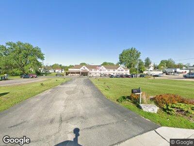
407 Rossville Rd Waukon, IA 52172
Estimated Value: $1,714,770
--
Bed
--
Bath
15,732
Sq Ft
$109/Sq Ft
Est. Value
About This Home
This home is located at 407 Rossville Rd, Waukon, IA 52172 and is currently estimated at $1,714,770, approximately $108 per square foot. 407 Rossville Rd is a home located in Allamakee County with nearby schools including West Campus Elementary School, East Campus Elementary School, and Waukon Middle School.
Ownership History
Date
Name
Owned For
Owner Type
Purchase Details
Closed on
Sep 21, 2020
Sold by
Stoney Creek Partners Of Waukon Lp
Bought by
Amd Hotel Llc
Current Estimated Value
Home Financials for this Owner
Home Financials are based on the most recent Mortgage that was taken out on this home.
Original Mortgage
$1,015,000
Interest Rate
2.9%
Mortgage Type
Commercial
Create a Home Valuation Report for This Property
The Home Valuation Report is an in-depth analysis detailing your home's value as well as a comparison with similar homes in the area
Home Values in the Area
Average Home Value in this Area
Purchase History
| Date | Buyer | Sale Price | Title Company |
|---|---|---|---|
| Amd Hotel Llc | $1,225,000 | None Available |
Source: Public Records
Mortgage History
| Date | Status | Borrower | Loan Amount |
|---|---|---|---|
| Open | Amd Hotel Llc | $950,000 | |
| Closed | Amd Hotel Llc | $1,015,000 | |
| Previous Owner | Stoney Creek Partners Of Waukon | $75,000 |
Source: Public Records
Tax History Compared to Growth
Tax History
| Year | Tax Paid | Tax Assessment Tax Assessment Total Assessment is a certain percentage of the fair market value that is determined by local assessors to be the total taxable value of land and additions on the property. | Land | Improvement |
|---|---|---|---|---|
| 2024 | $34,598 | $1,187,700 | $81,600 | $1,106,100 |
| 2023 | $34,598 | $1,187,700 | $81,600 | $1,106,100 |
| 2022 | $23,680 | $882,500 | $81,600 | $800,900 |
| 2021 | $22,402 | $882,500 | $81,600 | $800,900 |
| 2020 | $22,402 | $845,300 | $81,900 | $763,400 |
| 2019 | $22,520 | $856,900 | $0 | $0 |
| 2018 | $26,078 | $1,015,000 | $0 | $0 |
| 2017 | $26,078 | $978,565 | $0 | $0 |
| 2016 | $25,930 | $1,015,000 | $0 | $0 |
| 2015 | $940 | $978,565 | $0 | $0 |
| 2014 | $28,994 | $1,015,000 | $0 | $0 |
Source: Public Records
Map
Nearby Homes
- 0 SW 11th Ave Unit 20222752
- 0 Parcel Id#1031376005 Unit 20211907
- 0 Parcel Id#1031351004 Unit 20211906
- 0 Parcel Id#1031376012 Unit 20211905
- 0 Parcel Id#1031376013 Unit 20211902
- 0 Parcel Id#1031351006 Unit 20211900
- 0 Parcel Id#1031351007 Unit 20211899
- 0 Parcel Id#1506100051 Unit 20211897
- 504 3rd Ave SW
- 303 E Main St
- 107 5th St SW
- 315 4th Ave NW
- 4 9th St SW
- 1017 2nd St SW
- Lot 1 NW Off of 9th St
- Lot 5 NW St
- 922 2nd St NW
- XXX Iron Mine Dr
- 1128 Makee Dr
- 228 Old Highway 9
- 407 Rossville Rd
- Lot Sw
- 307 Rossville Rd
- 501 Rossville Rd
- 309 West St SW
- 403 West St SW
- 18 3rd Ave SW
- 307 West St SW
- 303 West St SW
- 301 Rossville Rd
- 406 West St SW
- 405 West St SW
- 310 Rossville Rd
- 408 West St SW
- 306 Rossville Rd
- 407 West St SW
- 402 Rossville Rd
- 310 1st St SW
- 23 5th Ave SW
- 215 West St SW