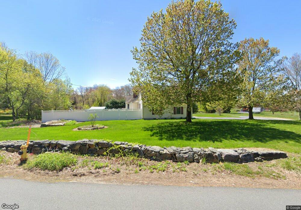
408 High Plain Rd Andover, MA 01810
Far West Andover NeighborhoodEstimated Value: $838,451 - $1,022,000
3
Beds
3
Baths
1,746
Sq Ft
$536/Sq Ft
Est. Value
About This Home
This home is located at 408 High Plain Rd, Andover, MA 01810 and is currently estimated at $936,363, approximately $536 per square foot. 408 High Plain Rd is a home located in Essex County with nearby schools including High Plain Elementary School, Wood Hill Middle School, and Andover High School.
Ownership History
Date
Name
Owned For
Owner Type
Purchase Details
Closed on
Nov 29, 2023
Sold by
Hill Scott and Hill Rebecca
Bought by
Hill Ft and Hill
Current Estimated Value
Purchase Details
Closed on
Jul 16, 1993
Sold by
Ekenbarger Barbara
Bought by
Hill Scott
Home Financials for this Owner
Home Financials are based on the most recent Mortgage that was taken out on this home.
Original Mortgage
$120,000
Interest Rate
7.16%
Create a Home Valuation Report for This Property
The Home Valuation Report is an in-depth analysis detailing your home's value as well as a comparison with similar homes in the area
Home Values in the Area
Average Home Value in this Area
Purchase History
| Date | Buyer | Sale Price | Title Company |
|---|---|---|---|
| Hill Ft | -- | None Available | |
| Hill Scott | $100,000 | -- |
Source: Public Records
Mortgage History
| Date | Status | Borrower | Loan Amount |
|---|---|---|---|
| Previous Owner | Hill Scott | $120,000 |
Source: Public Records
Tax History
| Year | Tax Paid | Tax Assessment Tax Assessment Total Assessment is a certain percentage of the fair market value that is determined by local assessors to be the total taxable value of land and additions on the property. | Land | Improvement |
|---|---|---|---|---|
| 2024 | $10,018 | $777,800 | $445,200 | $332,600 |
| 2023 | $9,615 | $703,900 | $401,200 | $302,700 |
| 2022 | $8,945 | $612,700 | $348,900 | $263,800 |
| 2021 | $8,595 | $562,100 | $317,100 | $245,000 |
| 2020 | $8,263 | $550,500 | $309,300 | $241,200 |
| 2019 | $8,198 | $536,900 | $300,200 | $236,700 |
| 2018 | $7,903 | $505,300 | $288,800 | $216,500 |
| 2017 | $7,576 | $499,100 | $283,200 | $215,900 |
| 2016 | $7,422 | $500,800 | $283,200 | $217,600 |
| 2015 | $7,171 | $479,000 | $272,300 | $206,700 |
Source: Public Records
Map
Nearby Homes
- 322 River Rd
- 29 Stoneybrook Cir
- 18 Ravens Bluff
- 2 Francis Dr Unit 405
- 4 Francis Dr Unit 312
- 4 Francis Dr Unit 207
- 2 Francis Dr Unit 301
- 46 Hopkins Cir
- 31 Varnum Ave
- 821 Merrimack Ave
- 22 Haggetts Pond Rd
- 20 Mount Pleasant St
- 30 Parker Rd
- 15 Geneva Rd
- 2 Weeping Willow Dr
- 14 Geneva Rd
- 4 Weeping Willow Dr
- 5 Weeping Willow Dr
- 750 Brookside Dr Unit G
- 20 Mount Joy Dr
- 410 High Plain Rd
- 1 Penni Ln
- 412 High Plain Rd
- 2 High Meadow Rd
- 407 High Plain Rd
- 1 High Meadow Rd
- 401 High Plain Rd
- 4 High Meadow Rd
- Lot 3 High Meadow Rd
- 416 High Plain Rd
- 231 Haggetts Pond Rd
- 3 High Meadow Rd
- 421 High Plain Rd
- 2 Penni Ln
- 397 High Plain Rd
- 5 Penni Ln
- 6 High Meadow Rd
- 20 Brady Loop
- 20 Brady Loop
- 4 Penni Ln
Your Personal Tour Guide
Ask me questions while you tour the home.