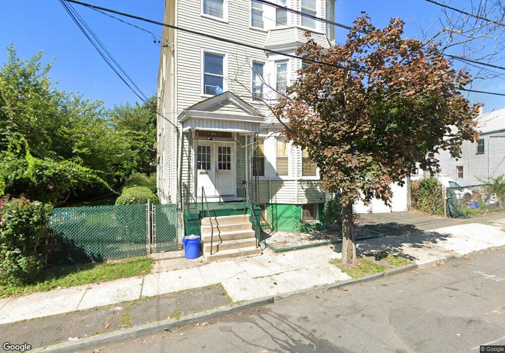
409 S 12th St Unit 413 Newark, NJ 07103
West Side NeighborhoodEstimated Value: $575,000 - $709,000
--
Bed
--
Bath
3,138
Sq Ft
$202/Sq Ft
Est. Value
About This Home
This home is located at 409 S 12th St Unit 413, Newark, NJ 07103 and is currently estimated at $633,123, approximately $201 per square foot. 409 S 12th St Unit 413 is a home located in Essex County with nearby schools including Hawthorne Avenue Elementary School, Louise A. Spencer School, and Belmont Runyon School.
Ownership History
Date
Name
Owned For
Owner Type
Purchase Details
Closed on
Jan 10, 2020
Sold by
Battle Hofler
Bought by
Battle Hofler
Current Estimated Value
Purchase Details
Closed on
Feb 19, 2004
Sold by
Hofler Helene
Bought by
Battle Milton Curtis and Battle Brenda Hofler
Home Financials for this Owner
Home Financials are based on the most recent Mortgage that was taken out on this home.
Original Mortgage
$133,850
Interest Rate
5.71%
Mortgage Type
FHA
Create a Home Valuation Report for This Property
The Home Valuation Report is an in-depth analysis detailing your home's value as well as a comparison with similar homes in the area
Home Values in the Area
Average Home Value in this Area
Purchase History
| Date | Buyer | Sale Price | Title Company |
|---|---|---|---|
| Battle Hofler | -- | None Available | |
| Battle Milton Curtis | $136,000 | -- |
Source: Public Records
Mortgage History
| Date | Status | Borrower | Loan Amount |
|---|---|---|---|
| Previous Owner | Battle Milton Curtis | $133,850 |
Source: Public Records
Tax History Compared to Growth
Tax History
| Year | Tax Paid | Tax Assessment Tax Assessment Total Assessment is a certain percentage of the fair market value that is determined by local assessors to be the total taxable value of land and additions on the property. | Land | Improvement |
|---|---|---|---|---|
| 2025 | $7,102 | $190,500 | $34,700 | $155,800 |
| 2024 | $7,102 | $190,500 | $34,700 | $155,800 |
| 2022 | $7,117 | $190,500 | $34,700 | $155,800 |
| 2021 | $7,113 | $190,500 | $34,700 | $155,800 |
| 2020 | $7,239 | $190,500 | $34,700 | $155,800 |
| 2019 | $7,165 | $190,500 | $34,700 | $155,800 |
| 2018 | $7,035 | $190,500 | $34,700 | $155,800 |
| 2017 | $6,782 | $190,500 | $34,700 | $155,800 |
| 2016 | $6,553 | $190,500 | $34,700 | $155,800 |
| 2015 | $6,304 | $190,500 | $34,700 | $155,800 |
| 2014 | $5,907 | $190,500 | $34,700 | $155,800 |
Source: Public Records
Map
Nearby Homes
- 431 S 14th St
- 436 S 11th St
- 438 S 11th St
- 461 S 14th St
- 406 S 15th St
- 414 S 10th St
- 407-409 S 15th St
- 407 S 15th St Unit 409
- 474 S 15th St Unit 2
- 440 S 16th St
- 388 S 9th St
- 474 15th Ave
- 413 S 16th St
- 489 15th Ave
- 327 S Orange Ave
- 265 S 8th St Unit 267
- 267 S 8th St
- 510 S 15th St
- 512 S 15th St
- 595 15th Ave
- 407 S 12th St
- 22 Ashland St
- 24 Ashland St Unit 26
- 405 S 12th St
- 405 S 12th St Unit 1
- 408 S 12th St Unit 412
- 20 Ashland St
- 18 Ashland St
- 26 Ashland St
- 241-243 14th Ave
- 241 14th Ave
- 239 14th Ave
- 252-258 14th Ave
- 237 14th Ave
- 395 S 11th St
- 427 S 12th St Unit 3
- 427 S 12th St
- 427 S 12th St Unit 1
- 389 S 11th St
- 235 14th Ave