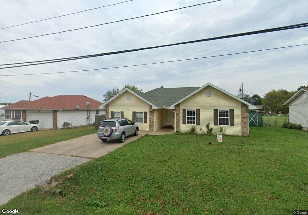
409 W High St Unit 1205857 Aurora, MO 65605
Estimated Value: $178,000 - $191,000
3
Beds
2
Baths
1,654
Sq Ft
$112/Sq Ft
Est. Value
About This Home
This home is located at 409 W High St Unit 1205857, Aurora, MO 65605 and is currently estimated at $185,061, approximately $111 per square foot. 409 W High St Unit 1205857 is a home located in Lawrence County with nearby schools including Pate Early Childhood Center, Robinson Intermediate School, and Robinson Elementary School.
Ownership History
Date
Name
Owned For
Owner Type
Purchase Details
Closed on
Apr 30, 2020
Sold by
Rivera Taylor
Bought by
Roberts Mickenzie J
Current Estimated Value
Home Financials for this Owner
Home Financials are based on the most recent Mortgage that was taken out on this home.
Original Mortgage
$122,000
Outstanding Balance
$109,982
Interest Rate
3.3%
Mortgage Type
USDA
Estimated Equity
$75,079
Purchase Details
Closed on
Sep 25, 2017
Sold by
Heit Karl and Perry Heit Karen
Bought by
Rivera Taylor
Home Financials for this Owner
Home Financials are based on the most recent Mortgage that was taken out on this home.
Original Mortgage
$86,111
Interest Rate
4.5%
Mortgage Type
FHA
Purchase Details
Closed on
Jan 29, 2015
Sold by
Secretary Of Veterans Affairs
Bought by
Heit Karl and Perry Heit Karen
Create a Home Valuation Report for This Property
The Home Valuation Report is an in-depth analysis detailing your home's value as well as a comparison with similar homes in the area
Home Values in the Area
Average Home Value in this Area
Purchase History
| Date | Buyer | Sale Price | Title Company |
|---|---|---|---|
| Roberts Mickenzie J | -- | None Available | |
| Rivera Taylor | -- | None Available | |
| Heit Karl | -- | None Available |
Source: Public Records
Mortgage History
| Date | Status | Borrower | Loan Amount |
|---|---|---|---|
| Open | Roberts Mickenzie J | $122,000 | |
| Previous Owner | Rivera Taylor | $86,111 | |
| Closed | Heit Karl | $0 |
Source: Public Records
Tax History Compared to Growth
Tax History
| Year | Tax Paid | Tax Assessment Tax Assessment Total Assessment is a certain percentage of the fair market value that is determined by local assessors to be the total taxable value of land and additions on the property. | Land | Improvement |
|---|---|---|---|---|
| 2025 | $988 | $19,730 | $2,360 | $17,370 |
| 2024 | $909 | $18,020 | $2,360 | $15,660 |
| 2023 | $904 | $18,020 | $2,360 | $15,660 |
| 2022 | $846 | $16,880 | $2,360 | $14,520 |
| 2021 | $847 | $16,880 | $2,360 | $14,520 |
| 2020 | $840 | $16,570 | $2,050 | $14,520 |
| 2019 | $825 | $16,570 | $2,050 | $14,520 |
| 2018 | $824 | $16,570 | $2,050 | $14,520 |
| 2017 | $820 | $16,570 | $2,050 | $14,520 |
| 2016 | -- | $15,140 | $2,050 | $13,090 |
| 2015 | -- | $15,140 | $2,050 | $13,090 |
| 2014 | -- | $15,140 | $2,050 | $13,090 |
Source: Public Records
Map
Nearby Homes
- 406 W Cline St
- 328 W Summit St
- 109 W Cline St
- 503 Mcnatt Ave
- Lot 2 Summit Grove Estates
- 225 Morgan Ave
- 15 E Cofield St
- 111 W Cofield St
- 238 E Delta St
- 112 N Madison Ave
- 311 W Pleasant St
- 304 E Cofield St
- 141 W Pleasant St
- 421 W College St
- 000 Crescent St
- 30 W College St
- 216 S Elliott Ave
- 308 W Church St
- 504 S Lincoln Ave
- 220 S Park Ave
- 409 W High St
- 411 W High St
- 411 W High St
- 405 W High St
- 836 Lovers Ln
- 401 W High St
- 866 Lovers Ln
- 406 W High St
- 420 W High St
- 402 W High St
- 319 W High St
- 508 W High St
- 328 W Hawthorne St
- 330 W Hawthorne St
- 330 W Hawthorne St Unit 1302240
- 326 W Hawthorne St
- 315 W High St
- 326 W High St
- 510 W High St
- 320 W Hawthorne St