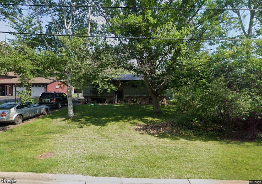
409 W Saint Andrews St Duluth, MN 55803
Hunters Park NeighborhoodEstimated Value: $375,678 - $485,000
3
Beds
2
Baths
1,810
Sq Ft
$233/Sq Ft
Est. Value
About This Home
This home is located at 409 W Saint Andrews St, Duluth, MN 55803 and is currently estimated at $421,920, approximately $233 per square foot. 409 W Saint Andrews St is a home located in St. Louis County with nearby schools including Lowell Elementary School, Ordean East Middle School, and East High School.
Ownership History
Date
Name
Owned For
Owner Type
Purchase Details
Closed on
Mar 18, 2007
Sold by
Monahan Sharon P
Bought by
Spenningsby Kristopher J and Spenningsby Kelly J
Current Estimated Value
Home Financials for this Owner
Home Financials are based on the most recent Mortgage that was taken out on this home.
Original Mortgage
$169,900
Outstanding Balance
$102,271
Interest Rate
6.25%
Mortgage Type
Purchase Money Mortgage
Estimated Equity
$319,649
Create a Home Valuation Report for This Property
The Home Valuation Report is an in-depth analysis detailing your home's value as well as a comparison with similar homes in the area
Home Values in the Area
Average Home Value in this Area
Purchase History
| Date | Buyer | Sale Price | Title Company |
|---|---|---|---|
| Spenningsby Kristopher J | $199,900 | Arrowhead |
Source: Public Records
Mortgage History
| Date | Status | Borrower | Loan Amount |
|---|---|---|---|
| Open | Spenningsby Kristopher J | $169,900 |
Source: Public Records
Tax History
| Year | Tax Paid | Tax Assessment Tax Assessment Total Assessment is a certain percentage of the fair market value that is determined by local assessors to be the total taxable value of land and additions on the property. | Land | Improvement |
|---|---|---|---|---|
| 2024 | $4,520 | $329,100 | $52,400 | $276,700 |
| 2023 | $4,520 | $335,300 | $41,300 | $294,000 |
| 2022 | $4,116 | $291,700 | $35,900 | $255,800 |
| 2021 | $3,956 | $249,200 | $30,800 | $218,400 |
| 2020 | $3,954 | $244,500 | $30,200 | $214,300 |
| 2019 | $3,632 | $237,500 | $30,200 | $207,300 |
| 2018 | $3,346 | $219,700 | $30,800 | $188,900 |
| 2017 | $3,516 | $216,300 | $30,600 | $185,700 |
| 2016 | $3,318 | $146,300 | $31,300 | $115,000 |
| 2015 | $3,006 | $194,400 | $31,500 | $162,900 |
| 2014 | $3,006 | $170,700 | $4,100 | $166,600 |
Source: Public Records
Map
Nearby Homes
- 2234 Dunedin Ave
- 2xxx Harvard Ave
- 2233 Woodland Ave
- 2015 Woodland Ave
- 2702 Woodland Ave
- 215 W Arrowhead Rd
- 1745 Carver Ave
- 907 Mellwood Ave
- 1011 W Arrowhead Rd
- 1609 Woodbury Ln
- 1205 W Arrowhead Rd
- 2610 E 8th St
- 3406 E 4th St
- 560 Marshall St
- 204 W Faribault St
- 124 N Hawthorne Rd
- 126 E Niagara St
- 116 E Niagara St
- 2815 E 2nd St
- 110 E Chisholm St
- 2201 Harvard Ave
- 415 W Saint Andrews St
- 2203 Harvard Ave
- 2147 Harvard Ave
- 423 W Saint Andrews St
- 420 W Saint Andrews St
- Lot on Harvard Ave
- XXX Harvard Ave
- 2202 Harvard Ave
- 2140 Dunedin Ave
- 2220 Dunedin Ave
- 2144 Harvard Ave
- 2201 Dunedin Ave
- 2129 Harvard Ave
- 2205 Dunedin Ave
- 2215 Dunedin Ave
- 2213 Dunedin Ave
- 2134 Dunedin Ave
- 2134 Harvard Ave
- 2134 Harvard Ave Unit 2134 Harvard Ave.
Your Personal Tour Guide
Ask me questions while you tour the home.