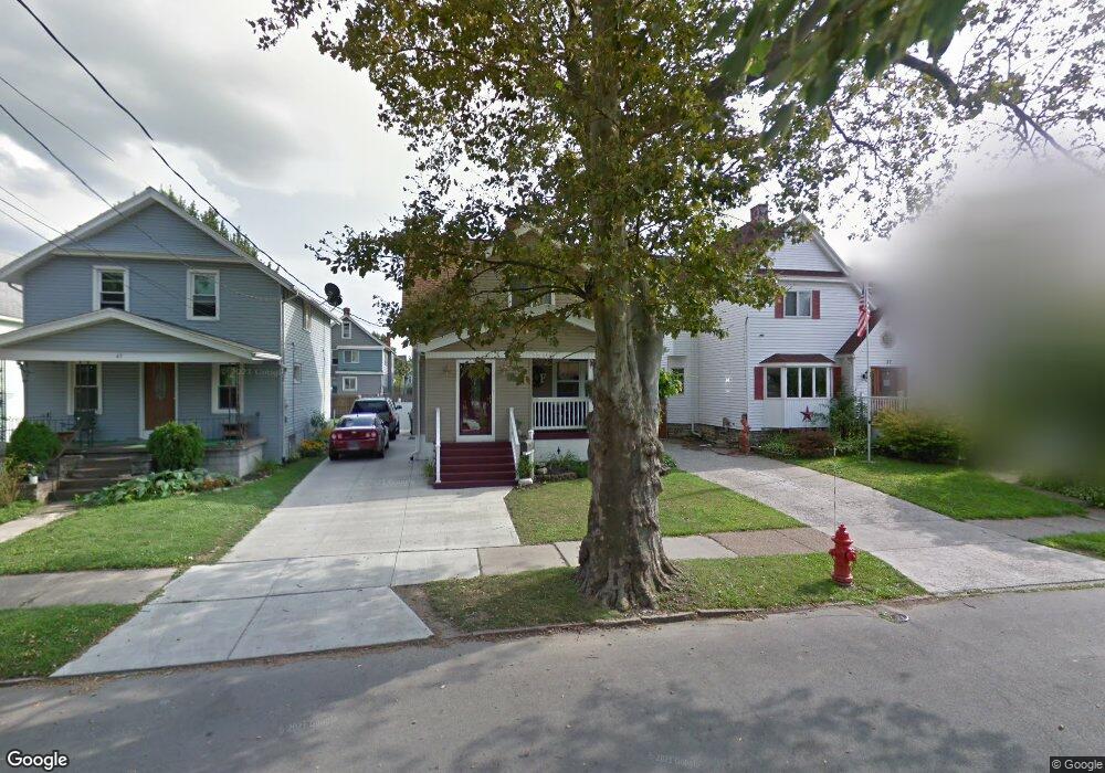
41 Bloomfield Ave Buffalo, NY 14220
South Park NeighborhoodEstimated Value: $193,889 - $240,000
3
Beds
1
Bath
1,014
Sq Ft
$213/Sq Ft
Est. Value
About This Home
This home is located at 41 Bloomfield Ave, Buffalo, NY 14220 and is currently estimated at $216,472, approximately $213 per square foot. 41 Bloomfield Ave is a home located in Erie County with nearby schools including Western New York Maritime Charter School, Bishop Timon-St. Jude High School, and Mount Mercy Academy.
Ownership History
Date
Name
Owned For
Owner Type
Purchase Details
Closed on
May 24, 2005
Sold by
Catalano Susan A
Bought by
Ferris Robert J
Current Estimated Value
Home Financials for this Owner
Home Financials are based on the most recent Mortgage that was taken out on this home.
Original Mortgage
$68,000
Outstanding Balance
$39,470
Interest Rate
7.65%
Mortgage Type
Fannie Mae Freddie Mac
Estimated Equity
$177,002
Purchase Details
Closed on
Jun 9, 1998
Sold by
Estate Davis Mary C
Bought by
Ferris Robert J and Catalano Susan A
Create a Home Valuation Report for This Property
The Home Valuation Report is an in-depth analysis detailing your home's value as well as a comparison with similar homes in the area
Home Values in the Area
Average Home Value in this Area
Purchase History
| Date | Buyer | Sale Price | Title Company |
|---|---|---|---|
| Ferris Robert J | -- | -- | |
| Ferris Robert J | $58,000 | -- |
Source: Public Records
Mortgage History
| Date | Status | Borrower | Loan Amount |
|---|---|---|---|
| Open | Ferris Robert J | $68,000 |
Source: Public Records
Tax History Compared to Growth
Tax History
| Year | Tax Paid | Tax Assessment Tax Assessment Total Assessment is a certain percentage of the fair market value that is determined by local assessors to be the total taxable value of land and additions on the property. | Land | Improvement |
|---|---|---|---|---|
| 2024 | $409 | $73,000 | $10,700 | $62,300 |
| 2023 | $370 | $73,000 | $10,700 | $62,300 |
| 2022 | $367 | $73,000 | $10,700 | $62,300 |
| 2021 | $367 | $73,000 | $10,700 | $62,300 |
| 2020 | $423 | $73,000 | $10,700 | $62,300 |
| 2019 | $1,509 | $55,000 | $6,600 | $48,400 |
| 2018 | $1,420 | $55,000 | $6,600 | $48,400 |
| 2017 | $327 | $55,000 | $6,600 | $48,400 |
| 2016 | $1,022 | $55,000 | $6,600 | $48,400 |
| 2015 | -- | $55,000 | $6,600 | $48,400 |
| 2014 | -- | $55,000 | $6,600 | $48,400 |
Source: Public Records
Map
Nearby Homes
- 66 Choate Ave
- 53 Richfield Ave
- 53 Choate Ave
- 32 Richfield Ave
- 117 Bloomfield Ave
- 190 Crystal Ave
- 95 Columbus Ave
- 166 Amber St
- 2065 S Park Ave
- 51 Olcott Ave
- 155 Altruria St
- 889 Tifft St
- 189 W Woodside Ave
- 89 Mariemont Ave
- 29 Allegany St
- 16 Lorraine Ave
- 52 Harding Rd
- 37 Alsace Ave
- 33 Harding Rd
- 30 Strathmore Ave
- 37 Bloomfield Ave
- 45 Bloomfield Ave
- 33 Bloomfield Ave
- 49 Bloomfield Ave
- 31 Bloomfield Ave
- 53 Bloomfield Ave
- 42 Choate Ave
- 38 Choate Ave
- 48 Choate Ave
- 27 Bloomfield Ave
- 50 Choate Ave
- 57 Bloomfield Ave
- 25 Bloomfield Ave
- 30 Choate Ave
- 54 Choate Ave
- 42 Bloomfield Ave
- 46 Bloomfield Ave
- 38 Bloomfield Ave
- 36 Bloomfield Ave
- 50 Bloomfield Ave