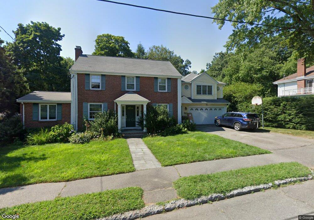
41 Risley Rd West Newton, MA 02465
West Newton NeighborhoodEstimated Value: $1,223,000 - $2,629,000
4
Beds
4
Baths
2,953
Sq Ft
$690/Sq Ft
Est. Value
About This Home
This home is located at 41 Risley Rd, West Newton, MA 02465 and is currently estimated at $2,037,459, approximately $689 per square foot. 41 Risley Rd is a home located in Middlesex County with nearby schools including Peirce Elementary School, F.A. Day Middle School, and Newton North High School.
Ownership History
Date
Name
Owned For
Owner Type
Purchase Details
Closed on
Jul 31, 1997
Sold by
Daniels William B and Suna Joann
Bought by
Norton Daniel and Norton Vita
Current Estimated Value
Purchase Details
Closed on
Jul 1, 1991
Sold by
Warshaver Charles M and Warshaver Sharon
Bought by
Daniels William B and Suna Jo-Ann
Purchase Details
Closed on
Jun 9, 1988
Sold by
Hootstein Melvin J
Bought by
Warshaver Charles M
Create a Home Valuation Report for This Property
The Home Valuation Report is an in-depth analysis detailing your home's value as well as a comparison with similar homes in the area
Home Values in the Area
Average Home Value in this Area
Purchase History
| Date | Buyer | Sale Price | Title Company |
|---|---|---|---|
| Norton Daniel | $483,000 | -- | |
| Daniels William B | $369,000 | -- | |
| Warshaver Charles M | $350,000 | -- |
Source: Public Records
Mortgage History
| Date | Status | Borrower | Loan Amount |
|---|---|---|---|
| Open | Warshaver Charles M | $523,750 | |
| Closed | Warshaver Charles M | $30,000 |
Source: Public Records
Tax History Compared to Growth
Tax History
| Year | Tax Paid | Tax Assessment Tax Assessment Total Assessment is a certain percentage of the fair market value that is determined by local assessors to be the total taxable value of land and additions on the property. | Land | Improvement |
|---|---|---|---|---|
| 2025 | $18,714 | $1,909,600 | $1,287,800 | $621,800 |
| 2024 | $18,095 | $1,854,000 | $1,250,300 | $603,700 |
| 2023 | $17,280 | $1,697,400 | $973,600 | $723,800 |
| 2022 | $16,534 | $1,571,700 | $901,500 | $670,200 |
| 2021 | $15,954 | $1,482,700 | $850,500 | $632,200 |
| 2020 | $15,479 | $1,482,700 | $850,500 | $632,200 |
| 2019 | $15,043 | $1,439,500 | $825,700 | $613,800 |
| 2018 | $14,634 | $1,352,500 | $746,600 | $605,900 |
| 2017 | $14,188 | $1,275,900 | $704,300 | $571,600 |
| 2016 | $13,570 | $1,192,400 | $658,200 | $534,200 |
| 2015 | $12,938 | $1,114,400 | $615,100 | $499,300 |
Source: Public Records
Map
Nearby Homes
- 73 Valentine St
- 97 Valentine St
- 19 Gordon Rd
- 55 Evelyn Rd
- 155 Paulson Rd
- 55 Grove Hill Park
- 18 Sewall St
- 40 Sewall St
- 1430 Beacon St
- 1114 Beacon St Unit 203
- 1114 Beacon St Unit 111
- 1114 Beacon St Unit 104
- 1114 Beacon St Unit 207
- 26 Wilson Cir Unit 26
- 29 Montclair Rd
- 28 Wilson Cir Unit 28
- 32 Wilson Cir Unit 32
- 123 Mount Vernon St Unit 2
- 123-125 Mount Vernon St
- 115 Windsor Rd
- 33 Risley Rd
- 318 Prince St
- 1253 Commonwealth Ave
- 34 Risley Rd
- 308 Prince St
- 23 Risley Rd
- 55 Colbert Rd E
- 45 Colbert Rd E
- 20 Risley Rd
- 65 Wauwinet Rd
- 300 Prince St
- 1245 Commonwealth Ave
- 1245 Commonwealth Ave
- 1256 Commonwealth Ave
- 1270 Commonwealth Ave
- 67 Colbert Rd E
- 1246 Commonwealth Ave
- 1280 Commonwealth Ave
- 39 Colbert Rd E
- 55 Wauwinet Rd