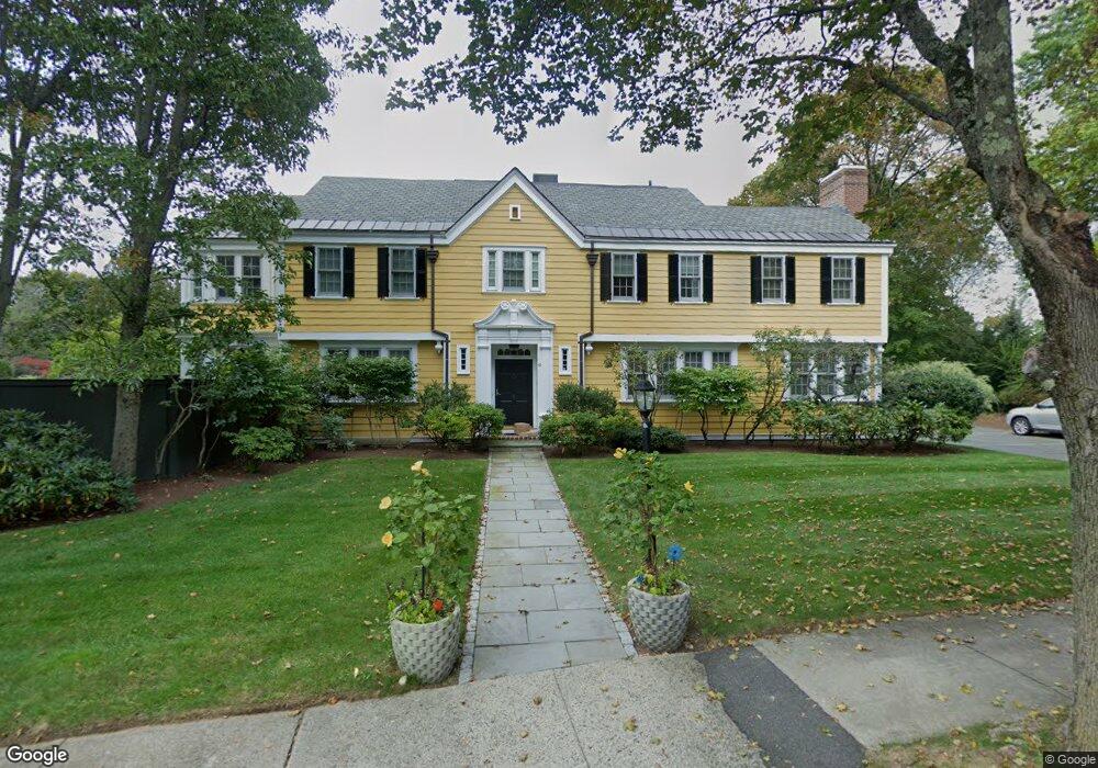
41 Wamesit Rd Waban, MA 02468
Waban NeighborhoodEstimated Value: $2,935,069 - $3,305,000
8
Beds
5
Baths
5,397
Sq Ft
$576/Sq Ft
Est. Value
About This Home
This home is located at 41 Wamesit Rd, Waban, MA 02468 and is currently estimated at $3,111,017, approximately $576 per square foot. 41 Wamesit Rd is a home located in Middlesex County with nearby schools including Angier Elementary School, Charles E Brown Middle School, and Newton South High School.
Ownership History
Date
Name
Owned For
Owner Type
Purchase Details
Closed on
Aug 4, 2017
Sold by
Korn Karen R
Bought by
Karen R Korn 1998 T
Current Estimated Value
Purchase Details
Closed on
Jul 3, 2003
Sold by
Glidden James L P and Glidden Elizabeth B
Bought by
Korn Karen R
Purchase Details
Closed on
Nov 1, 1994
Sold by
Givens Patricia P
Bought by
James Lp Glidden
Home Financials for this Owner
Home Financials are based on the most recent Mortgage that was taken out on this home.
Original Mortgage
$512,000
Interest Rate
8.65%
Mortgage Type
Purchase Money Mortgage
Create a Home Valuation Report for This Property
The Home Valuation Report is an in-depth analysis detailing your home's value as well as a comparison with similar homes in the area
Home Values in the Area
Average Home Value in this Area
Purchase History
| Date | Buyer | Sale Price | Title Company |
|---|---|---|---|
| Karen R Korn 1998 T | -- | -- | |
| Korn Karen R | $1,190,000 | -- | |
| James Lp Glidden | $640,000 | -- |
Source: Public Records
Mortgage History
| Date | Status | Borrower | Loan Amount |
|---|---|---|---|
| Previous Owner | James Lp Glidden | $490,000 | |
| Previous Owner | James Lp Glidden | $495,000 | |
| Previous Owner | James Lp Glidden | $512,000 |
Source: Public Records
Tax History
| Year | Tax Paid | Tax Assessment Tax Assessment Total Assessment is a certain percentage of the fair market value that is determined by local assessors to be the total taxable value of land and additions on the property. | Land | Improvement |
|---|---|---|---|---|
| 2025 | $28,098 | $2,867,100 | $1,497,500 | $1,369,600 |
| 2024 | $27,168 | $2,783,600 | $1,453,900 | $1,329,700 |
| 2023 | $26,299 | $2,583,400 | $1,143,000 | $1,440,400 |
| 2022 | $25,164 | $2,392,000 | $1,058,300 | $1,333,700 |
| 2021 | $4,709 | $2,256,600 | $998,400 | $1,258,200 |
| 2020 | $23,559 | $2,256,600 | $998,400 | $1,258,200 |
| 2019 | $22,895 | $2,190,900 | $969,300 | $1,221,600 |
| 2018 | $22,490 | $2,078,600 | $870,400 | $1,208,200 |
| 2017 | $21,805 | $1,960,900 | $821,100 | $1,139,800 |
| 2016 | $20,855 | $1,832,600 | $767,400 | $1,065,200 |
| 2015 | $19,884 | $1,712,700 | $717,200 | $995,500 |
Source: Public Records
Map
Nearby Homes
- 0 Metacomet Rd
- 33 Metacomet Rd
- 91 Waban Ave
- 31 Wilde Rd
- 20 Kinmonth Rd Unit 203
- 20 Kinmonth Rd Unit 306
- 20 Kinmonth Rd Unit 4
- 64 Varick Rd
- 177 Varick Rd
- 26 Varick Hill Rd
- 115 Windsor Rd
- 29 Montclair Rd
- 447 Waban Ave
- 110 Avalon Rd
- 34 Larchmont Ave
- 18 Moffat Rd
- 32 Lantern Ln
- 1438 Beacon St
- 15 Gammons Rd
- 1754 Washington St
- 30 Winnetaska Rd
- 29 Wamesit Rd
- 24 Winnetaska Rd
- 6 Owaisa Rd
- 36 Wamesit Rd
- 0 Beacon Unit 71959628
- 0 Beacon Unit 72010853
- 0 Beacon Unit 71943528
- 0 Beacon Unit 72010851
- 1818 Beacon St
- 21 Wamesit Rd
- 28 Wamesit Rd
- 16 Winnetaska Rd
- 1806 Beacon St
- 1830 Beacon St
- 39 Locke Rd
- 1791 Beacon St
- 1835 Beacon St
- 12 Owaisa Rd
- 31 Locke Rd
Your Personal Tour Guide
Ask me questions while you tour the home.