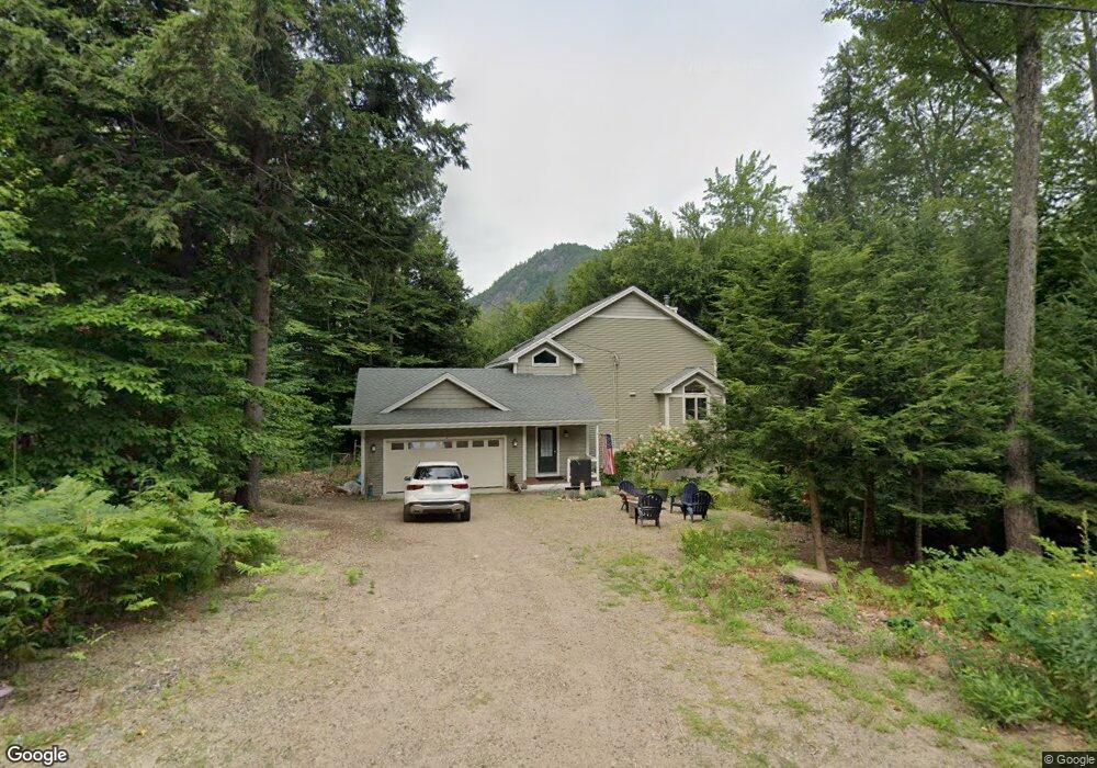
41 Whites Ledge Ln Bartlett, NH 03812
Estimated Value: $650,000 - $810,000
3
Beds
3
Baths
2,593
Sq Ft
$280/Sq Ft
Est. Value
About This Home
This home is located at 41 Whites Ledge Ln, Bartlett, NH 03812 and is currently estimated at $725,213, approximately $279 per square foot. 41 Whites Ledge Ln is a home with nearby schools including Josiah Bartlett Elementary School.
Ownership History
Date
Name
Owned For
Owner Type
Purchase Details
Closed on
Sep 25, 2024
Sold by
Walraven Peter E and Walraven Amy B
Bought by
Dougherty Elizabeth
Current Estimated Value
Home Financials for this Owner
Home Financials are based on the most recent Mortgage that was taken out on this home.
Original Mortgage
$320,000
Outstanding Balance
$316,724
Interest Rate
6.49%
Mortgage Type
Purchase Money Mortgage
Estimated Equity
$408,489
Purchase Details
Closed on
Nov 16, 2005
Sold by
Weigold 3Rd George J and Weigold Karen G
Bought by
Walraven Peter E and Walraven Amy B
Create a Home Valuation Report for This Property
The Home Valuation Report is an in-depth analysis detailing your home's value as well as a comparison with similar homes in the area
Home Values in the Area
Average Home Value in this Area
Purchase History
| Date | Buyer | Sale Price | Title Company |
|---|---|---|---|
| Dougherty Elizabeth | $710,000 | None Available | |
| Dougherty Elizabeth | $710,000 | None Available | |
| Walraven Peter E | $387,500 | -- | |
| Walraven Peter E | $387,500 | -- |
Source: Public Records
Mortgage History
| Date | Status | Borrower | Loan Amount |
|---|---|---|---|
| Open | Dougherty Elizabeth | $320,000 | |
| Closed | Dougherty Elizabeth | $320,000 | |
| Previous Owner | Walraven Peter E | $256,000 |
Source: Public Records
Tax History Compared to Growth
Tax History
| Year | Tax Paid | Tax Assessment Tax Assessment Total Assessment is a certain percentage of the fair market value that is determined by local assessors to be the total taxable value of land and additions on the property. | Land | Improvement |
|---|---|---|---|---|
| 2024 | $3,389 | $607,400 | $116,700 | $490,700 |
| 2023 | $3,134 | $607,400 | $116,700 | $490,700 |
| 2022 | $3,019 | $607,400 | $116,700 | $490,700 |
| 2021 | $3,479 | $365,100 | $135,700 | $229,400 |
| 2020 | $3,527 | $365,100 | $135,700 | $229,400 |
| 2019 | $3,410 | $365,100 | $135,700 | $229,400 |
| 2018 | $3,333 | $365,100 | $135,700 | $229,400 |
| 2016 | $2,477 | $260,700 | $65,100 | $195,600 |
| 2015 | $2,487 | $260,700 | $65,100 | $195,600 |
| 2014 | $2,552 | $260,700 | $65,100 | $195,600 |
| 2010 | $2,423 | $264,800 | $61,400 | $203,400 |
Source: Public Records
Map
Nearby Homes
- 17 Pickering Rd
- 791 W Side Rd
- 4 Seasons at Attitash Rd Unit D
- 12G Seasons at Attitash Rd
- 1 Seasons at Attitash Rd
- 2 Seasons at Attitash Rd
- 41 Linden Rd
- 31 Cave Mountain Rd
- 17 The Meadows Rd
- 30 Top Notch Rd Unit 30
- 46 Ammonoosuc Dr
- 166 U S 302
- 2E/F River Run Dr Unit E/F
- 8 River Run Dr Unit J
- 8 River Run Dr Unit H
- 8 River Run Dr Unit G
- 10 River Run Dr Unit G
- 419 Glen Ledge Rd
- N2 Sandtrap Loop Unit 2
- 00 Tall Woods Loop Unit 9
- 41 Whites Ledge Ln
- 39 Whites Ledge Ln
- 178 Covered Bridge Ln
- 191 Covered Bridge Ln
- 261 Covered Bridge Ln
- 40 Whites Ledge Ln
- 194 Covered Bridge Ln
- 46 Whites Ledge Ln
- 197 Covered Bridge Ln
- 203 Covered Bridge Ln
- 31 Whites Ledge Ln
- 223 Covered Bridge Ln
- 30 Whites Ledge Ln
- 193 Covered Bridge Ln
- 215 Covered Bridge Ln
- 87 Oak Ridge Rd
- 40 Whites Ledge Ln
- 35 Whites Ledge Ln
- 191 Covered Bridge Ln
- 264 Covered Bridge Ln