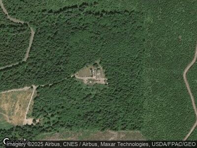
410 NE Brower Rd Corbett, OR 97019
East Sandy River Area NeighborhoodEstimated Value: $1,224,000 - $1,225,502
6
Beds
4
Baths
6,369
Sq Ft
$192/Sq Ft
Est. Value
About This Home
This home is located at 410 NE Brower Rd, Corbett, OR 97019 and is currently estimated at $1,224,751, approximately $192 per square foot. 410 NE Brower Rd is a home located in Multnomah County.
Ownership History
Date
Name
Owned For
Owner Type
Purchase Details
Closed on
Dec 28, 2020
Sold by
Vanhorn Vern
Bought by
Vanhorn Vern and Vanhorn Vern Van
Current Estimated Value
Purchase Details
Closed on
Apr 11, 2002
Sold by
Burkholder Dale
Bought by
Chandler Steven G and Chandler Peggy S
Purchase Details
Closed on
Jan 12, 2001
Sold by
Burkholder Dale Robert and Burkholder Leslie M
Bought by
Vanhorn Vern
Home Financials for this Owner
Home Financials are based on the most recent Mortgage that was taken out on this home.
Original Mortgage
$570,800
Interest Rate
7.54%
Purchase Details
Closed on
May 25, 2000
Sold by
Burkholder Dale Robert
Bought by
Burkholder Dale Robert and Burkholder Leslie M
Home Financials for this Owner
Home Financials are based on the most recent Mortgage that was taken out on this home.
Original Mortgage
$500,000
Interest Rate
8.18%
Create a Home Valuation Report for This Property
The Home Valuation Report is an in-depth analysis detailing your home's value as well as a comparison with similar homes in the area
Home Values in the Area
Average Home Value in this Area
Purchase History
| Date | Buyer | Sale Price | Title Company |
|---|---|---|---|
| Vanhorn Vern | -- | Accommodation | |
| Chandler Steven G | $154,000 | Oregon Title Insurance Co | |
| Vanhorn Vern | $713,500 | Oregon Title Insurance Co | |
| Burkholder Dale Robert | -- | Fidelity National Title Co |
Source: Public Records
Mortgage History
| Date | Status | Borrower | Loan Amount |
|---|---|---|---|
| Open | Vanhorn Vern | $500,000 | |
| Closed | Vanhorn Vern | $300,000 | |
| Previous Owner | Vanhorn Vern | $570,800 | |
| Previous Owner | Burkholder Dale Robert | $500,000 |
Source: Public Records
Tax History Compared to Growth
Tax History
| Year | Tax Paid | Tax Assessment Tax Assessment Total Assessment is a certain percentage of the fair market value that is determined by local assessors to be the total taxable value of land and additions on the property. | Land | Improvement |
|---|---|---|---|---|
| 2023 | $12,450 | $827,950 | $0 | $0 |
| 2022 | $11,408 | $803,840 | $0 | $0 |
| 2021 | $11,061 | $780,430 | $0 | $0 |
| 2020 | $9,649 | $757,700 | $0 | $0 |
| 2019 | $9,378 | $735,640 | $0 | $0 |
| 2018 | $9,082 | $714,220 | $0 | $0 |
| 2017 | $8,811 | $673,030 | $0 | $0 |
| 2016 | $8,557 | $673,220 | $0 | $0 |
| 2015 | $8,373 | $653,610 | $0 | $0 |
| 2014 | $7,846 | $634,580 | $0 | $0 |
Source: Public Records
Map
Nearby Homes
- 47645 N E Hist Columbia Rive Hwy
- 41300 SE Louden Rd
- 38718 E Hist Columbia River Hwy
- 41920 SE Gordon Creek Rd
- 37555 E Knieriem Rd
- 601 NE Littlepage Rd
- 39335 SE Trout Creek Rd
- 0 Mt Pleasant Rd Unit 1 NWM2248562
- 0 Mt Pleasant Rd Unit tract 1 24567142
- 0 NE Clara Smith Rd
- 22 Prindle Rd
- 281 Prindle Rd
- 10650 SE Bull Run Rd
- 2445 NE Corbett Hill Rd
- 36410 SE Gordon Creek Rd
- 0 SE Gordon Creek Rd
- 132 Angelo Rd
- 35400 SE Smith Rd
- 35327 SE Ellis Rd
- 71 Cedar Fork Ln
