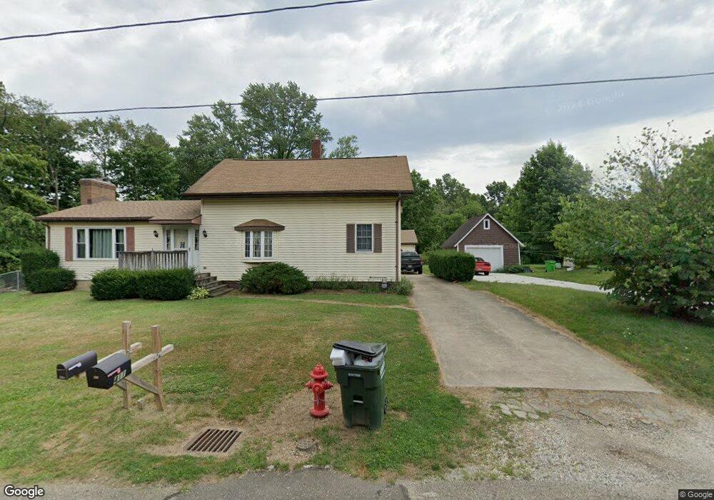
411 Buckeye Ave Alliance, OH 44601
Estimated Value: $118,000 - $193,853
3
Beds
2
Baths
1,452
Sq Ft
$110/Sq Ft
Est. Value
About This Home
This home is located at 411 Buckeye Ave, Alliance, OH 44601 and is currently estimated at $159,463, approximately $109 per square foot. 411 Buckeye Ave is a home located in Stark County with nearby schools including Alliance Early Learning School, Alliance Intermediate School at Northside, and Alliance Middle School.
Ownership History
Date
Name
Owned For
Owner Type
Purchase Details
Closed on
Jun 10, 2019
Sold by
Stark County Land Reutilization Corp
Bought by
Macenczak Steven A and Macenczak Susan A
Current Estimated Value
Purchase Details
Closed on
Nov 24, 1997
Sold by
Oyster Steven G
Bought by
Macenczak Steven A and Macenczak Susan
Home Financials for this Owner
Home Financials are based on the most recent Mortgage that was taken out on this home.
Original Mortgage
$54,150
Interest Rate
7.38%
Mortgage Type
New Conventional
Create a Home Valuation Report for This Property
The Home Valuation Report is an in-depth analysis detailing your home's value as well as a comparison with similar homes in the area
Home Values in the Area
Average Home Value in this Area
Purchase History
| Date | Buyer | Sale Price | Title Company |
|---|---|---|---|
| Macenczak Steven A | -- | None Available | |
| Macenczak Steven A | $57,000 | -- |
Source: Public Records
Mortgage History
| Date | Status | Borrower | Loan Amount |
|---|---|---|---|
| Previous Owner | Macenczak Steven A | $54,150 |
Source: Public Records
Tax History Compared to Growth
Tax History
| Year | Tax Paid | Tax Assessment Tax Assessment Total Assessment is a certain percentage of the fair market value that is determined by local assessors to be the total taxable value of land and additions on the property. | Land | Improvement |
|---|---|---|---|---|
| 2025 | -- | $47,880 | $26,250 | $21,630 |
| 2024 | -- | $47,880 | $26,250 | $21,630 |
| 2023 | $1,488 | $36,960 | $16,030 | $20,930 |
| 2022 | $1,498 | $36,960 | $16,030 | $20,930 |
| 2021 | $1,500 | $36,960 | $16,030 | $20,930 |
| 2020 | $1,317 | $30,280 | $13,160 | $17,120 |
| 2019 | $1,226 | $0 | $0 | $0 |
Source: Public Records
Map
Nearby Homes
- 432 Johnson Ave
- 000 Klinger Ave
- 000 Meadowbrook Ave
- 565 W Broadway St
- 0 Meadowbrook Ave
- 329 1/2 W Main St
- 345 W Market St
- 0 Homestead Ave NE
- 520 W Cambridge St
- 163 W Market St
- 0 Johnson Ave NE Unit 5142926
- 132 S Haines Ave
- 0 Klinger Ave NE
- 725 W Summit St
- 734 Parkway Blvd
- 645 W Summit St
- 0 W Main St Unit 5090123
- 505 N Union Ave
- 14723 Bolton St NE
- 14422 Sturbridge Rd NE
- 379 Buckeye Ave
- 400 Johnson Ave
- 363 Buckeye Ave
- 410 Buckeye Ave
- 380 Buckeye Ave
- 355 Buckeye Ave
- 424 Johnson Ave
- 372 Buckeye Ave
- 372 Buckeye Ave
- 372 Johnson Ave
- 347 Buckeye Ave
- 354 Buckeye Ave
- 432 Johnson Ave
- 339 Buckeye Ave
- 350 Johnson Ave
- 448 Buckeye Ave
- 344 Buckeye Ave
- 323 Buckeye Ave
- 1063 W Ely St
- 1079 W Ely St