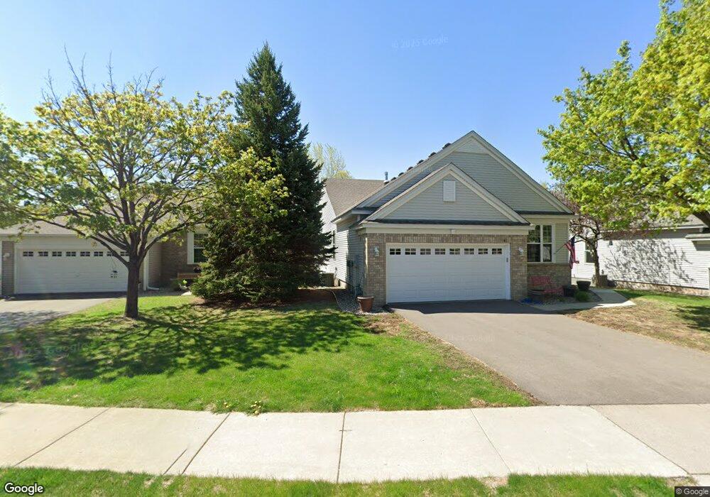
411 Campfire Curve Chaska, MN 55318
Estimated Value: $453,377 - $493,000
4
Beds
3
Baths
1,869
Sq Ft
$254/Sq Ft
Est. Value
About This Home
This home is located at 411 Campfire Curve, Chaska, MN 55318 and is currently estimated at $474,344, approximately $253 per square foot. 411 Campfire Curve is a home located in Carver County with nearby schools including Jonathan Elementary School, Chaska Middle School East, and Chaska High School.
Ownership History
Date
Name
Owned For
Owner Type
Purchase Details
Closed on
Dec 3, 2020
Sold by
Altenburg Jeffrey A and Altenburg Katie A
Bought by
Altenburg Jeffrey A and Altenburg Katie A
Current Estimated Value
Purchase Details
Closed on
Jun 15, 2015
Sold by
Tilkens Michael J and Tilkens Dilma T
Bought by
Altenburg Jeffrey A and Altenburg Katie A
Home Financials for this Owner
Home Financials are based on the most recent Mortgage that was taken out on this home.
Original Mortgage
$170,000
Outstanding Balance
$132,044
Interest Rate
3.83%
Mortgage Type
New Conventional
Estimated Equity
$342,300
Purchase Details
Closed on
Jul 2, 2002
Sold by
Pulte Homes Minnesota Corp
Bought by
Pattridge Roger H and Pattridge Dilma T
Create a Home Valuation Report for This Property
The Home Valuation Report is an in-depth analysis detailing your home's value as well as a comparison with similar homes in the area
Home Values in the Area
Average Home Value in this Area
Purchase History
| Date | Buyer | Sale Price | Title Company |
|---|---|---|---|
| Altenburg Jeffrey A | -- | None Available | |
| Altenburg Jeffrey A | $320,000 | Realstar Title | |
| Pattridge Roger H | $272,790 | -- |
Source: Public Records
Mortgage History
| Date | Status | Borrower | Loan Amount |
|---|---|---|---|
| Open | Altenburg Jeffrey A | $170,000 |
Source: Public Records
Tax History Compared to Growth
Tax History
| Year | Tax Paid | Tax Assessment Tax Assessment Total Assessment is a certain percentage of the fair market value that is determined by local assessors to be the total taxable value of land and additions on the property. | Land | Improvement |
|---|---|---|---|---|
| 2025 | $4,702 | $408,000 | $78,800 | $329,200 |
| 2024 | $4,638 | $400,000 | $78,800 | $321,200 |
| 2023 | $4,738 | $396,300 | $78,800 | $317,500 |
| 2022 | $4,224 | $421,300 | $78,700 | $342,600 |
| 2021 | $3,762 | $317,300 | $65,600 | $251,700 |
| 2020 | $3,792 | $317,300 | $65,600 | $251,700 |
| 2019 | $3,708 | $298,000 | $62,500 | $235,500 |
| 2018 | $3,704 | $298,000 | $62,500 | $235,500 |
| 2017 | $3,588 | $294,800 | $56,800 | $238,000 |
| 2016 | $3,624 | $260,300 | $0 | $0 |
| 2015 | $3,028 | $239,800 | $0 | $0 |
| 2014 | $3,028 | $206,900 | $0 | $0 |
Source: Public Records
Map
Nearby Homes
- 379 Wagon Wheel Ln
- 314 Campfire Curve
- 2732 Wagon Wheel Curve Unit 11
- 312 Wagon Wheel Ln Unit 16
- 670 Weston Ridge Pkwy
- 112010 Faber Ln
- 2890 Autumn Woods Dr
- 110696 Village Rd Unit 219
- 3110 N Chestnut St Unit 414
- 110282 Village Rd
- 110309 Center Green Cir
- 110102 Arboretum Way
- 1078 Overlook Dr
- 936 Bluff Pointe Dr
- 3130 Sugar Maple Dr
- 349 Pleasant Ln
- 441 Pleasant Ln
- 2888 Forest Ridge
- 2906 Butternut Dr
- 554 Satori Way
- 415 Campfire Curve
- 409 Campfire Curve
- 419 Campfire Curve
- 405 Campfire Curve
- 423 Campfire Curve
- 401 Campfire Curve
- 487 Campfire Curve
- 427 Campfire Curve
- 483 Campfire Curve
- 431 Campfire Curve
- 439 Campfire Curve
- 479 Campfire Curve
- 443 Campfire Curve
- 475 Campfire Curve
- 447 Campfire Curve
- 499 Wilderness Dr
- 451 Campfire Curve
- 493 Wilderness Dr
- 463 Campfire Curve
- 471 Campfire Curve