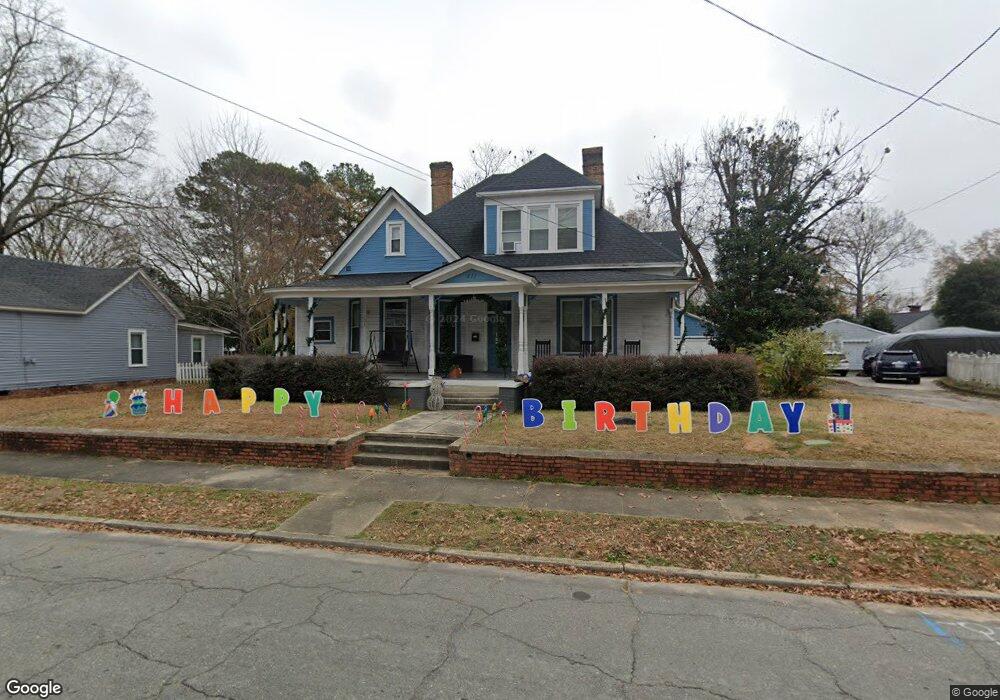
411 S 5th St Smithfield, NC 27577
Estimated Value: $361,000 - $459,278
4
Beds
3
Baths
3,148
Sq Ft
$130/Sq Ft
Est. Value
About This Home
This home is located at 411 S 5th St, Smithfield, NC 27577 and is currently estimated at $410,320, approximately $130 per square foot. 411 S 5th St is a home located in Johnston County with nearby schools including South Smithfield Elementary School, Smithfield Middle School, and Smithfield-Selma High School.
Ownership History
Date
Name
Owned For
Owner Type
Purchase Details
Closed on
Mar 24, 2021
Sold by
Earp Talton F and Earp Gwendolen J
Bought by
Burns Brandon
Current Estimated Value
Home Financials for this Owner
Home Financials are based on the most recent Mortgage that was taken out on this home.
Original Mortgage
$270,019
Outstanding Balance
$242,176
Interest Rate
2.73%
Mortgage Type
FHA
Estimated Equity
$168,144
Purchase Details
Closed on
Feb 20, 2020
Sold by
Coram John Carl and Hobbs Maria Ann
Bought by
Earp Talton F
Purchase Details
Closed on
Jul 21, 2008
Sold by
Coram John C and Coram Barbara H
Bought by
Coram John C
Home Financials for this Owner
Home Financials are based on the most recent Mortgage that was taken out on this home.
Original Mortgage
$78,800
Interest Rate
4.75%
Mortgage Type
Purchase Money Mortgage
Purchase Details
Closed on
Nov 4, 2002
Sold by
Coram John C
Bought by
Bell Robert E
Create a Home Valuation Report for This Property
The Home Valuation Report is an in-depth analysis detailing your home's value as well as a comparison with similar homes in the area
Home Values in the Area
Average Home Value in this Area
Purchase History
| Date | Buyer | Sale Price | Title Company |
|---|---|---|---|
| Burns Brandon | $275,000 | Barristers Title Services | |
| Earp Talton F | $65,000 | None Available | |
| Coram John C | -- | None Available | |
| Bell Robert E | $65,000 | -- |
Source: Public Records
Mortgage History
| Date | Status | Borrower | Loan Amount |
|---|---|---|---|
| Open | Burns Brandon | $270,019 | |
| Previous Owner | Coram John C | $78,800 |
Source: Public Records
Tax History
| Year | Tax Paid | Tax Assessment Tax Assessment Total Assessment is a certain percentage of the fair market value that is determined by local assessors to be the total taxable value of land and additions on the property. | Land | Improvement |
|---|---|---|---|---|
| 2025 | $4,159 | $428,730 | $70,000 | $358,730 |
| 2024 | $3,399 | $274,140 | $45,000 | $229,140 |
| 2023 | $3,454 | $274,140 | $45,000 | $229,140 |
| 2022 | $3,564 | $274,140 | $45,000 | $229,140 |
| 2021 | $3,564 | $274,140 | $45,000 | $229,140 |
| 2020 | $2,032 | $152,810 | $45,000 | $107,810 |
| 2019 | $2,032 | $152,810 | $45,000 | $107,810 |
| 2018 | $1,831 | $135,600 | $43,050 | $92,550 |
| 2017 | $1,831 | $135,600 | $43,050 | $92,550 |
| 2016 | $1,831 | $135,600 | $43,050 | $92,550 |
| 2015 | $1,831 | $135,600 | $43,050 | $92,550 |
| 2014 | $1,831 | $135,600 | $43,050 | $92,550 |
Source: Public Records
Map
Nearby Homes
- 429 S 5th St
- 412 S 5th St
- 407 E Woodall St
- 313 S 4th St
- 212 S 6th St
- 514 S 5th St
- 510 S 4th St
- 707 Massey St
- 212 Lily Patch Ln
- 216 Lily Patch Ln
- 240 Lily Patch Ln
- 162 Caitlyn Pkwy
- 212 Caitlyn Pkwy
- 224 Lily Patch Ln
- 407 Collier St
- 210 E Holt St
- 109 W Riverside Dr
- 113 W Riverside Dr
- 181 Holton St
- 177 Holton St
Your Personal Tour Guide
Ask me questions while you tour the home.