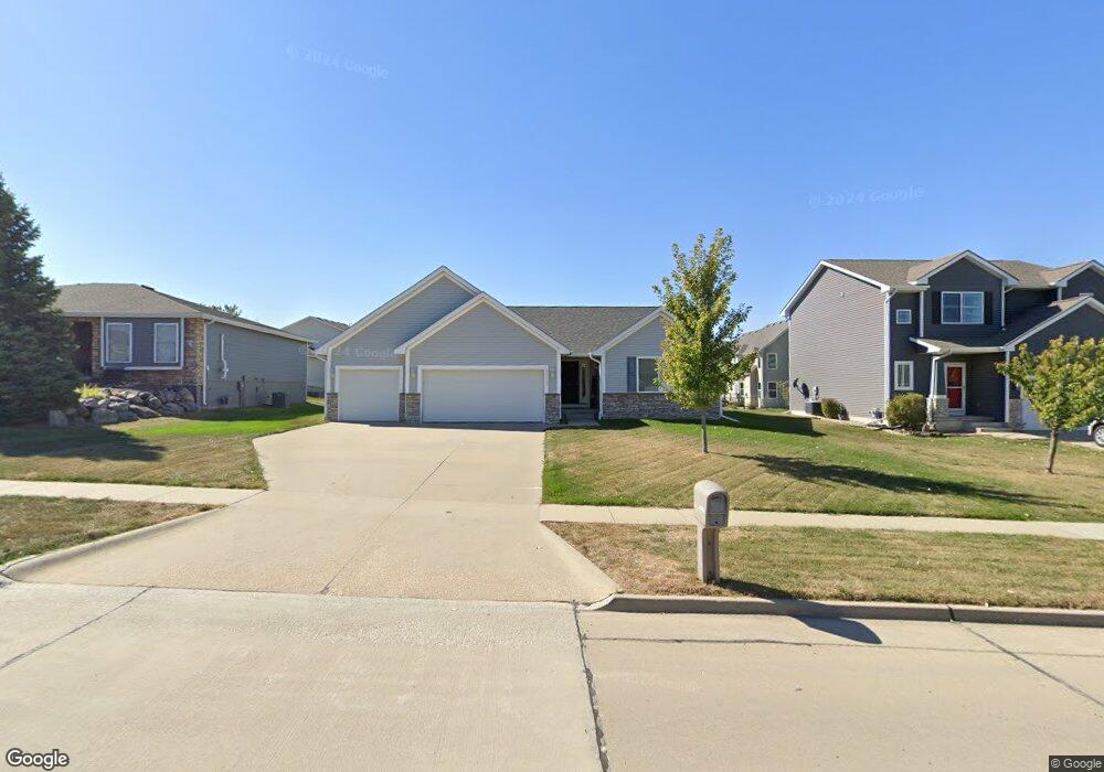
4110 152nd St Urbandale, IA 50323
Estimated Value: $378,900 - $386,000
3
Beds
2
Baths
1,596
Sq Ft
$239/Sq Ft
Est. Value
About This Home
This home is located at 4110 152nd St, Urbandale, IA 50323 and is currently estimated at $381,725, approximately $239 per square foot. 4110 152nd St is a home located in Dallas County with nearby schools including Walnut Hills Elementary School and Des Moines Christian Schools.
Ownership History
Date
Name
Owned For
Owner Type
Purchase Details
Closed on
Jul 13, 2006
Sold by
Regency Land Company Lc
Bought by
Midland Homes Lc
Current Estimated Value
Home Financials for this Owner
Home Financials are based on the most recent Mortgage that was taken out on this home.
Original Mortgage
$184,400
Outstanding Balance
$110,498
Interest Rate
6.82%
Mortgage Type
New Conventional
Estimated Equity
$271,227
Purchase Details
Closed on
Jul 12, 2006
Sold by
Amerus Land Development Inc
Bought by
Regency Land Company Lc
Home Financials for this Owner
Home Financials are based on the most recent Mortgage that was taken out on this home.
Original Mortgage
$184,400
Outstanding Balance
$110,498
Interest Rate
6.82%
Mortgage Type
New Conventional
Estimated Equity
$271,227
Purchase Details
Closed on
Apr 13, 2006
Sold by
Midland Homes Lc
Bought by
Deshane Michael A and Deshane Jill A
Home Financials for this Owner
Home Financials are based on the most recent Mortgage that was taken out on this home.
Original Mortgage
$46,100
Interest Rate
6.73%
Mortgage Type
Stand Alone Second
Create a Home Valuation Report for This Property
The Home Valuation Report is an in-depth analysis detailing your home's value as well as a comparison with similar homes in the area
Home Values in the Area
Average Home Value in this Area
Purchase History
| Date | Buyer | Sale Price | Title Company |
|---|---|---|---|
| Midland Homes Lc | -- | None Available | |
| Regency Land Company Lc | $42,000 | None Available | |
| Deshane Michael A | $231,000 | None Available |
Source: Public Records
Mortgage History
| Date | Status | Borrower | Loan Amount |
|---|---|---|---|
| Open | Regency Land Company Lc | $184,400 | |
| Previous Owner | Deshane Michael A | $46,100 |
Source: Public Records
Tax History Compared to Growth
Tax History
| Year | Tax Paid | Tax Assessment Tax Assessment Total Assessment is a certain percentage of the fair market value that is determined by local assessors to be the total taxable value of land and additions on the property. | Land | Improvement |
|---|---|---|---|---|
| 2024 | $5,258 | $332,640 | $60,000 | $272,640 |
| 2023 | $5,258 | $332,640 | $60,000 | $272,640 |
| 2022 | $4,564 | $297,330 | $60,000 | $237,330 |
| 2021 | $4,564 | $262,350 | $50,000 | $212,350 |
| 2020 | $4,474 | $248,220 | $50,000 | $198,220 |
| 2019 | $4,610 | $248,220 | $50,000 | $198,220 |
| 2018 | $4,610 | $241,280 | $50,000 | $191,280 |
| 2017 | $4,452 | $241,280 | $50,000 | $191,280 |
| 2016 | $4,094 | $230,240 | $42,000 | $188,240 |
| 2015 | $3,950 | $225,410 | $0 | $0 |
| 2014 | $3,646 | $215,760 | $0 | $0 |
Source: Public Records
Map
Nearby Homes
- 15214 Aurora Cir
- 5627 163rd St
- 15231 Aurora Cir
- 15220 Ridgemont Dr
- 5502 144th St
- 4315 153rd St
- 15421 Westbrook Dr
- 15212 Greenbelt Dr
- 15203 Greenbelt Dr
- 4472 154th St
- 4468 154th St
- 4445 154th St
- 4449 154th St
- 4453 154th St
- 3904 153rd St
- 15715 Tanglewood Dr
- 15112 Goodman Dr
- 14612 Westbrook Dr
- 14603 Westbrook Dr
- 5016 150th St
- 4114 152nd St
- 4106 152nd St
- 15206 Aurora Cir
- 15209 Winston Ave
- 15210 Aurora Cir
- 15215 Winston Ave
- 4109 152nd St
- 4105 152nd St
- 15221 Winston Ave
- 5608 163rd St
- 5632 163rd St
- 5615 163rd St
- 5612 163rd St
- 5611 163rd St
- 5652 163rd St
- 15201 Aurora Cir
- 4115 152nd St
- 4030 152nd St
- 15205 Aurora Cir
- 4101 152nd St