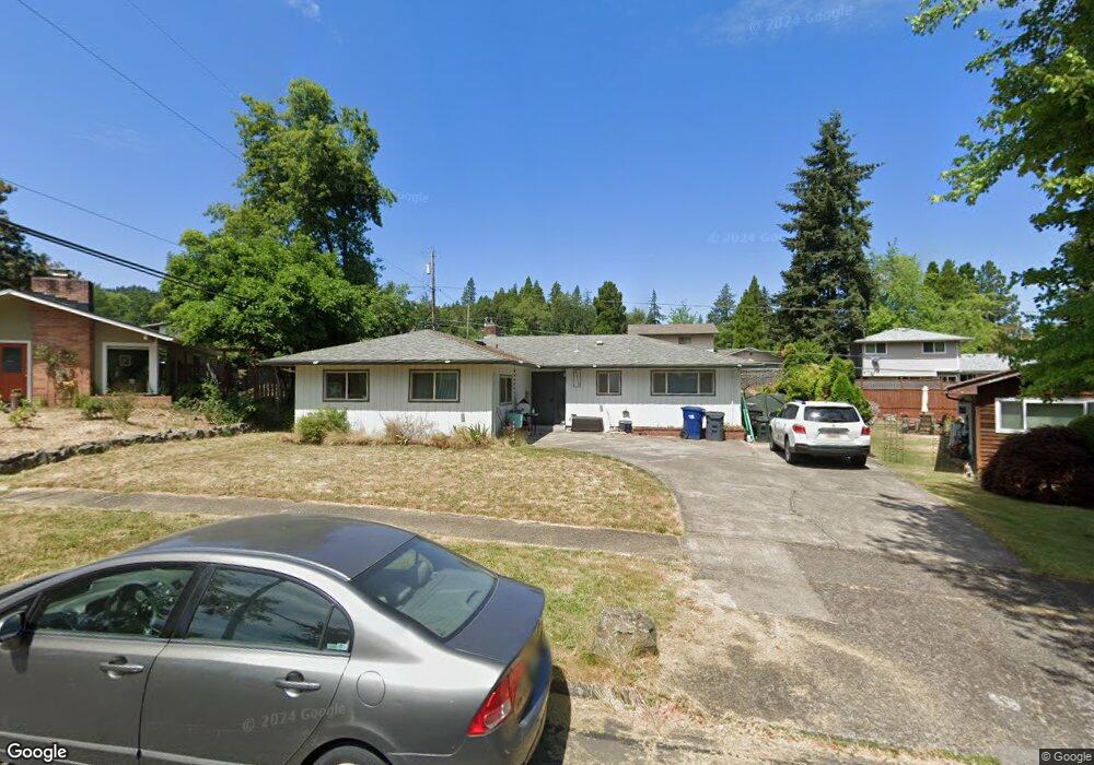
4110 Pearl St Eugene, OR 97405
Southeast Eugene NeighborhoodEstimated Value: $489,000 - $583,000
3
Beds
2
Baths
1,516
Sq Ft
$348/Sq Ft
Est. Value
About This Home
This home is located at 4110 Pearl St, Eugene, OR 97405 and is currently estimated at $528,191, approximately $348 per square foot. 4110 Pearl St is a home located in Lane County with nearby schools including Edgewood Community Elementary School, Spencer Butte Middle School, and South Eugene High School.
Ownership History
Date
Name
Owned For
Owner Type
Purchase Details
Closed on
Apr 3, 2015
Sold by
Hilkene Christopher R and Zaldua Hilkene Dena L
Bought by
Macovis Bohdan
Current Estimated Value
Home Financials for this Owner
Home Financials are based on the most recent Mortgage that was taken out on this home.
Original Mortgage
$229,092
Outstanding Balance
$175,467
Interest Rate
3.76%
Mortgage Type
New Conventional
Estimated Equity
$352,724
Purchase Details
Closed on
Oct 2, 2009
Sold by
Reader Geoffrey G and Reader Launee G
Bought by
Hilkene Christopher R and Zaldua Hilkene Dena L
Home Financials for this Owner
Home Financials are based on the most recent Mortgage that was taken out on this home.
Original Mortgage
$264,618
Interest Rate
5.08%
Mortgage Type
FHA
Purchase Details
Closed on
Jun 29, 2006
Sold by
Ross Randall W
Bought by
Eggleston Carol L and Estate Of Robert W Ross
Home Financials for this Owner
Home Financials are based on the most recent Mortgage that was taken out on this home.
Original Mortgage
$34,500
Interest Rate
6.18%
Mortgage Type
Stand Alone Second
Purchase Details
Closed on
Jun 28, 2006
Sold by
Eggleston Carol L
Bought by
Reader Geoffrey G and Reader Launee G
Home Financials for this Owner
Home Financials are based on the most recent Mortgage that was taken out on this home.
Original Mortgage
$34,500
Interest Rate
6.18%
Mortgage Type
Stand Alone Second
Purchase Details
Closed on
Jun 15, 2004
Sold by
Ross Robert W and Ross Betty J
Bought by
Ross Robert W
Create a Home Valuation Report for This Property
The Home Valuation Report is an in-depth analysis detailing your home's value as well as a comparison with similar homes in the area
Home Values in the Area
Average Home Value in this Area
Purchase History
| Date | Buyer | Sale Price | Title Company |
|---|---|---|---|
| Macovis Bohdan | $241,150 | Western Title & Escrow Co | |
| Hilkene Christopher R | $269,500 | Western Title | |
| Eggleston Carol L | -- | Cascade Title Co | |
| Reader Geoffrey G | $230,000 | Cascade Title Co | |
| Eggleston Carol L | -- | Cascade Title Co | |
| Eggleston Carol L | -- | Cascade Title Co | |
| Ross Robert W | -- | -- |
Source: Public Records
Mortgage History
| Date | Status | Borrower | Loan Amount |
|---|---|---|---|
| Open | Macovis Bohdan | $229,092 | |
| Previous Owner | Hilkene Christopher R | $264,618 | |
| Previous Owner | Reader Geoffrey G | $34,500 | |
| Previous Owner | Reader Geoffrey G | $184,000 |
Source: Public Records
Tax History
| Year | Tax Paid | Tax Assessment Tax Assessment Total Assessment is a certain percentage of the fair market value that is determined by local assessors to be the total taxable value of land and additions on the property. | Land | Improvement |
|---|---|---|---|---|
| 2025 | $5,157 | $264,657 | -- | -- |
| 2024 | $5,092 | $256,949 | -- | -- |
| 2023 | $5,092 | $249,466 | $0 | $0 |
| 2022 | $4,771 | $242,200 | $0 | $0 |
| 2021 | $4,481 | $235,146 | $0 | $0 |
| 2020 | $4,497 | $228,298 | $0 | $0 |
| 2019 | $4,343 | $221,649 | $0 | $0 |
| 2018 | $4,088 | $208,926 | $0 | $0 |
| 2017 | $3,905 | $208,926 | $0 | $0 |
| 2016 | $3,756 | $202,841 | $0 | $0 |
| 2015 | $3,598 | $196,933 | $0 | $0 |
| 2014 | $3,508 | $191,197 | $0 | $0 |
Source: Public Records
Map
Nearby Homes
- 170 E 40th Ave
- 4023 Donald St Unit K
- 395 E 46th Ave
- 4295 Ferry St
- 17 Westbrook Way
- 21 Westbrook Way
- 434 E 39th Ave
- 275 E 39th Ave
- 36 Westbrook Way
- 4734 Brookwood St
- 0 E 39th Ave
- 4425 Hilyard St
- 278 Rockridge Ct
- 4845 Brookwood St
- 320 Dellwood Dr
- 75 W 35th Place
- 4320 Fox Hollow Rd
- 4364 Fox Hollow Rd
- 126 Treehill Loop Unit 126
- 910 E 43rd Ave
Your Personal Tour Guide
Ask me questions while you tour the home.