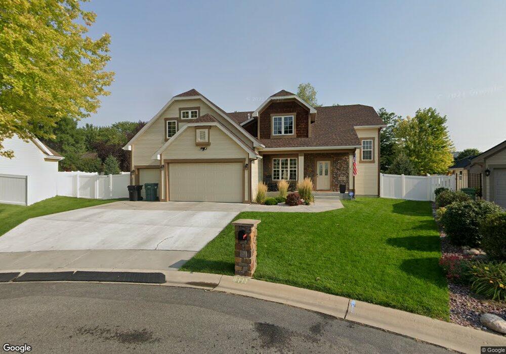
4111 Rangeview Dr Billings, MT 59106
West Shiloh NeighborhoodEstimated Value: $616,000 - $795,000
4
Beds
5
Baths
2,684
Sq Ft
$263/Sq Ft
Est. Value
About This Home
This home is located at 4111 Rangeview Dr, Billings, MT 59106 and is currently estimated at $705,552, approximately $262 per square foot. 4111 Rangeview Dr is a home located in Yellowstone County with nearby schools including Arrowhead School, Ben Steele Middle School, and Billings West High School.
Ownership History
Date
Name
Owned For
Owner Type
Purchase Details
Closed on
Jan 19, 2010
Sold by
National Residential Nominee Services In
Bought by
Nafts Jason A and Nafts Melanie C
Current Estimated Value
Home Financials for this Owner
Home Financials are based on the most recent Mortgage that was taken out on this home.
Original Mortgage
$338,105
Outstanding Balance
$221,535
Interest Rate
4.91%
Mortgage Type
New Conventional
Estimated Equity
$484,017
Purchase Details
Closed on
Jul 18, 2005
Sold by
Design Builders Inc
Bought by
Wolff Eric B and Wolff Denelle L
Home Financials for this Owner
Home Financials are based on the most recent Mortgage that was taken out on this home.
Original Mortgage
$210,000
Interest Rate
5.55%
Mortgage Type
New Conventional
Create a Home Valuation Report for This Property
The Home Valuation Report is an in-depth analysis detailing your home's value as well as a comparison with similar homes in the area
Home Values in the Area
Average Home Value in this Area
Purchase History
| Date | Buyer | Sale Price | Title Company |
|---|---|---|---|
| Nafts Jason A | -- | None Available | |
| Wolff Eric B | -- | None Available |
Source: Public Records
Mortgage History
| Date | Status | Borrower | Loan Amount |
|---|---|---|---|
| Open | Nafts Jason A | $338,105 | |
| Previous Owner | Wolff Eric B | $210,000 |
Source: Public Records
Tax History Compared to Growth
Tax History
| Year | Tax Paid | Tax Assessment Tax Assessment Total Assessment is a certain percentage of the fair market value that is determined by local assessors to be the total taxable value of land and additions on the property. | Land | Improvement |
|---|---|---|---|---|
| 2025 | $5,971 | $654,900 | $110,289 | $544,611 |
| 2024 | $5,971 | $625,700 | $99,779 | $525,921 |
| 2023 | $5,952 | $625,700 | $99,779 | $525,921 |
| 2022 | $5,325 | $490,900 | $0 | $0 |
| 2021 | $5,029 | $490,900 | $0 | $0 |
| 2020 | $5,212 | $488,400 | $0 | $0 |
| 2019 | $4,969 | $488,400 | $0 | $0 |
| 2018 | $5,022 | $485,200 | $0 | $0 |
| 2017 | $4,926 | $485,200 | $0 | $0 |
| 2016 | $4,458 | $442,800 | $0 | $0 |
| 2015 | $4,368 | $442,800 | $0 | $0 |
| 2014 | $3,943 | $211,894 | $0 | $0 |
Source: Public Records
Map
Nearby Homes
- 2213 Westfield Dr
- 2301 Elsa Dr
- 2020 Swanson Ln
- 4044 Backwoods Dr
- 4342 Rangeview Dr
- 3865 Avenue C
- 2280 Ridgewood Ln S
- 3720 Parkhill Dr
- 3743 Hayden Dr
- 1818 Tiburon Ln
- 3928 Audubon Way
- 1747 Tiburon Ln
- 1713 Tiburon Ln
- TBD Rimrock Rd
- 2238 Pine Creek Trail
- 5073 Audubon Way
- 4204 Pine Cove Rd
- 3654 Donna Dr
- 3210 40th St W
- 3935 Pine Cove Rd
- 4123 Rangeview Dr
- 4105 Rangeview Dr
- 4122 Corbin Dr
- 4128 Corbin Dr
- 4116 Corbin Dr
- 4110 Corbin Dr
- 4023 Colton Blvd
- 4135 Rangeview Dr
- 4114 Corbin Dr
- 4134 Corbin Dr
- 1812 Kamton Ct
- 1809 Kamton Ct
- 1808 Kamton Ct
- 4104 Corbin Dr
- 4140 Corbin Dr
- 4017 Colton Blvd
- 4130 Rangeview Dr
- 4147 Rangeview Dr
- 4127 Corbin Dr
- 4119 Corbin Dr