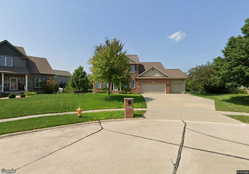
4114 126th St Urbandale, IA 50323
Estimated Value: $463,000 - $538,000
4
Beds
4
Baths
2,413
Sq Ft
$208/Sq Ft
Est. Value
About This Home
This home is located at 4114 126th St, Urbandale, IA 50323 and is currently estimated at $501,808, approximately $207 per square foot. 4114 126th St is a home located in Polk County with nearby schools including Webster Elementary School, Urbandale Middle School, and Urbandale High School.
Ownership History
Date
Name
Owned For
Owner Type
Purchase Details
Closed on
Apr 18, 2019
Sold by
Fuchs Jamel
Bought by
Fuchs Brian
Current Estimated Value
Purchase Details
Closed on
Jun 29, 2005
Sold by
Millard Construction Inc
Bought by
Fuchs Brian K and Fuchs Jamel
Home Financials for this Owner
Home Financials are based on the most recent Mortgage that was taken out on this home.
Original Mortgage
$65,625
Interest Rate
7.75%
Mortgage Type
Credit Line Revolving
Create a Home Valuation Report for This Property
The Home Valuation Report is an in-depth analysis detailing your home's value as well as a comparison with similar homes in the area
Home Values in the Area
Average Home Value in this Area
Purchase History
| Date | Buyer | Sale Price | Title Company |
|---|---|---|---|
| Fuchs Brian | -- | None Available | |
| Fuchs Brian K | $437,000 | -- |
Source: Public Records
Mortgage History
| Date | Status | Borrower | Loan Amount |
|---|---|---|---|
| Previous Owner | Fuchs Brian K | $65,625 | |
| Previous Owner | Fuchs Brian K | $350,000 |
Source: Public Records
Tax History Compared to Growth
Tax History
| Year | Tax Paid | Tax Assessment Tax Assessment Total Assessment is a certain percentage of the fair market value that is determined by local assessors to be the total taxable value of land and additions on the property. | Land | Improvement |
|---|---|---|---|---|
| 2025 | $8,956 | $533,100 | $89,900 | $443,200 |
| 2024 | $8,956 | $504,900 | $84,300 | $420,600 |
| 2023 | $8,402 | $504,900 | $84,300 | $420,600 |
| 2022 | $8,304 | $400,500 | $68,500 | $332,000 |
| 2021 | $8,524 | $400,500 | $68,500 | $332,000 |
| 2020 | $8,376 | $390,100 | $66,500 | $323,600 |
| 2019 | $9,142 | $390,100 | $66,500 | $323,600 |
| 2018 | $8,818 | $400,000 | $57,400 | $342,600 |
| 2017 | $8,484 | $400,000 | $57,400 | $342,600 |
| 2016 | $8,280 | $377,900 | $53,500 | $324,400 |
| 2015 | $8,280 | $377,900 | $53,500 | $324,400 |
| 2014 | $7,510 | $353,500 | $45,200 | $308,300 |
Source: Public Records
Map
Nearby Homes
- 12510 Prairie Dr
- 4016 127th St
- 12527 Airline Ave
- 12515 Airline Ave
- 12335 Tanglewood Dr
- 12912 Hammontree Dr
- 12723 Sunflower Dr
- 4309 129th St
- 4412 125th St
- 4143 122nd St
- 12220 Horton Ave
- 3935 122nd St
- 12202 Madison Ave
- 13114 Iltis Dr
- 14311 Catalpa Dr
- 14212 Catalpa Dr
- 14216 Catalpa Dr
- 12917 Timberline Dr
- 4111 140th St
- 12926 Timberline Dr
- 4110 126th St
- 4115 126th St
- 12606 Winston Ave
- 12516 Winston Ave
- 4119 127th St
- 4106 126th St
- 4115 127th St
- 4111 126th St
- 4111 127th St
- 4123 127th St
- 12510 Winston Ave
- 4107 127th St
- 4107 126th St
- 4102 126th St
- 4118 Belair Dr
- 4122 Belair Dr
- 4114 Belair Dr
- 12605 Winston Ave
- 12601 Winston Ave
- 4103 126th St