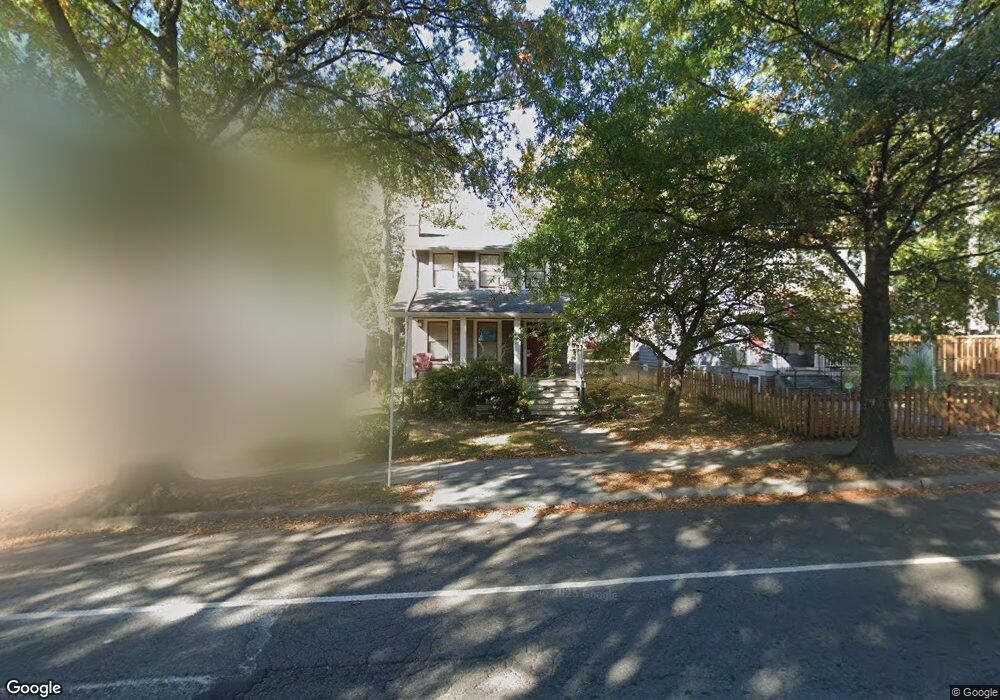
4114 12th St NE Washington, DC 20017
Brookland NeighborhoodEstimated Value: $647,000 - $841,000
3
Beds
1
Bath
1,440
Sq Ft
$507/Sq Ft
Est. Value
About This Home
This home is located at 4114 12th St NE, Washington, DC 20017 and is currently estimated at $729,834, approximately $506 per square foot. 4114 12th St NE is a home located in District of Columbia with nearby schools including Bunker Hill Elementary School, Brookland Middle School, and Dunbar High School.
Ownership History
Date
Name
Owned For
Owner Type
Purchase Details
Closed on
Nov 20, 2003
Sold by
Brooks Trenton
Bought by
Brooks Trenton
Current Estimated Value
Home Financials for this Owner
Home Financials are based on the most recent Mortgage that was taken out on this home.
Original Mortgage
$99,750
Interest Rate
5.83%
Mortgage Type
New Conventional
Purchase Details
Closed on
Jul 26, 1994
Sold by
Secretary Veterans Affair
Bought by
Brooks Trenton M
Home Financials for this Owner
Home Financials are based on the most recent Mortgage that was taken out on this home.
Original Mortgage
$88,825
Interest Rate
8.19%
Purchase Details
Closed on
Dec 13, 1993
Sold by
William K E
Bought by
Sec Vet Affr
Create a Home Valuation Report for This Property
The Home Valuation Report is an in-depth analysis detailing your home's value as well as a comparison with similar homes in the area
Home Values in the Area
Average Home Value in this Area
Purchase History
| Date | Buyer | Sale Price | Title Company |
|---|---|---|---|
| Brooks Trenton | $30,029 | -- | |
| Brooks Trenton M | $93,500 | -- | |
| Sec Vet Affr | $92,500 | -- |
Source: Public Records
Mortgage History
| Date | Status | Borrower | Loan Amount |
|---|---|---|---|
| Previous Owner | Brooks Trenton | $99,750 | |
| Previous Owner | Brooks Trenton M | $88,825 |
Source: Public Records
Tax History Compared to Growth
Tax History
| Year | Tax Paid | Tax Assessment Tax Assessment Total Assessment is a certain percentage of the fair market value that is determined by local assessors to be the total taxable value of land and additions on the property. | Land | Improvement |
|---|---|---|---|---|
| 2025 | $4,904 | $685,980 | $415,580 | $270,400 |
| 2024 | $4,480 | $659,860 | $402,790 | $257,070 |
| 2023 | $4,096 | $633,270 | $392,820 | $240,450 |
| 2022 | $3,765 | $566,820 | $349,240 | $217,580 |
| 2021 | $3,441 | $547,850 | $344,100 | $203,750 |
| 2020 | $3,133 | $530,250 | $329,480 | $200,770 |
| 2019 | $2,855 | $507,650 | $311,650 | $196,000 |
| 2018 | $2,607 | $492,640 | $0 | $0 |
| 2017 | $2,377 | $472,800 | $0 | $0 |
| 2016 | $2,166 | $415,300 | $0 | $0 |
| 2015 | $1,972 | $392,080 | $0 | $0 |
| 2014 | $1,802 | $337,150 | $0 | $0 |
Source: Public Records
Map
Nearby Homes
- 1006 Shepherd St NE
- 1004 Shepherd St NE
- 4200 13th St NE
- 0 Taussig Place NE
- 1005 Urell Place NE
- 4019 9th St NE Unit 4
- 4019 9th St NE Unit 1
- 1207 Randolph St NE
- 820 Taylor St NE
- 901 Varnum St NE
- 1355 Michigan Ave NE
- 1336 Randolph St NE
- 4414 13th Place NE
- 913 Quincy St NE Unit 3
- 705 Quincy St NE Unit 2
- 705 Quincy St NE Unit 4
- 4509 12th St NE
- 4032 7th St NE
- 1235 Perry St NE
- 1241 Perry St NE
- 4116 12th St NE
- 4112 12th St NE
- 1011 Taylor St NE
- 1016 Sigsbee Place NE
- 1127 Sigsbee Place NE
- 4200 12th St NE
- 4109 12th St NE
- 1014 Sigsbee Place NE
- 4111 12th St NE
- 4107 12th St NE
- 1011 Sigsbee Place NE
- 1009 Taylor St NE
- 4102 12th St NE
- 1010 Taylor St NE
- 4105 12th St NE
- 1012 Sigsbee Place NE
- 4206 12th St NE
- 4201 12th St NE
- 1126 Shepherd St NE
- 4103 12th St NE