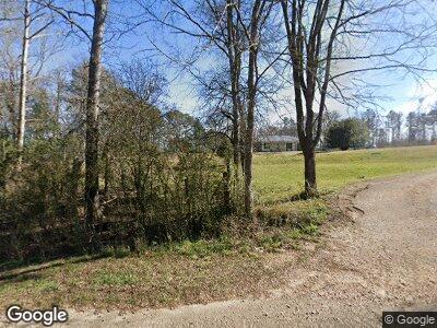
4114 Union Rd Hazlehurst, MS 39083
Estimated Value: $184,000 - $348,000
3
Beds
2
Baths
1,934
Sq Ft
$121/Sq Ft
Est. Value
About This Home
This home is located at 4114 Union Rd, Hazlehurst, MS 39083 and is currently estimated at $233,875, approximately $120 per square foot. 4114 Union Rd is a home located in Copiah County with nearby schools including Hazlehurst Middle School and Hazlehurst High School.
Ownership History
Date
Name
Owned For
Owner Type
Purchase Details
Closed on
Oct 18, 2021
Sold by
United States Of America
Bought by
Powell James
Current Estimated Value
Purchase Details
Closed on
Oct 13, 2021
Sold by
United States Of America
Bought by
Lloyd William W
Create a Home Valuation Report for This Property
The Home Valuation Report is an in-depth analysis detailing your home's value as well as a comparison with similar homes in the area
Home Values in the Area
Average Home Value in this Area
Purchase History
| Date | Buyer | Sale Price | Title Company |
|---|---|---|---|
| Powell James | -- | None Listed On Document | |
| Lloyd William W | -- | United States Government | |
| Lloyd William W | -- | None Listed On Document | |
| Lloyd William M | -- | None Listed On Document | |
| Powell Hearman | -- | None Listed On Document | |
| Powell James | -- | None Listed On Document | |
| Hill Jacob K | -- | None Listed On Document | |
| Powell Harman | -- | None Listed On Document |
Source: Public Records
Mortgage History
| Date | Status | Borrower | Loan Amount |
|---|---|---|---|
| Previous Owner | Gladden Adam | $103,000 |
Source: Public Records
Tax History Compared to Growth
Tax History
| Year | Tax Paid | Tax Assessment Tax Assessment Total Assessment is a certain percentage of the fair market value that is determined by local assessors to be the total taxable value of land and additions on the property. | Land | Improvement |
|---|---|---|---|---|
| 2024 | $1,021 | $11,005 | $0 | $0 |
| 2023 | $1,021 | $11,005 | $0 | $0 |
| 2022 | $1,049 | $11,005 | $0 | $0 |
| 2021 | $988 | $10,717 | $0 | $0 |
| 2020 | $956 | $10,377 | $0 | $0 |
| 2019 | $954 | $10,377 | $0 | $0 |
| 2018 | $970 | $10,377 | $0 | $0 |
| 2017 | $943 | $10,377 | $0 | $0 |
| 2016 | $943 | $10,258 | $0 | $0 |
| 2015 | -- | $10,258 | $0 | $0 |
| 2014 | -- | $10,258 | $0 | $0 |
Source: Public Records
Map
Nearby Homes
- 2048 Ashley Rd
- 0 Runnels Rd Unit 140947
- 000 Monticello Rd
- 00 Steel Creek Rd
- 3133 Russell Rd
- 0 Rials Rd
- 0 Steel Creek Rd
- 0 Rails Rd
- 5146 New Hope Rd
- 0 Knight Rd
- 0 Bethesda Rd Unit 20660796
- 0 Bethesda Rd Unit 4082888
- 0 Little Rock Rd Unit 4111856
- 7055 King Rd
- 744 Georgetown St
- 0 Railroad Ave
- 3125 Beasley Rd
- 000 King Rd
- 0 Broad St
- 2060 Swilley Rd
- 4114 Union Rd
- 4123 Union Rd
- 4104 Union Rd
- 4095 Union Rd
- 4012 Union Rd
- 5025 Union Rd
- 1001 Eagle Landing Ln
- 7112 Highway 472
- 1002 Whitetown Ln
- 1002 Whitetown Ln
- 7081 Highway 472
- 3144 Union Rd
- 7099 Highway 472
- 3130 Union Rd
- 7018 Highway 472
- 2001 Union Rd
- 8038 Highway 472
- 1037 Whitetown Ln
- 7017 Highway 472
- 7147 Highway 472
