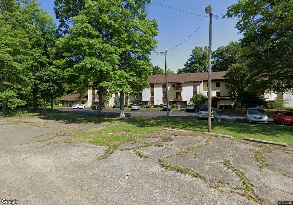
4119 Karl Rd Columbus, OH 43224
Clinton Estates NeighborhoodEstimated Value: $82,000 - $99,000
2
Beds
1
Bath
882
Sq Ft
$103/Sq Ft
Est. Value
About This Home
This home is located at 4119 Karl Rd, Columbus, OH 43224 and is currently estimated at $91,258, approximately $103 per square foot. 4119 Karl Rd is a home located in Franklin County with nearby schools including Maize Road Elementary School, Medina Middle School, and Mifflin High School.
Ownership History
Date
Name
Owned For
Owner Type
Purchase Details
Closed on
Oct 27, 2005
Sold by
Cardiff Clara E
Bought by
Cardiff John Patrick and Gilkerson Mary Jo
Current Estimated Value
Purchase Details
Closed on
Aug 9, 1996
Sold by
Rohr Norman E
Bought by
Cardiff Jonathan H and Cardiff Clara E
Home Financials for this Owner
Home Financials are based on the most recent Mortgage that was taken out on this home.
Original Mortgage
$52,000
Interest Rate
8.25%
Mortgage Type
New Conventional
Purchase Details
Closed on
Nov 1, 1984
Create a Home Valuation Report for This Property
The Home Valuation Report is an in-depth analysis detailing your home's value as well as a comparison with similar homes in the area
Home Values in the Area
Average Home Value in this Area
Purchase History
| Date | Buyer | Sale Price | Title Company |
|---|---|---|---|
| Cardiff John Patrick | -- | -- | |
| Cardiff Jonathan H | $67,000 | -- | |
| -- | $48,500 | -- |
Source: Public Records
Mortgage History
| Date | Status | Borrower | Loan Amount |
|---|---|---|---|
| Previous Owner | Cardiff Jonathan H | $52,000 |
Source: Public Records
Tax History Compared to Growth
Tax History
| Year | Tax Paid | Tax Assessment Tax Assessment Total Assessment is a certain percentage of the fair market value that is determined by local assessors to be the total taxable value of land and additions on the property. | Land | Improvement |
|---|---|---|---|---|
| 2024 | $1,522 | $22,230 | $4,730 | $17,500 |
| 2023 | $1,006 | $22,225 | $4,725 | $17,500 |
| 2022 | $707 | $13,310 | $1,650 | $11,660 |
| 2021 | $709 | $13,310 | $1,650 | $11,660 |
| 2020 | $710 | $13,310 | $1,650 | $11,660 |
| 2019 | $614 | $9,880 | $1,230 | $8,650 |
| 2018 | $724 | $9,880 | $1,230 | $8,650 |
| 2017 | $692 | $9,880 | $1,230 | $8,650 |
| 2016 | $802 | $11,070 | $1,790 | $9,280 |
| 2015 | $685 | $11,070 | $1,790 | $9,280 |
| 2014 | $686 | $11,070 | $1,790 | $9,280 |
| 2013 | $423 | $13,825 | $2,240 | $11,585 |
Source: Public Records
Map
Nearby Homes
- 4115 Karl Rd Unit A302
- 4145 Karl Rd Unit 4222
- 4143 Karl Rd Unit 214
- 4143 Karl Rd Unit 113
- 1530 Evaline Dr
- 1485 Shanley Dr
- 1296 Bryson Rd
- 3967 Karl Rd Unit 118
- 3965 Karl Rd Unit 208
- 3965 Karl Rd Unit 200
- 3941 Karl Rd Unit 321
- 1512 Shanley Dr
- 4256 Blythe Rd
- 3939 Karl Rd Unit 217
- 1345 Shanley Dr
- 1309 Shanley Dr
- 1201 Bryson Rd
- 1359 E Cooke Rd
- 4456 Densmore Rd
- 4390 Maize Rd
- 4119 Karl Rd Unit 204C
- 4119 Karl Rd Unit C301
- 4119 Karl Rd Unit C110
- 4119 Karl Rd Unit C306
- 4119 Karl Rd Unit C308
- 4119 Karl Rd
- 4119 Karl Rd Unit C100
- 4119 Karl Rd Unit C201
- 4119 Karl Rd
- 4119 Karl Rd Unit C207
- 4119 Karl Rd
- 4119 Karl Rd
- 4119 Karl Rd Unit C307
- 4119 Karl Rd
- 4119 Karl Rd
- 4119 Karl Rd
- 4119 Karl Rd
- 4119 Karl Rd
- 4119 Karl Rd
- 4119 Karl Rd