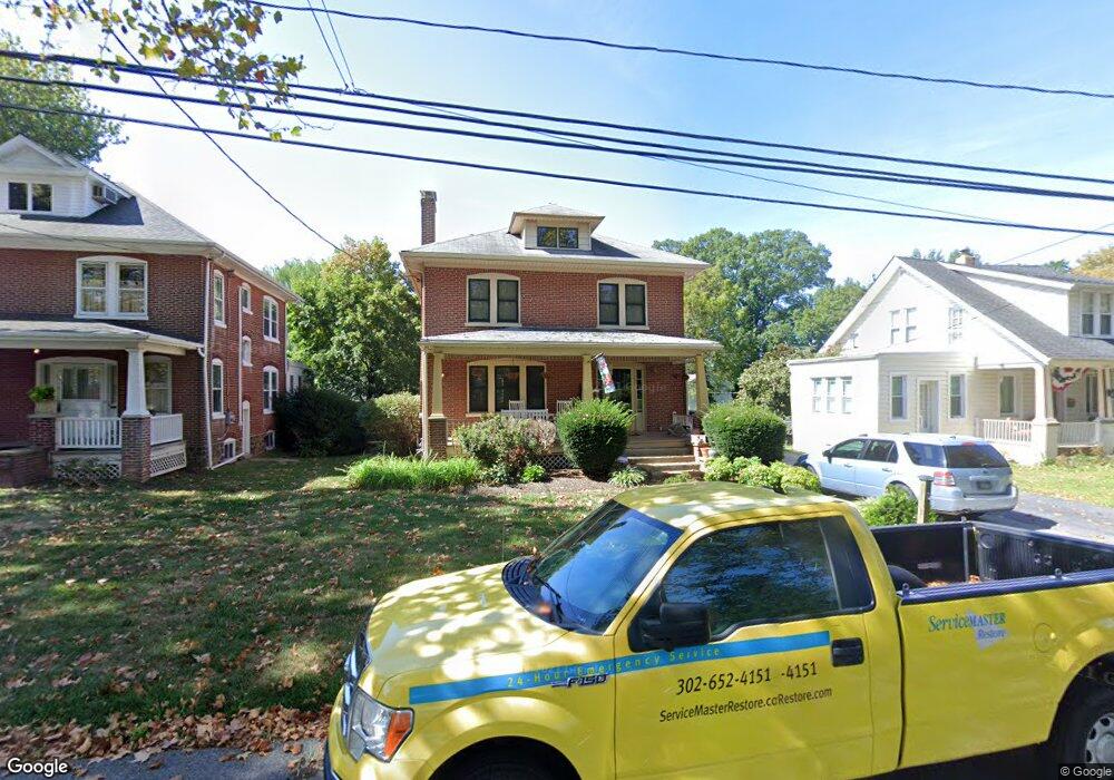
412 Lore Ave Wilmington, DE 19809
Estimated Value: $354,000 - $407,000
4
Beds
1
Bath
1,864
Sq Ft
$202/Sq Ft
Est. Value
About This Home
This home is located at 412 Lore Ave, Wilmington, DE 19809 and is currently estimated at $376,516, approximately $201 per square foot. 412 Lore Ave is a home located in New Castle County with nearby schools including Mount Pleasant Elementary School, Pierre S. Dupont Middle School, and Mount Pleasant High School.
Ownership History
Date
Name
Owned For
Owner Type
Purchase Details
Closed on
Oct 21, 2005
Sold by
Deloretto John N and Deloretto John N
Bought by
Deloretto John N and Deloretto Denise L
Current Estimated Value
Home Financials for this Owner
Home Financials are based on the most recent Mortgage that was taken out on this home.
Original Mortgage
$301,500
Interest Rate
5.79%
Mortgage Type
New Conventional
Create a Home Valuation Report for This Property
The Home Valuation Report is an in-depth analysis detailing your home's value as well as a comparison with similar homes in the area
Home Values in the Area
Average Home Value in this Area
Purchase History
| Date | Buyer | Sale Price | Title Company |
|---|---|---|---|
| Deloretto John N | -- | -- |
Source: Public Records
Mortgage History
| Date | Status | Borrower | Loan Amount |
|---|---|---|---|
| Closed | Deloretto John N | $301,500 |
Source: Public Records
Tax History
| Year | Tax Paid | Tax Assessment Tax Assessment Total Assessment is a certain percentage of the fair market value that is determined by local assessors to be the total taxable value of land and additions on the property. | Land | Improvement |
|---|---|---|---|---|
| 2024 | $2,217 | $56,800 | $10,100 | $46,700 |
| 2023 | $2,032 | $56,800 | $10,100 | $46,700 |
| 2022 | $2,055 | $56,800 | $10,100 | $46,700 |
| 2021 | $2,054 | $56,800 | $10,100 | $46,700 |
| 2020 | $2,054 | $56,800 | $10,100 | $46,700 |
| 2019 | $2,473 | $56,800 | $10,100 | $46,700 |
| 2018 | $1,965 | $56,800 | $10,100 | $46,700 |
| 2017 | $1,936 | $56,800 | $10,100 | $46,700 |
| 2016 | $1,931 | $56,800 | $10,100 | $46,700 |
| 2015 | $1,779 | $56,800 | $10,100 | $46,700 |
| 2014 | $1,779 | $56,800 | $10,100 | $46,700 |
Source: Public Records
Map
Nearby Homes
- 509 Marion Ave
- 47 N Pennewell Dr
- 205 Edgewood Dr
- 20 Brandywine Blvd
- 408 Marsh Rd
- 10 Nancy Rd
- 5 Hillcrest Ave
- 302 River Rd Unit D8
- 47 N Cannon Dr
- 21 N Rodney Dr
- 213 Philadelphia Pike
- 4 Corinne Ct
- 37 W Salisbury Dr
- 518 Lennox Rd
- 1213 Talley Rd
- 4103 Eastview Ln
- 210 Beechwood Rd
- 52 Paladin Dr Unit 52
- 128 Paladin Dr
- 2112 Heather Ct
- 414 Lore Ave
- 408 Lore Ave
- 309 Blue Rock Rd
- 406 Lore Ave
- 307 Blue Rock Rd
- 500 Lore Ave
- 314 Chestnut Ave
- 404 Lore Ave
- 305 Blue Rock Rd
- 312 Chestnut Ave
- 411 Lore Ave
- 306 Blue Rock Rd
- 304 Blue Rock Rd
- 512 Lore Ave
- 302 Blue Rock Rd
- 405 Lore Ave
- 501 Lore Ave
- 304 Chestnut Ave
- 303 Blue Rock Rd
- 300 1/2 Blue Rock Rd
Your Personal Tour Guide
Ask me questions while you tour the home.