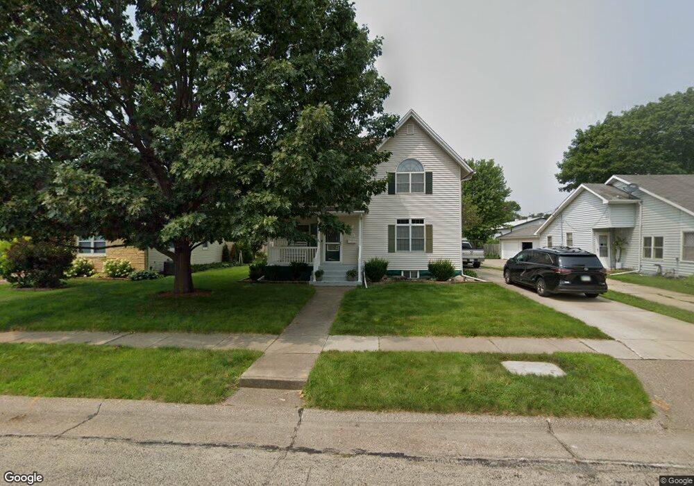
412 N 5th St Maquoketa, IA 52060
Estimated Value: $170,114 - $190,000
3
Beds
4
Baths
1,894
Sq Ft
$95/Sq Ft
Est. Value
About This Home
This home is located at 412 N 5th St, Maquoketa, IA 52060 and is currently estimated at $179,779, approximately $94 per square foot. 412 N 5th St is a home located in Jackson County with nearby schools including Cardinal Elementary School, Briggs Elementary School, and Maquoketa Middle School.
Ownership History
Date
Name
Owned For
Owner Type
Purchase Details
Closed on
Sep 27, 2012
Sold by
Tranel William J and Tranel Kristine L
Bought by
Howad Christopher N and Howard Andrea E
Current Estimated Value
Home Financials for this Owner
Home Financials are based on the most recent Mortgage that was taken out on this home.
Original Mortgage
$130,000
Outstanding Balance
$89,955
Interest Rate
3.57%
Mortgage Type
New Conventional
Estimated Equity
$89,824
Create a Home Valuation Report for This Property
The Home Valuation Report is an in-depth analysis detailing your home's value as well as a comparison with similar homes in the area
Home Values in the Area
Average Home Value in this Area
Purchase History
| Date | Buyer | Sale Price | Title Company |
|---|---|---|---|
| Howad Christopher N | $150,000 | None Available |
Source: Public Records
Mortgage History
| Date | Status | Borrower | Loan Amount |
|---|---|---|---|
| Open | Howad Christopher N | $130,000 |
Source: Public Records
Tax History Compared to Growth
Tax History
| Year | Tax Paid | Tax Assessment Tax Assessment Total Assessment is a certain percentage of the fair market value that is determined by local assessors to be the total taxable value of land and additions on the property. | Land | Improvement |
|---|---|---|---|---|
| 2025 | $1,994 | $155,100 | $12,800 | $142,300 |
| 2024 | $1,994 | $135,800 | $9,600 | $126,200 |
| 2023 | $2,266 | $135,800 | $9,600 | $126,200 |
| 2022 | $2,178 | $125,400 | $9,600 | $115,800 |
| 2021 | $2,170 | $125,400 | $9,600 | $115,800 |
| 2020 | $2,170 | $120,200 | $9,600 | $110,600 |
| 2019 | $2,156 | $120,200 | $0 | $0 |
| 2018 | $2,048 | $120,200 | $0 | $0 |
| 2017 | $2,004 | $114,000 | $0 | $0 |
| 2016 | $1,926 | $114,000 | $0 | $0 |
| 2015 | $1,926 | $114,000 | $0 | $0 |
| 2014 | $1,958 | $114,000 | $0 | $0 |
Source: Public Records
Map
Nearby Homes
- 318 N Main St
- 124 E Platt St
- 210 S 2nd St
- 107 N Otto St
- 216 E Maple St
- 412 E Pleasant St
- 402 S 2nd St
- 306 S Eliza St
- 401-435 Forest Dr
- 220 S Matteson St
- 109 N Dearborn St
- 208 S Clark St
- 708 E Platt St
- 209 W Summit St
- 1007 Kathey Dr
- 911 Lisa Dr
- 1010 Kathey Dr
- 816 Vine St
- 312 Rosemere Ln
- 108 W Monroe St