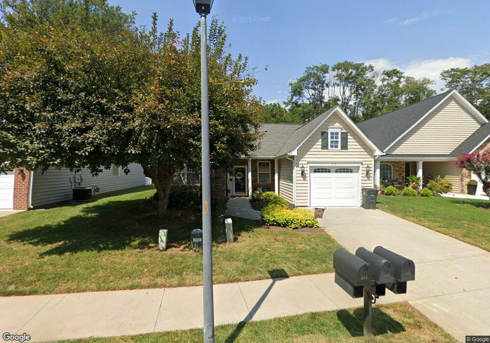
412 Paulette Cir Lynchburg, VA 24502
Wyndhurst NeighborhoodEstimated Value: $285,839 - $366,000
2
Beds
2
Baths
1,313
Sq Ft
$253/Sq Ft
Est. Value
About This Home
This home is located at 412 Paulette Cir, Lynchburg, VA 24502 and is currently estimated at $332,210, approximately $253 per square foot. 412 Paulette Cir is a home located in Lynchburg City with nearby schools including Heritage Elementary School, Sandusky Middle School, and Heritage High School.
Ownership History
Date
Name
Owned For
Owner Type
Purchase Details
Closed on
Nov 29, 2005
Sold by
Heritage Neighborhood Development Llc
Bought by
D O Allen Homes Inc
Current Estimated Value
Home Financials for this Owner
Home Financials are based on the most recent Mortgage that was taken out on this home.
Original Mortgage
$52,350
Outstanding Balance
$29,484
Interest Rate
6.5%
Mortgage Type
New Conventional
Estimated Equity
$302,726
Create a Home Valuation Report for This Property
The Home Valuation Report is an in-depth analysis detailing your home's value as well as a comparison with similar homes in the area
Home Values in the Area
Average Home Value in this Area
Purchase History
| Date | Buyer | Sale Price | Title Company |
|---|---|---|---|
| D O Allen Homes Inc | -- | None Available |
Source: Public Records
Mortgage History
| Date | Status | Borrower | Loan Amount |
|---|---|---|---|
| Open | D O Allen Homes Inc | $52,350 |
Source: Public Records
Tax History Compared to Growth
Tax History
| Year | Tax Paid | Tax Assessment Tax Assessment Total Assessment is a certain percentage of the fair market value that is determined by local assessors to be the total taxable value of land and additions on the property. | Land | Improvement |
|---|---|---|---|---|
| 2025 | $2,541 | $302,500 | $50,000 | $252,500 |
| 2024 | $2,205 | $247,800 | $50,000 | $197,800 |
| 2023 | $2,205 | $247,800 | $50,000 | $197,800 |
| 2022 | $1,942 | $188,500 | $35,000 | $153,500 |
| 2021 | $2,092 | $188,500 | $35,000 | $153,500 |
| 2020 | $1,915 | $172,500 | $35,000 | $137,500 |
| 2019 | $1,915 | $172,500 | $35,000 | $137,500 |
| 2018 | $1,746 | $158,900 | $35,000 | $123,900 |
| 2017 | $1,764 | $158,900 | $35,000 | $123,900 |
| 2016 | $1,728 | $155,700 | $35,000 | $120,700 |
| 2015 | $1,728 | $155,700 | $35,000 | $120,700 |
| 2014 | $1,728 | $160,500 | $35,000 | $125,500 |
Source: Public Records
Map
Nearby Homes
- 114 Thornfield Dr
- 114 Bexley Dr
- 408 Robin Dr
- 725 Wyndhurst Dr
- 102 Springvale Dr
- 694 Wyndhurst Dr
- 206 Simsbury Ln
- 112 Forest Dale Dr
- 300 Robin Dr
- 17513 Forest Rd
- 105 Simsbury Ln
- 324 Beverly Hills Cir
- 1245 Jefferson Oaks Ct Unit 69
- 102 N Woodfin Ct
- 219 Duncraig Dr
- 1055 Jefferson Oaks Ct Unit 3
- 1700 Laxton Rd
- 123 Seven Oaks Dr
- 121 Seven Oaks Dr
- 1721 Heritage Cir
- 410 Paulette Cir
- 408 Paulette Cir
- 414-A Paulette Cir
- 414 Paulette Cir
- 406 Paulette Cir
- 409 Paulette Cir
- 407 Paulette Cir
- 405 Paulette Cir
- 117 Bexley Dr
- 416 Paulette Cir
- 402 Paulette Cir
- 115 Bexley Dr
- 418 Paulette Cir
- 113 Bexley Dr
- 112 Thornfield Dr
- 400 Paulette Cir
- 201 Paulette Cir
- 110 Thornfield Dr
- 111 Bexley Dr
- 420 Paulette Cir