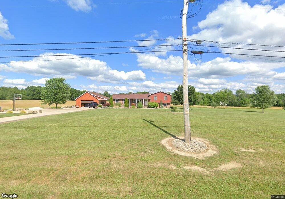
4120 Porter Rd Rootstown, OH 44272
Estimated Value: $280,000 - $333,000
3
Beds
2
Baths
1,582
Sq Ft
$193/Sq Ft
Est. Value
About This Home
This home is located at 4120 Porter Rd, Rootstown, OH 44272 and is currently estimated at $305,265, approximately $192 per square foot. 4120 Porter Rd is a home located in Portage County with nearby schools including Southeast High School.
Ownership History
Date
Name
Owned For
Owner Type
Purchase Details
Closed on
Feb 8, 2018
Sold by
Lavigna Michele M
Bought by
Lavigna Frank H and Lavigna Frank H
Current Estimated Value
Purchase Details
Closed on
Jul 16, 2012
Sold by
Gates Jeffrey T and Gates Rhonda S
Bought by
Lavigna Frank H and Lavigna Michele M
Home Financials for this Owner
Home Financials are based on the most recent Mortgage that was taken out on this home.
Original Mortgage
$123,292
Outstanding Balance
$84,419
Interest Rate
3.5%
Mortgage Type
FHA
Estimated Equity
$220,846
Purchase Details
Closed on
Oct 5, 2007
Sold by
Federal National Mortgage Association
Bought by
Gates Jeffrey T and Cain Rhonda S
Home Financials for this Owner
Home Financials are based on the most recent Mortgage that was taken out on this home.
Original Mortgage
$120,000
Interest Rate
6.45%
Mortgage Type
Purchase Money Mortgage
Purchase Details
Closed on
Jan 18, 2007
Sold by
Simmons Christina Corin
Bought by
Federal National Mortgage Association
Create a Home Valuation Report for This Property
The Home Valuation Report is an in-depth analysis detailing your home's value as well as a comparison with similar homes in the area
Purchase History
| Date | Buyer | Sale Price | Title Company |
|---|---|---|---|
| Lavigna Frank H | -- | -- | |
| Lavigna Frank H | $126,500 | American Land Title | |
| Gates Jeffrey T | $120,000 | None Available | |
| Federal National Mortgage Association | $147,000 | None Available |
Source: Public Records
Mortgage History
| Date | Status | Borrower | Loan Amount |
|---|---|---|---|
| Open | Lavigna Frank H | $123,292 | |
| Closed | Gates Jeffrey T | $120,000 |
Source: Public Records
Tax History
| Year | Tax Paid | Tax Assessment Tax Assessment Total Assessment is a certain percentage of the fair market value that is determined by local assessors to be the total taxable value of land and additions on the property. | Land | Improvement |
|---|---|---|---|---|
| 2024 | $3,107 | $95,550 | $18,550 | $77,000 |
| 2023 | $2,378 | $67,870 | $16,030 | $51,840 |
| 2022 | $2,484 | $67,870 | $16,030 | $51,840 |
| 2021 | $2,505 | $67,870 | $16,030 | $51,840 |
| 2020 | $2,211 | $58,870 | $14,560 | $44,310 |
| 2019 | $2,216 | $58,870 | $14,560 | $44,310 |
| 2018 | $2,319 | $49,490 | $14,140 | $35,350 |
| 2017 | $2,319 | $49,490 | $14,140 | $35,350 |
| 2016 | $2,311 | $49,490 | $14,140 | $35,350 |
| 2015 | $2,212 | $49,490 | $14,140 | $35,350 |
| 2014 | $2,174 | $47,500 | $14,140 | $33,360 |
| 2013 | $2,118 | $47,500 | $14,140 | $33,360 |
Source: Public Records
Map
Nearby Homes
- 7392 Tallmadge Rd
- 3545 Porter Rd
- 3798 State Route 183
- 6747 Giddings Rd
- 2880 State Route 14
- 0 John Thomas
- 2896 Alliance Rd
- 4133 State Route 225
- 9408 Tallmadge Rd
- 0 Ohio 225 Unit 5174573
- 3609 State Route 225
- 2171 Alliance Rd
- 3207 Prairie Cir
- 6605 State Route 5
- 2434 Taft Ave
- 6720 Newton Falls Rd
- 9865 Tallmadge Rd
- 5560 Wilkes Rd
- 3875 McClintocksburg Rd
- 4225 Hattrick Rd
- 4121 Porter Rd
- 4151 Porter Rd
- 4075 Porter Rd
- 4179 Porter Rd
- 4099 Porter Rd
- 4199 Porter Rd
- 4251 Porter Rd
- 7502 Tallmadge Rd
- 7468 Tallmadge Rd
- 7565 Tallmadge Rd
- 4213 Porter Rd
- 7409 Tallmadge Rd
- 4300 Porter Rd
- 4324 Porter Rd
- 4348 Porter Rd
- 7436 Tallmadge Rd
- 7577 Tallmadge Rd
- 6 Porter Rd
- 4 Porter Rd
- 5 Porter Rd