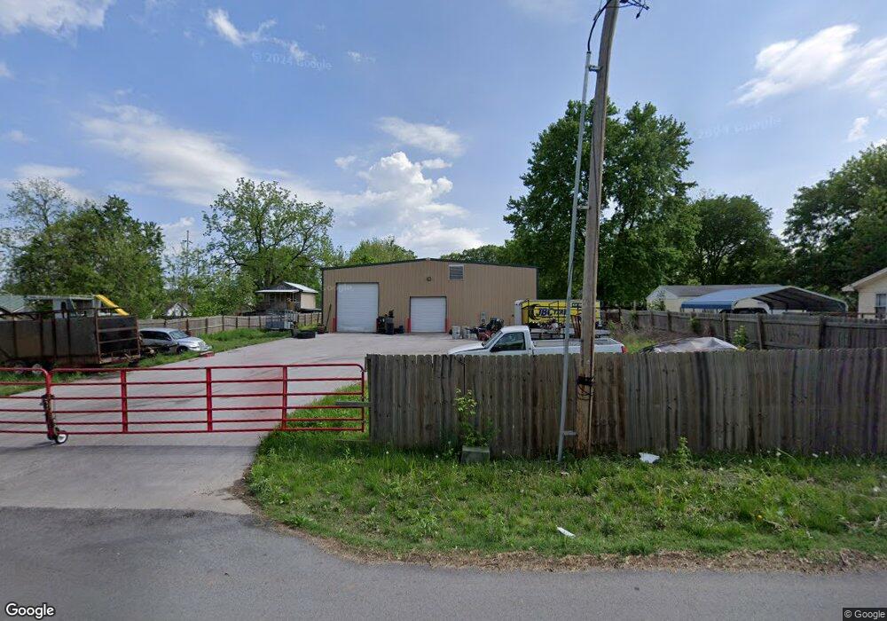
4126 W Junction St Springfield, MO 65802
Estimated Value: $345,634
Studio
1
Bath
4,800
Sq Ft
$72/Sq Ft
Est. Value
About This Home
This home is located at 4126 W Junction St, Springfield, MO 65802 and is currently priced at $345,634, approximately $72 per square foot. 4126 W Junction St is a home located in Greene County with nearby schools including Willard Intermediate-South.
Ownership History
Date
Name
Owned For
Owner Type
Purchase Details
Closed on
Sep 30, 2020
Sold by
Boswell John Steven and John Steven Boswell Revocable
Bought by
Jeffcoat Charles
Current Estimated Value
Home Financials for this Owner
Home Financials are based on the most recent Mortgage that was taken out on this home.
Original Mortgage
$64,500
Outstanding Balance
$57,109
Interest Rate
2.9%
Mortgage Type
New Conventional
Purchase Details
Closed on
May 13, 2014
Sold by
Boswell John Steven
Bought by
Boswell John Steven and The John Steven Boswell Revocable Trust
Home Financials for this Owner
Home Financials are based on the most recent Mortgage that was taken out on this home.
Original Mortgage
$108,300
Interest Rate
4.46%
Mortgage Type
Construction
Purchase Details
Closed on
Apr 18, 2013
Sold by
City Of Springfield
Bought by
John Steven Boswell Irrevocable Trust
Create a Home Valuation Report for This Property
The Home Valuation Report is an in-depth analysis detailing your home's value as well as a comparison with similar homes in the area
Purchase History
| Date | Buyer | Sale Price | Title Company |
|---|---|---|---|
| Jeffcoat Charles | -- | None Available | |
| Boswell John Steven | -- | None Available | |
| John Steven Boswell Irrevocable Trust | -- | None Available |
Source: Public Records
Mortgage History
| Date | Status | Borrower | Loan Amount |
|---|---|---|---|
| Open | Jeffcoat Charles | $64,500 | |
| Previous Owner | Boswell John Steven | $108,300 |
Source: Public Records
Tax History
| Year | Tax Paid | Tax Assessment Tax Assessment Total Assessment is a certain percentage of the fair market value that is determined by local assessors to be the total taxable value of land and additions on the property. | Land | Improvement |
|---|---|---|---|---|
| 2025 | $6,525 | $101,220 | $15,840 | $85,380 |
| 2024 | $6,218 | $95,010 | $15,840 | $79,170 |
| 2023 | $6,199 | $95,010 | $15,840 | $79,170 |
| 2022 | $5,190 | $79,200 | $5,180 | $74,020 |
| 2021 | $5,192 | $79,200 | $5,180 | $74,020 |
| 2020 | $5,230 | $79,160 | $5,180 | $73,980 |
| 2019 | $5,210 | $79,160 | $5,180 | $73,980 |
| 2018 | $4,344 | $65,720 | $5,180 | $60,540 |
| 2017 | $4,313 | $64,990 | $5,180 | $59,810 |
| 2016 | $4,246 | $1,900 | $1,900 | $0 |
| 2015 | $104 | $1,900 | $1,900 | $0 |
| 2014 | $104 | $0 | $0 | $0 |
Source: Public Records
Map
Nearby Homes
- 705 N Jonathan Ave
- 3823 W Dover St
- 208 S York Ave
- 305 S Troy Ave
- 4033 W Tarkio St
- 4231 W Tilden St
- 3952 W Collings St
- 511 S Duke Ave
- 4442 W Tilden St
- 4562 W Tarkio St
- 227 S Lulwood Ave
- 233 S Lulwood Ave
- 1139 N Dickerson
- 1135 N Dickerson Ave
- 1137 N Dickerson Ave
- 826 S Orchard Crest Ave
- 832 S Orchard Crest Ave
- 842 S Orchard Crest Ave
- 870 S Orchard Crest Ave
- 3024 W Mount Vernon St
- 4134 W Junction St
- 4277 E Farm Lane Rd Unit 130
- 4140 W Junction St
- 739 N Orchard Crest Ave
- 4133 W Church St
- 4149 W Church St
- 804 N Meteor Ave
- 810 N Meteor Ave
- 731 N Orchard Crest Ave
- 4151 W Church St
- 818 N Orchard Crest
- 818 N Orchard Crest Ave
- 709 N Orchard Crest Ave
- 4124 W Church St
- 4134 W Church St
- 4148 W Church St
- 805 N Meteor Ave
- 805 N Meteor Ave
- 670 N Meteor Ave
- 4125 W Maple St
Your Personal Tour Guide
Ask me questions while you tour the home.