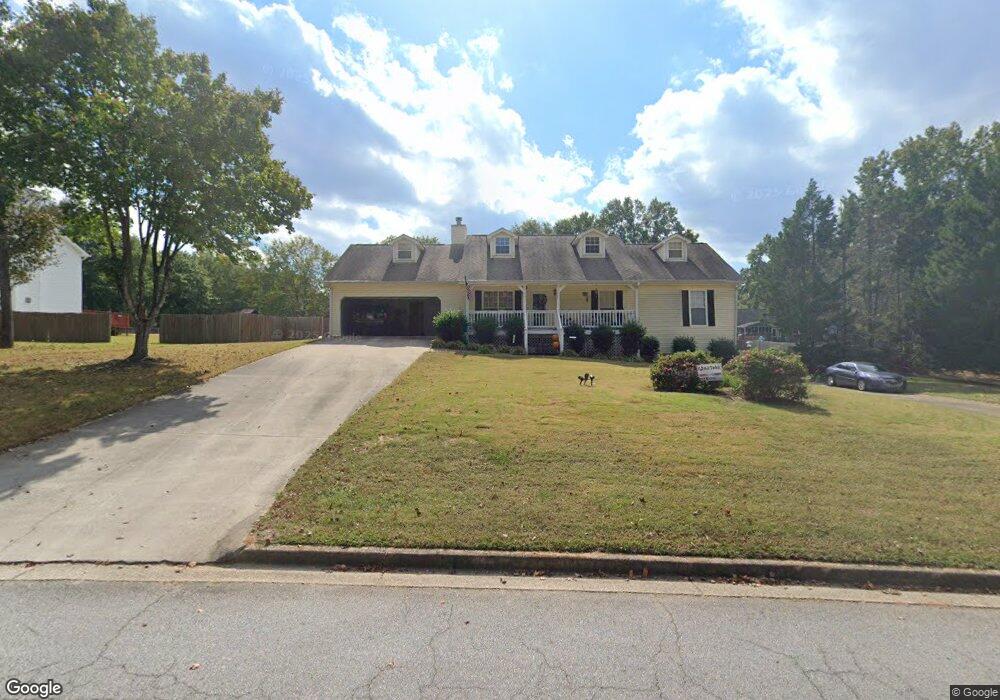
413 Mckenzie Ave Stockbridge, GA 30281
Estimated Value: $317,000 - $359,000
3
Beds
2
Baths
1,682
Sq Ft
$204/Sq Ft
Est. Value
About This Home
This home is located at 413 Mckenzie Ave, Stockbridge, GA 30281 and is currently estimated at $342,396, approximately $203 per square foot. 413 Mckenzie Ave is a home located in Henry County with nearby schools including Woodland Elementary School, Woodland Middle School, and Woodland High School.
Ownership History
Date
Name
Owned For
Owner Type
Purchase Details
Closed on
Feb 23, 2012
Sold by
Federal National Mortgage Association
Bought by
Taylor Joshua T
Current Estimated Value
Purchase Details
Closed on
Sep 6, 2011
Sold by
Bank Of America Na
Bought by
Federal National Mtg Associati
Purchase Details
Closed on
Jul 30, 1993
Sold by
Ga Homes
Bought by
Harbuck Daniel W
Home Financials for this Owner
Home Financials are based on the most recent Mortgage that was taken out on this home.
Original Mortgage
$101,867
Interest Rate
7.34%
Mortgage Type
FHA
Create a Home Valuation Report for This Property
The Home Valuation Report is an in-depth analysis detailing your home's value as well as a comparison with similar homes in the area
Home Values in the Area
Average Home Value in this Area
Purchase History
| Date | Buyer | Sale Price | Title Company |
|---|---|---|---|
| Taylor Joshua T | -- | -- | |
| Federal National Mtg Associati | $75,961 | -- | |
| Bank Of America Na | $75,961 | -- | |
| Harbuck Daniel W | $103,600 | -- |
Source: Public Records
Mortgage History
| Date | Status | Borrower | Loan Amount |
|---|---|---|---|
| Previous Owner | Harbuck Daniel W | $101,867 |
Source: Public Records
Tax History Compared to Growth
Tax History
| Year | Tax Paid | Tax Assessment Tax Assessment Total Assessment is a certain percentage of the fair market value that is determined by local assessors to be the total taxable value of land and additions on the property. | Land | Improvement |
|---|---|---|---|---|
| 2025 | $4,397 | $129,584 | $18,000 | $111,584 |
| 2024 | $4,397 | $130,680 | $18,000 | $112,680 |
| 2023 | $3,933 | $130,000 | $16,000 | $114,000 |
| 2022 | $4,167 | $106,920 | $12,000 | $94,920 |
| 2021 | $3,556 | $91,000 | $12,000 | $79,000 |
| 2020 | $3,291 | $84,080 | $10,800 | $73,280 |
| 2019 | $3,215 | $82,120 | $10,800 | $71,320 |
| 2018 | $2,988 | $76,200 | $10,000 | $66,200 |
| 2016 | $2,445 | $62,040 | $10,000 | $52,040 |
| 2015 | $2,225 | $54,600 | $7,200 | $47,400 |
| 2014 | $2,116 | $51,240 | $7,200 | $44,040 |
Source: Public Records
Map
Nearby Homes
- 164 Mckenzie Ct
- 1720 Highway 138 E
- 608 Mckenzie Cir
- 320 Mckenzie Dr
- 1810 Highway 138 E
- 564 Mckenzie Ave
- 0 Mckenzie Ave Unit 10593345
- 719 Erin Dr
- 663 Moseley Dr
- 551 Hood Rd
- 1548 Harlequin Way
- 100 Kim Trail
- 805 Anna Kathryn Dr
- 825 Anna Kathryn Dr
- 809 Anna Kathryn Dr
- 807 Anna Kathryn Dr
- 829 Anna Kathryn Dr
- 830 Anna Kathryn Dr
- 811 Anna Kathryn Dr
- 831 Anna Kathryn Dr
- 421 Mckenzie Ave
- 405 Mckenzie Ave
- 135 Mckenzie Ct
- 143 Mckenzie Ct
- 408 Mckenzie Ave
- 416 Mckenzie Ave
- 151 Mckenzie Ct
- 0 Mckenzie Ct Unit 8832671
- 0 Mckenzie Ct Unit 7418194
- 0 Mckenzie Ct
- 400 Mckenzie Ave
- 108 Mckenzie Ct
- 395 Mckenzie Ave
- 116 Mckenzie Ct
- 132 Mckenzie Ct
- 159 Mckenzie Ct
- 124 Mckenzie Ct
- 140 Mckenzie Ct
- 148 Mckenzie Ct
- 200 Mckenzie Dr