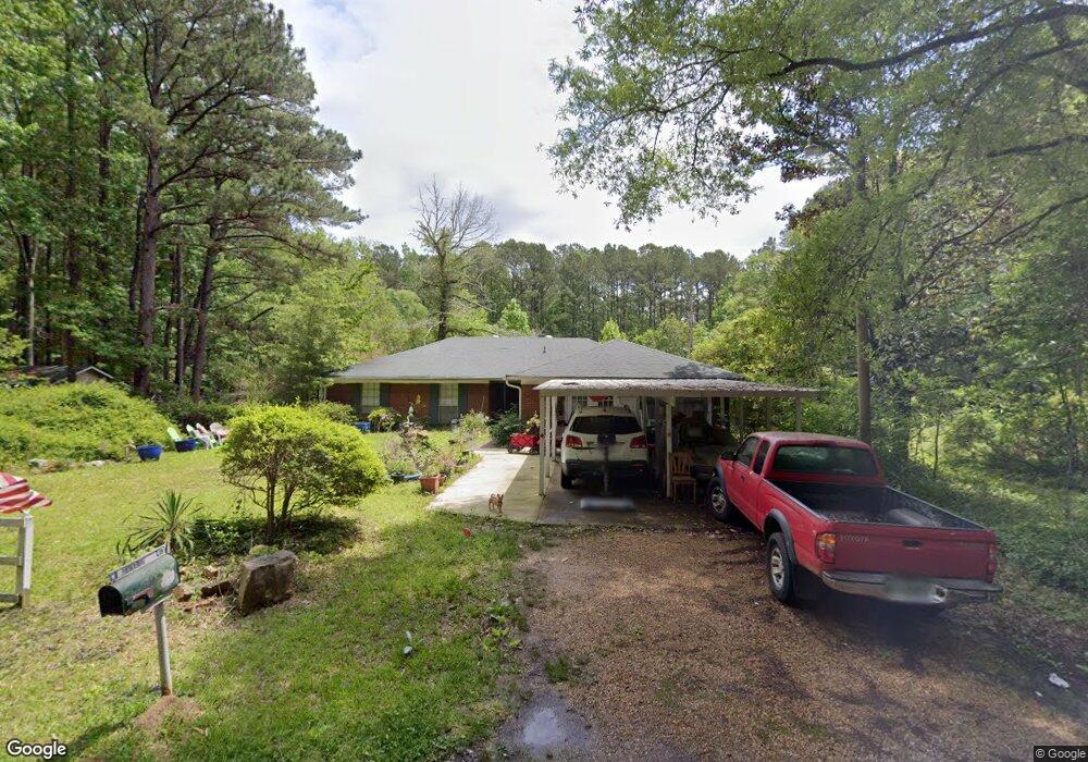
413 Michael Dr Brandon, MS 39042
Estimated Value: $135,000 - $250,000
3
Beds
3
Baths
1,614
Sq Ft
$121/Sq Ft
Est. Value
About This Home
This home is located at 413 Michael Dr, Brandon, MS 39042 and is currently estimated at $195,497, approximately $121 per square foot. 413 Michael Dr is a home located in Rankin County with nearby schools including McLaurin Elementary School.
Ownership History
Date
Name
Owned For
Owner Type
Purchase Details
Closed on
Feb 11, 2026
Sold by
Carey Robert E
Bought by
Edwards Alliance Group Llc
Current Estimated Value
Home Financials for this Owner
Home Financials are based on the most recent Mortgage that was taken out on this home.
Original Mortgage
$148,586
Outstanding Balance
$148,586
Interest Rate
6.15%
Mortgage Type
Construction
Estimated Equity
$46,911
Purchase Details
Closed on
Jan 23, 2020
Sold by
Mullins Howard
Bought by
Wimberley Suvatana B
Create a Home Valuation Report for This Property
The Home Valuation Report is an in-depth analysis detailing your home's value as well as a comparison with similar homes in the area
Purchase History
| Date | Buyer | Sale Price | Title Company |
|---|---|---|---|
| Edwards Alliance Group Llc | -- | None Listed On Document | |
| Wimberley Suvatana B | -- | None Listed On Document |
Source: Public Records
Mortgage History
| Date | Status | Borrower | Loan Amount |
|---|---|---|---|
| Open | Edwards Alliance Group Llc | $148,586 | |
| Previous Owner | Wimberley Suvatana B | $0 |
Source: Public Records
Tax History
| Year | Tax Paid | Tax Assessment Tax Assessment Total Assessment is a certain percentage of the fair market value that is determined by local assessors to be the total taxable value of land and additions on the property. | Land | Improvement |
|---|---|---|---|---|
| 2024 | $560 | $8,058 | $0 | $0 |
| 2023 | -- | $5,740 | $0 | $0 |
| 2022 | $0 | $5,740 | $0 | $0 |
| 2021 | $0 | $5,740 | $0 | $0 |
| 2020 | $0 | $5,740 | $0 | $0 |
| 2019 | $0 | $5,044 | $0 | $0 |
| 2018 | $0 | $5,044 | $0 | $0 |
| 2017 | $0 | $5,044 | $0 | $0 |
| 2016 | $0 | $5,220 | $0 | $0 |
| 2015 | -- | $5,220 | $0 | $0 |
| 2014 | -- | $5,220 | $0 | $0 |
| 2013 | -- | $5,220 | $0 | $0 |
Source: Public Records
Map
Nearby Homes
- 0 Donna Ashley St
- 0 Joe Davis Dr
- 1622 Old Lake Rd
- 1392 Old Lake Rd
- J05 Red Light Rd
- 0 Sir Guy Ln
- 308 Stronghold Dr
- 305 Stronghold Dr
- 306 Stronghold Dr
- 146 Lady Marian Rd
- 1142 Sanctuary Dr
- 217 New Haven Ln
- 1178 Sanctuary Dr
- 1154 Sanctuary Dr
- 112 Sir Richard Rd
- 110 Sir Richard Rd
- 0 Will Stutely Dr
- 176 Will Stutely Dr
- 1264 Shell Oil Rd
- 538 Stone Brook Place
- 160 Black St
- 365 Applewood Ln
- 748 Brown St W
- 0 Michael Dr
- 340 Apple Wood Ln
- 0 Lynell St Unit Lot 291 and Lot
- 137 Lisa St
- No Donna Ashley St
- 902 Shannon Lee Dr
- 730 Green St
- 746 Brown St W
- 730 Black St
- 821 Angela Hudson St
- 00 Jones St
- 716 Green St
- 830 John Davis St
- 818 Angela Hudson St
- 739 Brown St W
- 300 Tanya Ave
- 615 Jones St
Your Personal Tour Guide
Ask me questions while you tour the home.