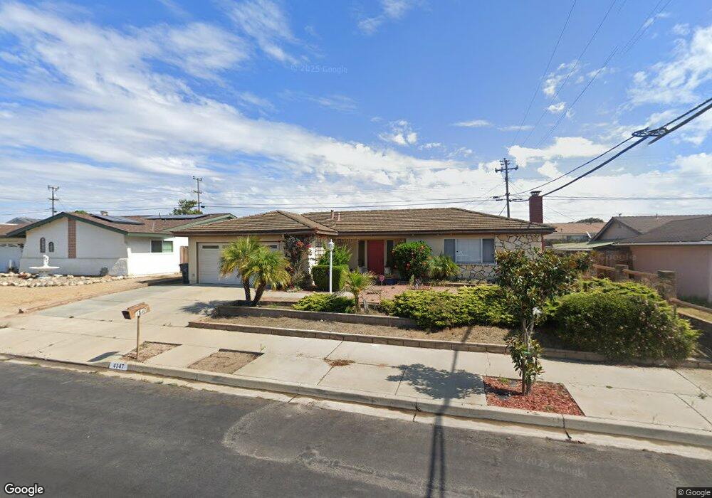
4147 Polaris Ave Unit 1 Lompoc, CA 93436
Estimated Value: $561,887 - $627,000
3
Beds
2
Baths
1,641
Sq Ft
$370/Sq Ft
Est. Value
About This Home
This home is located at 4147 Polaris Ave Unit 1, Lompoc, CA 93436 and is currently estimated at $607,722, approximately $370 per square foot. 4147 Polaris Ave Unit 1 is a home located in Santa Barbara County with nearby schools including Buena Vista Elementary School, Cabrillo High School, and Olive Grove Charter - Lompoc.
Ownership History
Date
Name
Owned For
Owner Type
Purchase Details
Closed on
Mar 21, 2024
Sold by
Fajardo Juan Roberto and Fajardo Martha Patricia
Bought by
Juan And Martha Fajardo Living Trust and Fajardo
Current Estimated Value
Purchase Details
Closed on
Feb 14, 2001
Sold by
Roberson Gerry Belisle and Wragge Carolyn Roberson
Bought by
Fajardo John R O and Fajardo Martha Patricia
Home Financials for this Owner
Home Financials are based on the most recent Mortgage that was taken out on this home.
Original Mortgage
$170,100
Interest Rate
6.98%
Purchase Details
Closed on
Feb 12, 2001
Sold by
Wragge Carolyn Roberson
Bought by
Roberson Gerry Belisle and Wragge Carolyn Roberson
Home Financials for this Owner
Home Financials are based on the most recent Mortgage that was taken out on this home.
Original Mortgage
$170,100
Interest Rate
6.98%
Create a Home Valuation Report for This Property
The Home Valuation Report is an in-depth analysis detailing your home's value as well as a comparison with similar homes in the area
Home Values in the Area
Average Home Value in this Area
Purchase History
| Date | Buyer | Sale Price | Title Company |
|---|---|---|---|
| Juan And Martha Fajardo Living Trust | -- | None Listed On Document | |
| Fajardo John R O | $189,000 | First American Title | |
| Roberson Gerry Belisle | -- | First American Title |
Source: Public Records
Mortgage History
| Date | Status | Borrower | Loan Amount |
|---|---|---|---|
| Previous Owner | Fajardo John R O | $170,100 |
Source: Public Records
Tax History Compared to Growth
Tax History
| Year | Tax Paid | Tax Assessment Tax Assessment Total Assessment is a certain percentage of the fair market value that is determined by local assessors to be the total taxable value of land and additions on the property. | Land | Improvement |
|---|---|---|---|---|
| 2025 | $3,455 | $286,276 | $97,932 | $188,344 |
| 2023 | $3,455 | $275,161 | $94,130 | $181,031 |
| 2022 | $3,403 | $269,767 | $92,285 | $177,482 |
| 2021 | $3,438 | $264,478 | $90,476 | $174,002 |
| 2020 | $3,405 | $261,767 | $89,549 | $172,218 |
| 2019 | $3,356 | $256,636 | $87,794 | $168,842 |
| 2018 | $3,311 | $251,605 | $86,073 | $165,532 |
| 2017 | $3,167 | $246,673 | $84,386 | $162,287 |
| 2016 | $2,844 | $241,837 | $82,732 | $159,105 |
| 2014 | $2,784 | $233,541 | $79,894 | $153,647 |
Source: Public Records
Map
Nearby Homes
- 4108 Constellation Rd
- 4139 Constellation Rd Unit 2
- 252 Pegasus Ave
- 129 Hercules Ave
- 113 Gemini Ave
- 4490 Sirius Ave
- 3951 Mesa Circle Dr
- 4021 Muirfield Place
- 52 Stanford Cir
- 3939 Saturn Ave
- 298 Saint Andrews Way
- 210 Oak Hill Dr
- 0 Oak Hill Dr Unit 24-783
- 240 Oak Hill Dr
- 384 Falcon Crest Dr
- 4464 Greenbrier Rd
- 445 Firestone Way
- 561 Andromeda Dr
- 579 Saint Andrews Way
- 3725 Jupiter Ave
- 4157 Polaris Ave Unit 1
- 4139 Polaris Ave
- 4148 Constellation Rd
- 4140 Constellation Rd Unit 2
- 4158 Constellation Rd
- 4167 Polaris Ave
- 4131 Polaris Ave
- 224 Vega Ave
- 4132 Constellation Rd
- 223 Orion Ave Unit 2
- 4168 Constellation Rd
- 4175 Polaris Ave
- 4125 Polaris Ave
- 228 Vega Ave
- 4170 Polaris Ave
- 4124 Constellation Rd Unit 2
- 227 Orion Ave
- 4178 Constellation Rd
- 4115 Polaris Ave
- 4185 Polaris Ave Unit 1