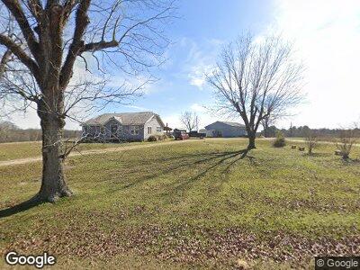
4150 Highway 472 Hazlehurst, MS 39083
Estimated Value: $168,000 - $301,000
--
Bed
1
Bath
1,622
Sq Ft
$147/Sq Ft
Est. Value
About This Home
This home is located at 4150 Highway 472, Hazlehurst, MS 39083 and is currently estimated at $237,931, approximately $146 per square foot. 4150 Highway 472 is a home located in Copiah County with nearby schools including Hazlehurst Middle School and Hazlehurst High School.
Ownership History
Date
Name
Owned For
Owner Type
Purchase Details
Closed on
Jul 18, 2022
Sold by
Le Dean Marcus E
Bought by
Dean Marcus E
Current Estimated Value
Home Financials for this Owner
Home Financials are based on the most recent Mortgage that was taken out on this home.
Original Mortgage
$231,600
Outstanding Balance
$201,608
Interest Rate
4.81%
Mortgage Type
New Conventional
Estimated Equity
$50,220
Purchase Details
Closed on
May 7, 2007
Sold by
Walker Penny Louise
Bought by
Entrican David Richard
Purchase Details
Closed on
Jul 24, 2006
Sold by
Morris John C
Bought by
Bank Of New York
Purchase Details
Closed on
Oct 14, 2005
Sold by
Henley Harris B
Bought by
Henley Harris B and Henley James W
Purchase Details
Closed on
Apr 29, 2005
Sold by
Dean Cynthia Myers and Myers David Mark
Bought by
Myers Clell D
Create a Home Valuation Report for This Property
The Home Valuation Report is an in-depth analysis detailing your home's value as well as a comparison with similar homes in the area
Home Values in the Area
Average Home Value in this Area
Purchase History
| Date | Buyer | Sale Price | Title Company |
|---|---|---|---|
| Dean Marcus E | -- | None Listed On Document | |
| Entrican David Richard | -- | -- | |
| Bank Of New York | $47,214 | -- | |
| Henley Harris B | -- | -- | |
| Myers Clell D | -- | -- |
Source: Public Records
Mortgage History
| Date | Status | Borrower | Loan Amount |
|---|---|---|---|
| Open | Dean Marcus E | $231,600 |
Source: Public Records
Tax History Compared to Growth
Tax History
| Year | Tax Paid | Tax Assessment Tax Assessment Total Assessment is a certain percentage of the fair market value that is determined by local assessors to be the total taxable value of land and additions on the property. | Land | Improvement |
|---|---|---|---|---|
| 2024 | $2,604 | $23,760 | $0 | $0 |
| 2023 | $1,453 | $12,094 | $0 | $0 |
| 2022 | $1,477 | $12,037 | $0 | $0 |
| 2021 | $1,442 | $11,980 | $0 | $0 |
| 2020 | $1,371 | $11,315 | $0 | $0 |
| 2019 | $1,363 | $11,271 | $0 | $0 |
| 2018 | $1,394 | $11,376 | $0 | $0 |
| 2017 | $1,137 | $10,971 | $0 | $0 |
| 2016 | $1,137 | $9,358 | $0 | $0 |
| 2015 | -- | $9,217 | $0 | $0 |
| 2014 | -- | $6,795 | $0 | $0 |
Source: Public Records
Map
Nearby Homes
- 3016 Ashley Rd
- 2048 Ashley Rd
- 0 Little Rock Rd Unit 4111856
- 0 Bethesda Rd Unit 20660796
- 0 Runnels Rd Unit 140947
- 744 Georgetown St
- 00 Little Rock Rd
- 613 Georgetown St
- 308 Asbury Dr
- 229 Pinehurst Cir
- 348 S Extension St
- 330 S Extension St
- 214 W Green St
- 209 Downing St
- 000 Monticello Rd
- 0 Burt Loop Rd
- 5146 New Hope Rd
- 140 Westover Dr
- 0 Carlisle St
- 1002 Poplar Springs Rd
- 4150 Highway 472
- 4137 Highway 472
- 4169 Highway 472
- 4191 Highway 472
- 5012 Highway 472
- 4133 Highway 472
- 4192 Sardis Rd
- 4192 Sardis Rd
- 4173 Highway 472
- 5019 Highway 472
- 4091 Highway 472
- 5059 Highway 472
- 4092 Highway 472
- 5078 Highway 472
- 4069 Highway 472
- 4080 Highway 472
- 1019 Ramsey Ln
- 1191 Whitetown Ln
- 1191 Whitetown Ln
- 5064 Highway 472