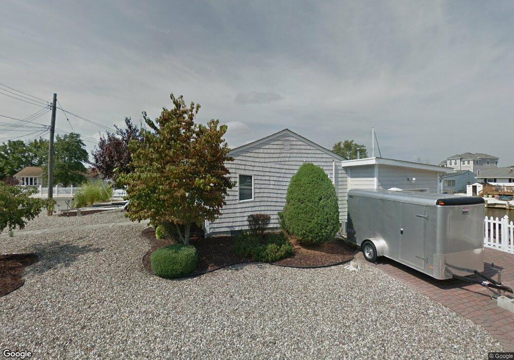
416 Whyatt Ct Forked River, NJ 08731
Lacey Township NeighborhoodEstimated Value: $452,161 - $631,000
2
Beds
1
Bath
1,080
Sq Ft
$479/Sq Ft
Est. Value
About This Home
This home is located at 416 Whyatt Ct, Forked River, NJ 08731 and is currently estimated at $517,290, approximately $478 per square foot. 416 Whyatt Ct is a home located in Ocean County with nearby schools including Lacey Township High School.
Ownership History
Date
Name
Owned For
Owner Type
Purchase Details
Closed on
Mar 27, 2009
Sold by
Gibbs Philip and Gibbs Joan
Bought by
Dodds Steven M and Dodds Barbara A
Current Estimated Value
Home Financials for this Owner
Home Financials are based on the most recent Mortgage that was taken out on this home.
Original Mortgage
$267,750
Outstanding Balance
$169,079
Interest Rate
4.92%
Mortgage Type
Purchase Money Mortgage
Estimated Equity
$348,211
Purchase Details
Closed on
May 25, 2000
Sold by
Radomski Walter
Bought by
Gibbs Phillip and Gibbs Joan
Create a Home Valuation Report for This Property
The Home Valuation Report is an in-depth analysis detailing your home's value as well as a comparison with similar homes in the area
Home Values in the Area
Average Home Value in this Area
Purchase History
| Date | Buyer | Sale Price | Title Company |
|---|---|---|---|
| Dodds Steven M | $315,000 | Multiple | |
| Gibbs Phillip | $165,000 | -- |
Source: Public Records
Mortgage History
| Date | Status | Borrower | Loan Amount |
|---|---|---|---|
| Open | Dodds Steven M | $267,750 |
Source: Public Records
Tax History Compared to Growth
Tax History
| Year | Tax Paid | Tax Assessment Tax Assessment Total Assessment is a certain percentage of the fair market value that is determined by local assessors to be the total taxable value of land and additions on the property. | Land | Improvement |
|---|---|---|---|---|
| 2025 | $6,016 | $237,400 | $151,000 | $86,400 |
| 2024 | $5,624 | $237,400 | $151,000 | $86,400 |
| 2023 | $5,372 | $237,400 | $151,000 | $86,400 |
| 2022 | $5,372 | $237,400 | $151,000 | $86,400 |
| 2021 | $5,282 | $237,400 | $151,000 | $86,400 |
| 2020 | $5,114 | $237,400 | $151,000 | $86,400 |
| 2019 | $5,023 | $237,400 | $151,000 | $86,400 |
| 2018 | $4,964 | $237,400 | $151,000 | $86,400 |
| 2017 | $4,850 | $237,400 | $151,000 | $86,400 |
| 2016 | $4,831 | $237,400 | $151,000 | $86,400 |
| 2015 | $4,615 | $237,400 | $151,000 | $86,400 |
| 2014 | $5,783 | $336,200 | $251,000 | $85,200 |
Source: Public Records
Map
Nearby Homes
- 404 Beach Blvd
- 419 Beach Blvd
- 501 N Shore Dr
- 10 Dolphin Ct
- 604 Beach Blvd
- 25 Hollywood Blvd S
- 217 Nantucket Rd
- Lot1 Clearwater Dr
- 34 Mariner Dr
- 213 Beach Blvd
- 69 Saltspray Dr
- 79 Saltspray Dr
- 613 Twin River Dr
- 455 Newport Rd
- 78 Saltspray Dr
- 302 Reef Ct
- 9 Hollywood Blvd S
- 0 Clearwater Dr Unit NJOC2035594
- 741 S River Dr
- 124 Oakwood Place
- 414 Whyatt Ct
- 409 Seabright Rd
- 412 Whyatt Ct
- 413 Seabright Rd
- 407 Seabright Rd
- 420 Middle Branch Dr
- 421 Middle Branch Dr
- 410 Whyatt Ct
- 422 Middle Branch Dr
- 0 Middle Branch Dr Unit NJOC217938
- 405 Seabright Rd
- 408 Whyatt Ct
- 423 Middle Branch Dr
- 410 Beach Blvd
- 403 Seabright Rd
- 408 Beach Blvd
- 412 Beach Blvd
- 406 Whyatt Ct
- 414 Beach Blvd
- 406 Beach Blvd