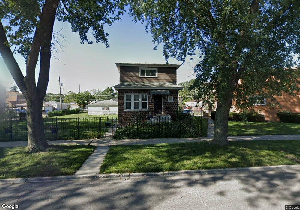
418 E 93rd St Chicago, IL 60619
Roseland NeighborhoodEstimated Value: $182,141 - $240,000
3
Beds
2
Baths
1,485
Sq Ft
$134/Sq Ft
Est. Value
About This Home
This home is located at 418 E 93rd St, Chicago, IL 60619 and is currently estimated at $198,785, approximately $133 per square foot. 418 E 93rd St is a home located in Cook County with nearby schools including Gillespie Elementary School, Harlan Community Academy High School, and Christian S T E M Scholars.
Ownership History
Date
Name
Owned For
Owner Type
Purchase Details
Closed on
Oct 16, 2013
Sold by
Stubbs Janice and Garner Arquella
Bought by
Jordan Misty Michelle
Current Estimated Value
Purchase Details
Closed on
Oct 15, 2013
Sold by
Stubbs Janice and Garner Arquella
Bought by
Jordan Misty Michelle
Purchase Details
Closed on
Aug 3, 1995
Sold by
Harper Odessa
Bought by
Hill Nathaniel and Hill Clyde
Purchase Details
Closed on
Jan 23, 1994
Sold by
Hill Willie Ella and Hill Yolanda
Bought by
Hill Nathaniel and Hill Clyde
Create a Home Valuation Report for This Property
The Home Valuation Report is an in-depth analysis detailing your home's value as well as a comparison with similar homes in the area
Home Values in the Area
Average Home Value in this Area
Purchase History
| Date | Buyer | Sale Price | Title Company |
|---|---|---|---|
| Jordan Misty Michelle | $45,000 | Git | |
| Jordan Misty Michelle | -- | None Available | |
| Hill Nathaniel | -- | -- | |
| Hill Nathaniel | -- | -- |
Source: Public Records
Tax History
| Year | Tax Paid | Tax Assessment Tax Assessment Total Assessment is a certain percentage of the fair market value that is determined by local assessors to be the total taxable value of land and additions on the property. | Land | Improvement |
|---|---|---|---|---|
| 2025 | $1,199 | $13,601 | $1,973 | $11,628 |
| 2024 | $1,199 | $13,601 | $1,973 | $11,628 |
| 2023 | $1,148 | $9,000 | $2,630 | $6,370 |
| 2022 | $1,148 | $9,000 | $2,630 | $6,370 |
| 2021 | $1,140 | $9,000 | $2,630 | $6,370 |
| 2020 | $1,663 | $10,566 | $2,104 | $8,462 |
| 2019 | $1,644 | $11,611 | $2,104 | $9,507 |
| 2018 | $1,615 | $11,611 | $2,104 | $9,507 |
| 2017 | $3,305 | $15,353 | $1,841 | $13,512 |
| 2016 | $3,075 | $15,353 | $1,841 | $13,512 |
| 2015 | $2,813 | $15,353 | $1,841 | $13,512 |
| 2014 | $2,669 | $14,384 | $1,578 | $12,806 |
| 2013 | $2,138 | $14,384 | $1,578 | $12,806 |
Source: Public Records
Map
Nearby Homes
- 9300 S Vernon Ave
- 9319 S Calumet Ave
- 500 E 92nd St
- 9323 S Rhodes Ave
- 543 E 92nd St
- 9400 S Calumet Ave
- 9432 S Vernon Ave
- 543 E 91st Place
- 9150 S Burnside Ave
- 628 E 92nd Place
- 518 E 95th St
- 9456 S Calumet Ave
- 9419 S Saint Lawrence Ave
- 549 E 91st St
- 9410 S Champlain Ave
- 9418 S Champlain Ave
- 9339 S Burnside Ave
- 654 E 92nd Place
- 9020 S King Dr
- 9549 S Calumet Ave
- 418 E 93rd St
- 416 E 93rd St
- 424 E 93rd St Unit 1
- 424 E 93rd St
- 9258 S Burnside Ave
- 9259 S Burnside Ave
- 9260 S Burnside Ave
- 9252 S Burnside Ave
- 9264 S Burnside Ave
- 9264 S Burnside Ave
- 9248 S Burnside Ave
- 9259 S King Dr
- 9261 S King Dr Unit 63
- 9257 S King Dr
- 9253 S King Dr
- 9263 S King Dr Unit 2E
- 9263 S King Dr Unit 2
- 9244 S Burnside Ave
- 9251 S King Dr
- 9254 S Burnside Ave
Your Personal Tour Guide
Ask me questions while you tour the home.