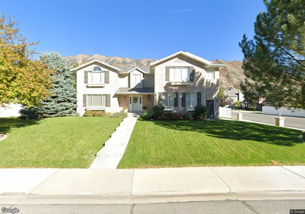
4196 N 430 E Provo, UT 84604
Rock Canyon NeighborhoodEstimated Value: $857,000 - $957,000
7
Beds
4
Baths
4,561
Sq Ft
$202/Sq Ft
Est. Value
About This Home
This home is located at 4196 N 430 E, Provo, UT 84604 and is currently estimated at $921,175, approximately $201 per square foot. 4196 N 430 E is a home located in Utah County with nearby schools including Edgemont School, Centennial Middle School, and Timpview High School.
Ownership History
Date
Name
Owned For
Owner Type
Purchase Details
Closed on
May 24, 2017
Sold by
Embro Holdigns L L C
Bought by
Mclaughlin Amy
Current Estimated Value
Home Financials for this Owner
Home Financials are based on the most recent Mortgage that was taken out on this home.
Original Mortgage
$530,000
Outstanding Balance
$288,383
Interest Rate
4.08%
Mortgage Type
Construction
Estimated Equity
$632,792
Purchase Details
Closed on
Nov 15, 2012
Sold by
Mitton Emily
Bought by
Embro Holdings Llc
Purchase Details
Closed on
Jul 8, 2004
Sold by
Pueblo Creek Land & Cattle Co Llc
Bought by
Hamblin Robert L and Hamblin Jane M
Purchase Details
Closed on
Apr 29, 2004
Sold by
Gardner Michael R
Bought by
Pueblo Creek Land & Cattle Co Llc
Purchase Details
Closed on
May 22, 2003
Sold by
County Of Utah
Bought by
Gardner Michael R
Create a Home Valuation Report for This Property
The Home Valuation Report is an in-depth analysis detailing your home's value as well as a comparison with similar homes in the area
Home Values in the Area
Average Home Value in this Area
Purchase History
| Date | Buyer | Sale Price | Title Company |
|---|---|---|---|
| Mclaughlin Amy | -- | Backman Title Services | |
| Embro Holdings Llc | -- | Cornerstone Title Insurance | |
| Mitton Emily | -- | Cornerstone Title Insurance | |
| Hamblin Robert L | -- | Sundance Title Insurance Ag | |
| Pueblo Creek Land & Cattle Co Llc | -- | -- | |
| Gardner Michael R | $13,150 | -- |
Source: Public Records
Mortgage History
| Date | Status | Borrower | Loan Amount |
|---|---|---|---|
| Open | Mclaughlin Amy | $530,000 |
Source: Public Records
Tax History
| Year | Tax Paid | Tax Assessment Tax Assessment Total Assessment is a certain percentage of the fair market value that is determined by local assessors to be the total taxable value of land and additions on the property. | Land | Improvement |
|---|---|---|---|---|
| 2025 | $4,370 | $427,955 | -- | -- |
| 2024 | $4,370 | $430,155 | $0 | $0 |
| 2023 | $4,287 | $415,965 | $0 | $0 |
| 2022 | $4,423 | $432,795 | $0 | $0 |
| 2021 | $3,417 | $583,100 | $209,300 | $373,800 |
| 2020 | $3,381 | $540,900 | $174,400 | $366,500 |
| 2019 | $2,964 | $493,100 | $174,400 | $318,700 |
| 2018 | $2,833 | $478,100 | $163,300 | $314,800 |
| 2017 | $2,748 | $254,760 | $0 | $0 |
| 2016 | $2,820 | $243,705 | $0 | $0 |
| 2015 | $2,464 | $215,270 | $0 | $0 |
| 2014 | $2,275 | $207,130 | $0 | $0 |
Source: Public Records
Map
Nearby Homes
- 4161 N Canyon Rd Unit 2
- 299 E 4000 N
- 407 E 3900 Rd N Unit 1
- 407 E 3900 Rd N
- 645 Foothill Dr
- 4601 Foothill Dr
- 3857 N 100 E
- 144 E 4620 N
- 3711 N Canyon Rd
- 3690 N Canyon Rd
- 285 Three Fountains Dr
- 924 Redford Dr
- 981 Waterford Dr Unit 5&6
- 3588 N 230 E
- 221 E 4735 N
- 4640 Brookshire Cir
- 4299 Ivy Ln
- 3702 N 920 E
- 5600 N Canyon Rd
- 3943 Foothill Dr
Your Personal Tour Guide
Ask me questions while you tour the home.