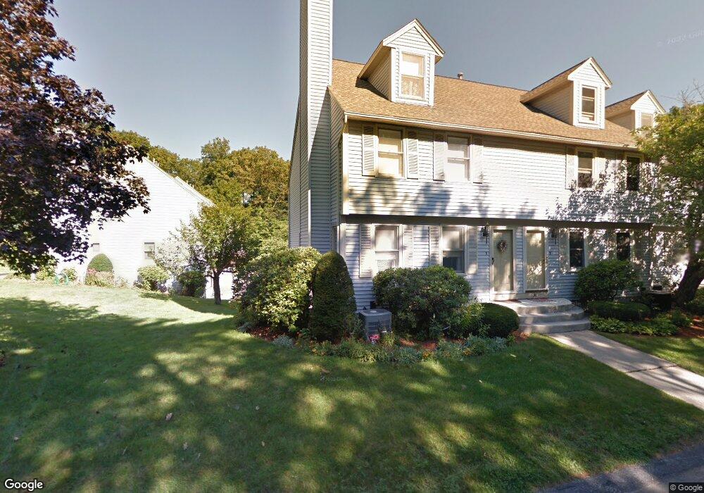
42 High Bridge Hill Unit U188 Nashua, NH 03063
Northwest Nashua NeighborhoodEstimated Value: $436,000 - $457,065
3
Beds
2
Baths
1,686
Sq Ft
$264/Sq Ft
Est. Value
About This Home
This home is located at 42 High Bridge Hill Unit U188, Nashua, NH 03063 and is currently estimated at $444,766, approximately $263 per square foot. 42 High Bridge Hill Unit U188 is a home located in Hillsborough County with nearby schools including Broad Street Elementary School, Pennichuck Middle School, and Nashua High School North.
Ownership History
Date
Name
Owned For
Owner Type
Purchase Details
Closed on
Jan 3, 2018
Sold by
Mckelvey John B
Bought by
John B Mckelvey Ret
Current Estimated Value
Purchase Details
Closed on
Aug 23, 2005
Sold by
Marudzinski Edward W
Bought by
Mckelvey John B
Home Financials for this Owner
Home Financials are based on the most recent Mortgage that was taken out on this home.
Original Mortgage
$140,000
Interest Rate
5.66%
Create a Home Valuation Report for This Property
The Home Valuation Report is an in-depth analysis detailing your home's value as well as a comparison with similar homes in the area
Home Values in the Area
Average Home Value in this Area
Purchase History
| Date | Buyer | Sale Price | Title Company |
|---|---|---|---|
| John B Mckelvey Ret | -- | -- | |
| Mckelvey John B | $238,000 | -- |
Source: Public Records
Mortgage History
| Date | Status | Borrower | Loan Amount |
|---|---|---|---|
| Previous Owner | Mckelvey John B | $98,000 | |
| Previous Owner | Mckelvey John B | $140,000 |
Source: Public Records
Tax History Compared to Growth
Tax History
| Year | Tax Paid | Tax Assessment Tax Assessment Total Assessment is a certain percentage of the fair market value that is determined by local assessors to be the total taxable value of land and additions on the property. | Land | Improvement |
|---|---|---|---|---|
| 2024 | $6,611 | $415,800 | $0 | $415,800 |
| 2023 | $6,320 | $346,700 | $0 | $346,700 |
| 2022 | $6,265 | $346,700 | $0 | $346,700 |
| 2021 | $5,584 | $240,500 | $0 | $240,500 |
| 2020 | $5,438 | $240,500 | $0 | $240,500 |
| 2019 | $5,233 | $240,500 | $0 | $240,500 |
| 2018 | $5,101 | $240,500 | $0 | $240,500 |
| 2017 | $4,101 | $159,000 | $0 | $159,000 |
| 2016 | $3,986 | $159,000 | $0 | $159,000 |
| 2015 | $3,900 | $159,000 | $0 | $159,000 |
| 2014 | $3,824 | $159,000 | $0 | $159,000 |
Source: Public Records
Map
Nearby Homes
- 38 Highbridge Hill Rd Unit 186
- 26 Andover Down Unit 276
- 123 Cannongate III
- 74 Profile Cir
- 75 Deerwood Dr Unit B
- 5 Dumaine Ave Unit B
- 5 Dumaine Ave Unit N
- 77 Deerwood Dr Unit E
- 66 Tinker Rd
- 47 Hanna Cir Unit 47
- 47 Hanna Cir
- 218 Millwright Dr Unit 218
- 201 Millwright Dr
- 33 Ferry Rd
- 3 Roedean Dr Unit C-207
- 7 Robert Dr
- 2 New Haven Dr Unit E303
- 18 Swift Ln
- 19 Dunloggin Rd
- 40 Merrimack Dr
- 40 High Bridge Hill Unit U187
- 40 Highbridge Hill Unit 40
- 38 High Bridge Hill Unit U186
- 38 High Bridge Hill Unit 186
- 36 High Bridge Hill Unit U185
- 36 High Bridge Hill Unit 185
- 36 High Bridge Hill
- 44 High Bridge Hill Unit U189
- 44 Highbridge Hill
- 46 Highbridge Hill Rd Unit 46
- 46 High Bridge Hill Unit U190
- 48 High Bridge Hill Unit U191
- 20 Highbridge Hill Rd Unit 180
- 50 High Bridge Hill Unit U192
- 50 Highbridge Hill
- 34 High Bridge Hill Unit U184
- 34 High Bridge Hill
- 32 High Bridge Hill Unit U183
- 30 High Bridge Hill Unit U182
- 30 Highbridge Unit 182