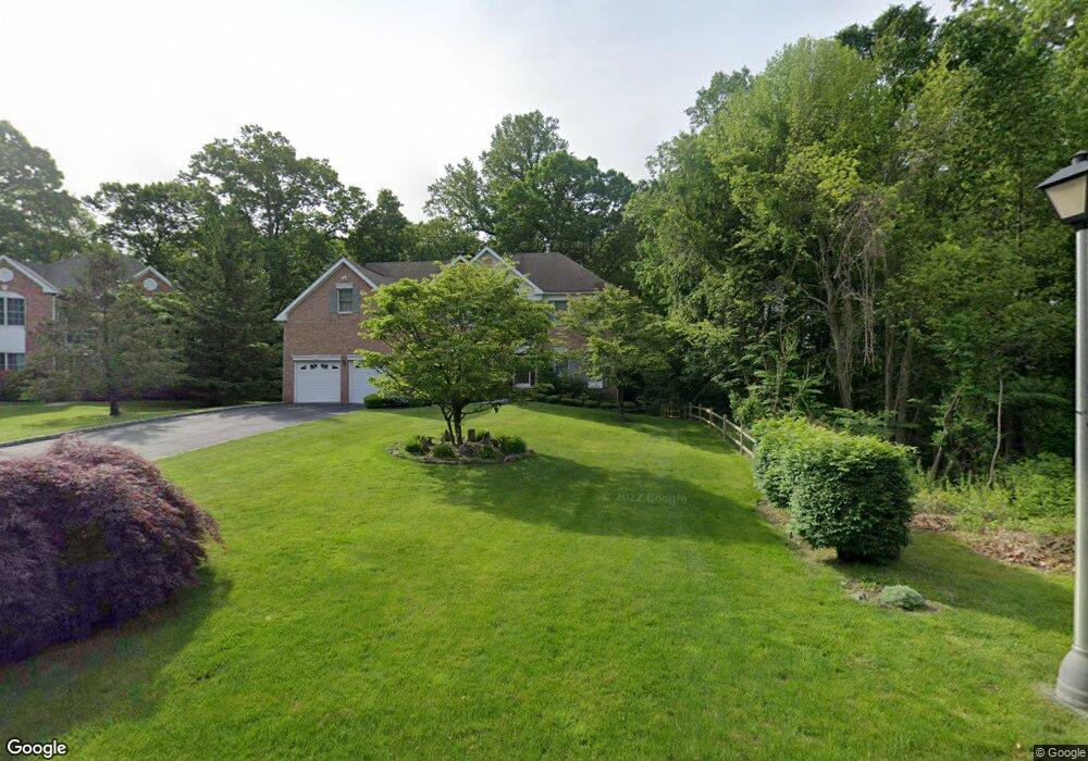
42 McGuiness Ln Unit 44 White Plains, NY 10605
North Street NeighborhoodEstimated Value: $1,605,150 - $1,991,000
4
Beds
2
Baths
3,406
Sq Ft
$534/Sq Ft
Est. Value
About This Home
This home is located at 42 McGuiness Ln Unit 44, White Plains, NY 10605 and is currently estimated at $1,818,788, approximately $533 per square foot. 42 McGuiness Ln Unit 44 is a home located in Westchester County with nearby schools including White Plains Middle School, White Plains Senior High School, and German International School New York.
Ownership History
Date
Name
Owned For
Owner Type
Purchase Details
Closed on
Dec 30, 2003
Sold by
Chang Ki Wha and Chang Mi Young
Bought by
Dempsey Paul and Dempsey Virginia A
Current Estimated Value
Home Financials for this Owner
Home Financials are based on the most recent Mortgage that was taken out on this home.
Original Mortgage
$500,000
Interest Rate
5.25%
Mortgage Type
Purchase Money Mortgage
Purchase Details
Closed on
Jul 25, 1997
Sold by
Toll Land Vi Ltd Partnership
Bought by
Chang Ki Wha and Chang Mi Young
Create a Home Valuation Report for This Property
The Home Valuation Report is an in-depth analysis detailing your home's value as well as a comparison with similar homes in the area
Home Values in the Area
Average Home Value in this Area
Purchase History
| Date | Buyer | Sale Price | Title Company |
|---|---|---|---|
| Dempsey Paul | $1,150,000 | The Judicial Title Ins Agenc | |
| Chang Ki Wha | $650,227 | -- |
Source: Public Records
Mortgage History
| Date | Status | Borrower | Loan Amount |
|---|---|---|---|
| Previous Owner | Dempsey Paul | $500,000 |
Source: Public Records
Tax History Compared to Growth
Tax History
| Year | Tax Paid | Tax Assessment Tax Assessment Total Assessment is a certain percentage of the fair market value that is determined by local assessors to be the total taxable value of land and additions on the property. | Land | Improvement |
|---|---|---|---|---|
| 2024 | $3,209 | $25,600 | $3,375 | $22,225 |
| 2023 | $3,318 | $25,600 | $3,375 | $22,225 |
| 2022 | $19,577 | $25,600 | $3,375 | $22,225 |
| 2021 | $19,555 | $25,600 | $3,375 | $22,225 |
| 2020 | $19,191 | $25,600 | $3,375 | $22,225 |
| 2019 | $26,442 | $25,600 | $3,375 | $22,225 |
| 2018 | $19,582 | $25,600 | $3,375 | $22,225 |
| 2017 | $0 | $25,600 | $3,375 | $22,225 |
| 2016 | $24,227 | $25,600 | $3,375 | $22,225 |
| 2015 | -- | $25,600 | $3,375 | $22,225 |
| 2014 | -- | $25,600 | $3,375 | $22,225 |
| 2013 | -- | $25,600 | $3,375 | $22,225 |
Source: Public Records
Map
Nearby Homes
- 133 Woodbrook Rd Unit 135
- 39 Club Pointe Dr Unit 11
- 75 Kenilworth Rd
- 455 Rosedale Ave
- 20 Devonshire Dr
- 655 North St
- 40 Polly Park Rd
- 3 Little Ln
- 144 Wendover Rd
- 33 Sammis Ln
- 3 Old Farm Cir
- 64 Richbell Rd
- 43 Westfield Rd
- 8 Westfield Cir
- 38 Middale Rd
- 11 Oxford Rd
- 4 Commodore Ave
- 17 Avondale Rd
- 35 Seville Ave
- 15 Rockledge Rd
- 46 McGuiness Ln Unit 48
- 50 McGuiness Ln Unit 52
- 51 McGuiness Ln
- 55 McGuiness Ln
- 39 McGuiness Ln Unit 43
- 27 Eagle Ct
- 34 McGuiness Ln Unit 36
- 23 Eagle Ct
- 35 McGuiness Ln Unit 37
- 35 McGuiness Ln Unit 1
- 35-37 McGuiness Ln Unit 1
- 26 Greene Ln Unit 30
- 19 Eagle Ct
- 31 McGuiness Ln Unit 33
- 30 McGuiness Ln Unit 32
- 22 Greene Ln Unit 24
- 31 Eagle Ct
- 34 Eagle Ct
- 27 McGuiness Ln Unit 29
- 15 Eagle Ct