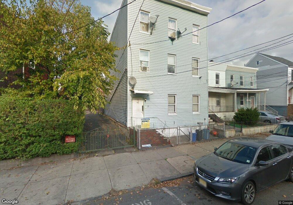
42 Saint Pauls Ave Jersey City, NJ 07306
The Heights NeighborhoodEstimated Value: $658,923 - $1,138,000
6
Beds
3
Baths
3,000
Sq Ft
$297/Sq Ft
Est. Value
About This Home
This home is located at 42 Saint Pauls Ave, Jersey City, NJ 07306 and is currently estimated at $892,481, approximately $297 per square foot. 42 Saint Pauls Ave is a home located in Hudson County with nearby schools including Jotham W. Wakeman No. 6 Elementary School, William L. Dickinson High School, and Dr Ronald McNair High School.
Ownership History
Date
Name
Owned For
Owner Type
Purchase Details
Closed on
Mar 30, 2017
Sold by
Intriago Lauro and Intriago Raquel
Bought by
Jsq Llc
Current Estimated Value
Purchase Details
Closed on
Oct 5, 2001
Sold by
Siljee Daniel
Bought by
Intriago Lauro
Home Financials for this Owner
Home Financials are based on the most recent Mortgage that was taken out on this home.
Original Mortgage
$167,373
Interest Rate
6.93%
Mortgage Type
FHA
Purchase Details
Closed on
Aug 24, 1998
Sold by
Roman Juan and Roman Ellen
Bought by
Hud
Purchase Details
Closed on
Sep 20, 1995
Sold by
Torres Raul
Bought by
Roman Juan
Purchase Details
Closed on
Sep 13, 1995
Sold by
The Federal Home Loan Mtg Corp
Bought by
Torres Raul
Purchase Details
Closed on
Nov 28, 1994
Sold by
Webster Edward J
Bought by
Federal Home Loan Mortgage Corporation
Create a Home Valuation Report for This Property
The Home Valuation Report is an in-depth analysis detailing your home's value as well as a comparison with similar homes in the area
Home Values in the Area
Average Home Value in this Area
Purchase History
| Date | Buyer | Sale Price | Title Company |
|---|---|---|---|
| Jsq Llc | $360,000 | Hudson Realty Abstarct Co | |
| Intriago Lauro | $170,000 | -- | |
| Hud | -- | -- | |
| Roman Juan | $163,000 | -- | |
| Torres Raul | -- | -- | |
| Federal Home Loan Mortgage Corporation | -- | -- |
Source: Public Records
Mortgage History
| Date | Status | Borrower | Loan Amount |
|---|---|---|---|
| Previous Owner | Intriago Lauro | $167,373 |
Source: Public Records
Tax History Compared to Growth
Tax History
| Year | Tax Paid | Tax Assessment Tax Assessment Total Assessment is a certain percentage of the fair market value that is determined by local assessors to be the total taxable value of land and additions on the property. | Land | Improvement |
|---|---|---|---|---|
| 2025 | $11,647 | $521,600 | $240,000 | $281,600 |
| 2024 | $11,720 | $521,600 | $240,000 | $281,600 |
| 2023 | $11,720 | $521,600 | $240,000 | $281,600 |
| 2022 | $11,047 | $521,600 | $240,000 | $281,600 |
| 2021 | $8,366 | $521,600 | $240,000 | $281,600 |
| 2020 | $8,398 | $521,600 | $240,000 | $281,600 |
| 2019 | $8,341 | $541,600 | $240,000 | $301,600 |
| 2018 | $2,009 | $541,600 | $240,000 | $301,600 |
| 2017 | $10,530 | $135,000 | $20,000 | $115,000 |
| 2016 | $10,396 | $135,000 | $20,000 | $115,000 |
| 2015 | $10,101 | $135,000 | $20,000 | $115,000 |
| 2014 | $10,036 | $135,000 | $20,000 | $115,000 |
Source: Public Records
Map
Nearby Homes
- 25 Saint Pauls Ave Unit 3
- 396 Baldwin Ave
- 41 Beacon Ave Unit 2
- 41 Beacon Ave Unit 1
- 60 Hopkins Ave
- 34 Concord St
- 40 Beacon Ave
- 28 Beacon Ave Unit 3
- 28 Beacon Ave Unit 1
- 28 Beacon Ave Unit 2
- 69 Beacon Ave
- 21 Concord St Unit 2
- 137 Palisade Ave
- 65 Fleet St Unit 403
- 97 Palisade Ave
- 83 Oakland Ave
- 10 Concord St
- 34 Laidlaw Ave
- 73 Laidlaw Ave
- 85 Palisade Ave
- 42 Saint Pauls Ave Unit 3
- 42 St Pauls Ave Unit 1
- 42 St Paul Ave Unit 1
- 40 Saint Pauls Ave
- 40 Saint Pauls Ave Unit 2
- 40 Saint Pauls Ave Unit 1
- 46 Saint Pauls Ave Unit 2R
- 46 Saint Pauls Ave
- 46 Saint Pauls Ave Unit 1A
- 48 St Pauls Ave Unit 1
- 38 Saint Pauls Ave
- 38 Saint Pauls Ave Unit 2
- 36 Saint Pauls Ave
- 48 Saint Pauls Ave Unit 1
- 48 Saint Pauls Ave Unit 2
- 39 Hopkins Ave
- 37 Hopkins Ave
- 37 Hopkins Ave Unit 2
- 50 Saint Pauls Ave
- 50 Saint Pauls Ave Unit 1