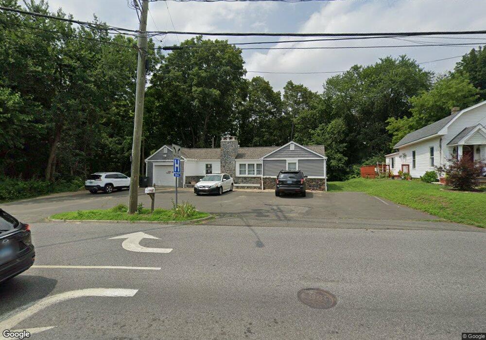
42 Sand Pit Rd Danbury, CT 06810
Germantown NeighborhoodEstimated Value: $320,000 - $446,000
2
Beds
2
Baths
1,169
Sq Ft
$332/Sq Ft
Est. Value
About This Home
This home is located at 42 Sand Pit Rd, Danbury, CT 06810 and is currently estimated at $388,542, approximately $332 per square foot. 42 Sand Pit Rd is a home located in Fairfield County with nearby schools including Ellsworth Avenue School, Broadview Middle School, and Danbury High School.
Ownership History
Date
Name
Owned For
Owner Type
Purchase Details
Closed on
Feb 18, 2021
Sold by
Ogden Enterprises Llc
Bought by
Cabrera Sergio G
Current Estimated Value
Home Financials for this Owner
Home Financials are based on the most recent Mortgage that was taken out on this home.
Original Mortgage
$176,250
Outstanding Balance
$157,500
Interest Rate
2.65%
Mortgage Type
Purchase Money Mortgage
Estimated Equity
$231,042
Purchase Details
Closed on
Jan 24, 2003
Sold by
Gavagan Roger
Bought by
Ogden Edward
Home Financials for this Owner
Home Financials are based on the most recent Mortgage that was taken out on this home.
Original Mortgage
$162,400
Interest Rate
6.11%
Create a Home Valuation Report for This Property
The Home Valuation Report is an in-depth analysis detailing your home's value as well as a comparison with similar homes in the area
Home Values in the Area
Average Home Value in this Area
Purchase History
| Date | Buyer | Sale Price | Title Company |
|---|---|---|---|
| Cabrera Sergio G | $235,000 | None Available | |
| Ogden Edward | $203,000 | -- |
Source: Public Records
Mortgage History
| Date | Status | Borrower | Loan Amount |
|---|---|---|---|
| Open | Cabrera Sergio G | $176,250 | |
| Previous Owner | Ogden Edward | $162,400 |
Source: Public Records
Tax History Compared to Growth
Tax History
| Year | Tax Paid | Tax Assessment Tax Assessment Total Assessment is a certain percentage of the fair market value that is determined by local assessors to be the total taxable value of land and additions on the property. | Land | Improvement |
|---|---|---|---|---|
| 2025 | $6,233 | $249,410 | $74,550 | $174,860 |
| 2024 | $6,096 | $249,410 | $74,550 | $174,860 |
| 2023 | $5,819 | $249,410 | $74,550 | $174,860 |
| 2022 | $3,875 | $137,300 | $61,200 | $76,100 |
| 2021 | $3,792 | $137,400 | $61,300 | $76,100 |
| 2020 | $3,792 | $137,400 | $61,300 | $76,100 |
| 2019 | $3,792 | $137,400 | $61,300 | $76,100 |
| 2018 | $3,792 | $137,400 | $61,300 | $76,100 |
| 2017 | $3,564 | $123,100 | $58,300 | $64,800 |
| 2016 | $3,531 | $123,100 | $58,300 | $64,800 |
| 2015 | $3,479 | $123,100 | $58,300 | $64,800 |
| 2014 | $3,398 | $123,100 | $58,300 | $64,800 |
Source: Public Records
Map
Nearby Homes
- 20 Oak Ridge Gate
- 7 Tilden Rd
- 40 Great Plain Rd
- 34 Morgan Ave
- 16 Springside Ave
- 30 Grove Place
- 2904 Eaton Ct
- 1304 Eaton Ct Unit 1304
- 18 Clearbrook Rd
- 1206 Eaton Ct Unit 1206
- 20 Meadow St
- 18 Meadow St
- 14 Locust Ave
- 25 E Cross Trail Unit 25
- 22 Brentwood Cir Unit 22
- 61 Brentwood Cir Unit 66
- 101 Brentwood Cir Unit 101
- 5 W Cross Trail Unit 5
- 4 Elwell Place
- 10 Valley Stream Dr
- 44 Sand Pit Rd
- 46 Sand Pit Rd
- 1 Great Plain Rd
- 48 Sand Pit Rd
- 50 Sand Pit Rd
- 11 Michaud Rd
- 4 Great Plain Rd
- 3 Great Plain Rd
- 2 Great Plain Rd
- 6 Great Plain Rd
- 52 Sand Pit Rd
- 1 Shepard Rd
- 2 Shepard Rd
- 9 Michaud Rd
- 8 Great Plain Rd
- 14 Great Plain Rd
- 4A Shepard Rd
- 56 Sand Pit Rd
- 20 Michaud Rd
- 5 Shepard Rd