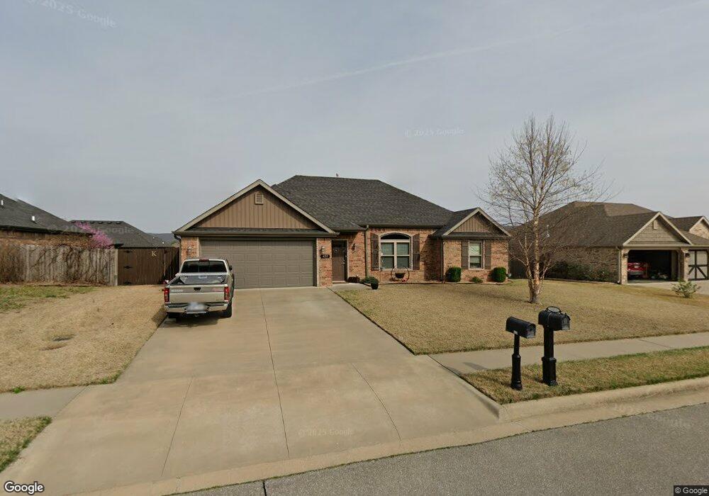
420 Captain Reid Ln Prairie Grove, AR 72753
Estimated Value: $303,000 - $326,000
3
Beds
2
Baths
1,574
Sq Ft
$199/Sq Ft
Est. Value
About This Home
This home is located at 420 Captain Reid Ln, Prairie Grove, AR 72753 and is currently estimated at $313,573, approximately $199 per square foot. 420 Captain Reid Ln is a home located in Washington County with nearby schools including Prairie Grove Elementary School, Prairie Grove Middle School, and Prairie Grove Junior High School.
Ownership History
Date
Name
Owned For
Owner Type
Purchase Details
Closed on
Oct 24, 2017
Sold by
Cox Developments Llc
Bought by
Kennedy Dwayne and Kennedy Paula L
Current Estimated Value
Home Financials for this Owner
Home Financials are based on the most recent Mortgage that was taken out on this home.
Original Mortgage
$166,920
Outstanding Balance
$137,865
Interest Rate
3.5%
Mortgage Type
FHA
Estimated Equity
$175,708
Purchase Details
Closed on
Feb 4, 2016
Bought by
Heritage Heights American Group and Llc
Purchase Details
Closed on
Jun 11, 2015
Bought by
Heritage Heights American Group and Llc
Purchase Details
Closed on
Apr 29, 2015
Bought by
Ozark Mountain Porterhouse and Club Llc
Create a Home Valuation Report for This Property
The Home Valuation Report is an in-depth analysis detailing your home's value as well as a comparison with similar homes in the area
Home Values in the Area
Average Home Value in this Area
Purchase History
| Date | Buyer | Sale Price | Title Company |
|---|---|---|---|
| Kennedy Dwayne | $170,000 | Lenders Title Co | |
| Heritage Heights American Group | -- | -- | |
| Heritage Heights American Group | -- | -- | |
| Ozark Mountain Porterhouse | -- | -- |
Source: Public Records
Mortgage History
| Date | Status | Borrower | Loan Amount |
|---|---|---|---|
| Open | Kennedy Dwayne | $166,920 |
Source: Public Records
Tax History Compared to Growth
Tax History
| Year | Tax Paid | Tax Assessment Tax Assessment Total Assessment is a certain percentage of the fair market value that is determined by local assessors to be the total taxable value of land and additions on the property. | Land | Improvement |
|---|---|---|---|---|
| 2025 | $1,402 | $57,500 | $8,000 | $49,500 |
| 2024 | $1,444 | $57,500 | $8,000 | $49,500 |
| 2023 | $1,502 | $57,500 | $8,000 | $49,500 |
| 2022 | $1,461 | $35,990 | $6,000 | $29,990 |
| 2021 | $1,381 | $35,990 | $6,000 | $29,990 |
| 2020 | $1,295 | $35,990 | $6,000 | $29,990 |
| 2019 | $1,233 | $29,560 | $5,000 | $24,560 |
| 2018 | $1,258 | $29,560 | $5,000 | $24,560 |
| 2017 | $27 | $5,000 | $5,000 | $0 |
| 2016 | $270 | $3,000 | $3,000 | $0 |
| 2015 | $162 | $3,000 | $3,000 | $0 |
| 2014 | $162 | $3,000 | $3,000 | $0 |
Source: Public Records
Map
Nearby Homes
- 1321 General Marmaduke Dr
- 611 Sundowner Ranch Ave
- 1280 General Parson Dr
- 631 Marcella St
- 650 Marcella St
- 511 Captain Stockton St
- 1461 General Parson Dr
- 101 S Eagle Mountain St
- 1380 Colonel Hawthorne Dr
- 150 N Eagle Mountain St
- 951 E Buchanan St
- 1421 Colonel McNeil Dr
- 816 Spurgeon Ln
- 123 S Eagle Mountain St
- 113 S Eagle Mountain St
- 1360 Colonel Bass Ln
- 841 Round Top St
- 921 Petit Jean St
- Bellvue Plan at Selah Meadows
- Bryant Plan at Selah Meadows
- 460 Captain Reid Ln
- 380 Captain Reid Ln
- 461 Sundowner Ranch Ave
- 381 Sundowner Ranch Ave
- 421 Captain Reid Ln
- 480 Captain Reid Ln
- 360 Captain Reid Ln
- 451 Captain Reid Ln
- 381 Captain Reid Ln
- 481 Sundowner Ranch Ave
- 361 Sundowner Ranch Ave
- 481 Captain Reid Ln
- 361 Captain Reid Ln
- 510 Captain Reid Ln
- 320 Captain Reid Ln
- 420 Captain Marshal St
- 511 Sundowner Ranch Ave
- 1220 General Fagan Dr
- 380 Captain Marshall St
- 321 Sundowner Ranch Ave