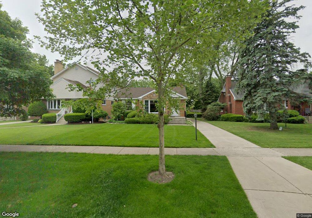
420 Nuttall Rd Riverside, IL 60546
Estimated Value: $336,000 - $420,000
2
Beds
1
Bath
1,100
Sq Ft
$339/Sq Ft
Est. Value
About This Home
This home is located at 420 Nuttall Rd, Riverside, IL 60546 and is currently estimated at $373,029, approximately $339 per square foot. 420 Nuttall Rd is a home located in Cook County with nearby schools including A F Ames Elementary School, L J Hauser Jr High School, and Riverside Brookfield High School.
Ownership History
Date
Name
Owned For
Owner Type
Purchase Details
Closed on
Dec 24, 2001
Sold by
Graham Nancy K
Bought by
Graham Nancy K and Nancy K Graham Trust
Current Estimated Value
Purchase Details
Closed on
Sep 12, 2001
Sold by
Graham Nancy K
Bought by
Graham Nancy K
Home Financials for this Owner
Home Financials are based on the most recent Mortgage that was taken out on this home.
Original Mortgage
$50,000
Interest Rate
6.97%
Purchase Details
Closed on
Aug 28, 2000
Sold by
Graham Nancy K
Bought by
Graham Nancy K and Nancy K Graham Trust
Create a Home Valuation Report for This Property
The Home Valuation Report is an in-depth analysis detailing your home's value as well as a comparison with similar homes in the area
Home Values in the Area
Average Home Value in this Area
Purchase History
| Date | Buyer | Sale Price | Title Company |
|---|---|---|---|
| Graham Nancy K | -- | -- | |
| Graham Nancy K | -- | First American Title | |
| Graham Nancy K | -- | -- |
Source: Public Records
Mortgage History
| Date | Status | Borrower | Loan Amount |
|---|---|---|---|
| Closed | Graham Nancy K | $50,000 |
Source: Public Records
Tax History
| Year | Tax Paid | Tax Assessment Tax Assessment Total Assessment is a certain percentage of the fair market value that is determined by local assessors to be the total taxable value of land and additions on the property. | Land | Improvement |
|---|---|---|---|---|
| 2025 | $8,008 | $27,240 | $5,460 | $21,780 |
| 2024 | $8,008 | $27,240 | $5,460 | $21,780 |
| 2023 | $8,196 | $31,000 | $5,460 | $25,540 |
| 2022 | $8,196 | $27,555 | $4,778 | $22,777 |
| 2021 | $3,786 | $27,553 | $4,777 | $22,776 |
| 2020 | $3,411 | $27,553 | $4,777 | $22,776 |
| 2019 | $3,728 | $21,729 | $4,368 | $17,361 |
| 2018 | $3,625 | $21,729 | $4,368 | $17,361 |
| 2017 | $3,446 | $21,729 | $4,368 | $17,361 |
| 2016 | $4,634 | $18,320 | $3,822 | $14,498 |
| 2015 | $4,757 | $18,320 | $3,822 | $14,498 |
| 2014 | $4,707 | $18,320 | $3,822 | $14,498 |
| 2013 | $5,620 | $22,522 | $3,822 | $18,700 |
Source: Public Records
Map
Nearby Homes
- 367 Bartram Rd
- 315 Bartram Rd
- 101 Southcote Rd
- 410 Repton Rd
- 305 Desplaines Ave
- 2527 Keystone Ave
- 8117 W 30th St
- 231 Bartram Rd
- 2433 Keystone Ave
- 236 Maplewood Rd
- 220 Maplewood Rd
- 2311 Park Ave
- 2245 Des Plaines Ave Unit A
- 2230 Keystone Ave
- 2233 Des Plaines Ave
- 269 Shenstone Rd
- 2252 Northgate Ave
- 108 E Burlington St Unit B
- 10 E Burlington St Unit 2C
- 10 E Burlington St Unit 2B
Your Personal Tour Guide
Ask me questions while you tour the home.