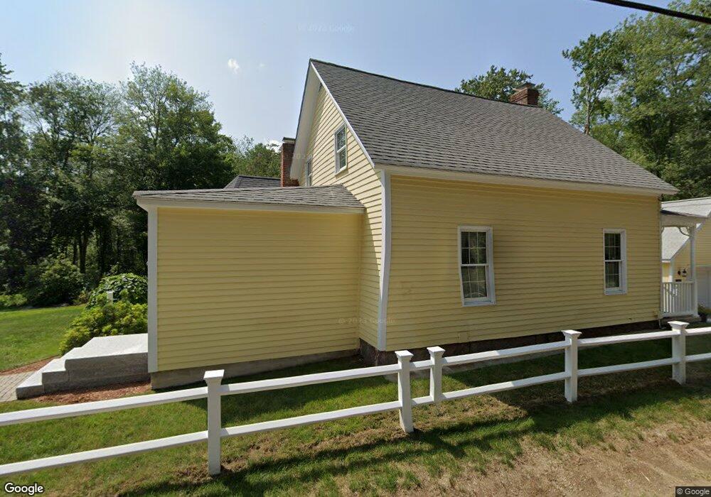
420 Putnam Hill Rd Sutton, MA 01590
Estimated Value: $415,000 - $494,000
3
Beds
1
Bath
1,580
Sq Ft
$285/Sq Ft
Est. Value
About This Home
This home is located at 420 Putnam Hill Rd, Sutton, MA 01590 and is currently estimated at $449,795, approximately $284 per square foot. 420 Putnam Hill Rd is a home located in Worcester County with nearby schools including Sutton Elementary School, Sutton Middle School, and Sutton High School.
Ownership History
Date
Name
Owned For
Owner Type
Purchase Details
Closed on
Dec 29, 2009
Sold by
Nedoroscik Andrew A and Nedoroscik Patricia E
Bought by
Salmon Laurie A and Nedoroscik Jeffrey A
Current Estimated Value
Create a Home Valuation Report for This Property
The Home Valuation Report is an in-depth analysis detailing your home's value as well as a comparison with similar homes in the area
Home Values in the Area
Average Home Value in this Area
Purchase History
| Date | Buyer | Sale Price | Title Company |
|---|---|---|---|
| Salmon Laurie A | -- | -- |
Source: Public Records
Tax History Compared to Growth
Tax History
| Year | Tax Paid | Tax Assessment Tax Assessment Total Assessment is a certain percentage of the fair market value that is determined by local assessors to be the total taxable value of land and additions on the property. | Land | Improvement |
|---|---|---|---|---|
| 2025 | $5,473 | $411,500 | $151,300 | $260,200 |
| 2024 | $5,435 | $393,300 | $144,800 | $248,500 |
| 2023 | $5,492 | $364,400 | $130,800 | $233,600 |
| 2022 | $5,001 | $302,000 | $104,700 | $197,300 |
| 2021 | $4,782 | $272,800 | $104,700 | $168,100 |
| 2020 | $4,538 | $263,100 | $104,700 | $158,400 |
| 2019 | $4,252 | $240,900 | $100,900 | $140,000 |
| 2018 | $3,860 | $217,600 | $85,700 | $131,900 |
| 2017 | $3,721 | $209,400 | $74,800 | $134,600 |
| 2016 | $3,755 | $209,400 | $74,800 | $134,600 |
| 2015 | $3,283 | $182,800 | $74,800 | $108,000 |
| 2014 | $3,190 | $175,300 | $72,700 | $102,600 |
Source: Public Records
Map
Nearby Homes
- 3 Ledge St
- 24 Cote Ln
- 34R Tucker Ln
- 4 1st St
- 8A Whitins Rd
- 8 Whitins Rd Unit A
- 18 Mumford Rd
- 108 Mumford St
- 223 West St
- 33 Nautical Way Unit 107
- 1 Nautical Way Unit 1
- 6 Nautical Way Unit INT.-122
- 190 Whitins Rd
- 8 Hough Rd
- 265 Mendon Rd
- 18 Lakeshore Dr
- 8 Virginia Ave
- 31 Douglas Rd
- 24 Manchaug Rd
- 5 B St
- 417 Putnam Hill Rd
- 419 Putnam Hill Rd
- 424R Putnam Hill Rd
- 421 Putnam Hill Rd
- 424-R Putnam Hill Rd Unit R
- 424-R Putnam Hill Rd
- 424 Putnam Hill Rd
- 426 Putnam Hill Rd
- 423 Putnam Hill Rd
- 1 Cote Ln
- 425 Putnam Hill Rd
- 428 Putnam Hill Rd
- 7 Lanes End
- 10 Lanes End
- 427 Putnam Hill Rd
- 8 Ledge St Unit R
- 8 Ledge St
- 5 Ledge St
- 8 Lanes End
- 6 Ledge St