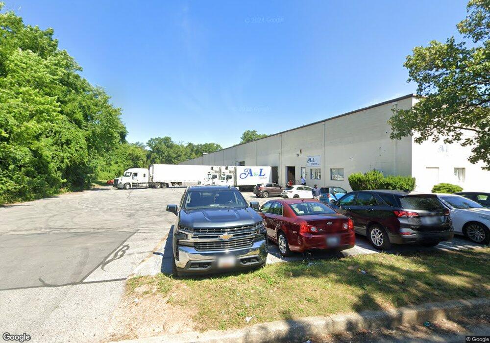
4200 Amos Ave Baltimore, MD 21215
Reisterstown Station Neighborhood
--
Bed
--
Bath
48,000
Sq Ft
7.54
Acres
About This Home
This home is located at 4200 Amos Ave, Baltimore, MD 21215. 4200 Amos Ave is a home located in Baltimore City with nearby schools including Cross Country Elementary School, Booker T. Washington Middle School, and Forest Park High School.
Ownership History
Date
Name
Owned For
Owner Type
Purchase Details
Closed on
Dec 21, 2021
Sold by
Menlo Investors Llc
Bought by
Wilmington Menlo Llc and Menlo Park Investors Llc
Home Financials for this Owner
Home Financials are based on the most recent Mortgage that was taken out on this home.
Original Mortgage
$12,375,000
Outstanding Balance
$11,372,578
Interest Rate
3.05%
Mortgage Type
New Conventional
Purchase Details
Closed on
Mar 24, 2017
Sold by
Menlo Industrial Park Inc
Bought by
Menlo Investors
Home Financials for this Owner
Home Financials are based on the most recent Mortgage that was taken out on this home.
Original Mortgage
$6,000,000
Interest Rate
4.21%
Mortgage Type
Commercial
Create a Home Valuation Report for This Property
The Home Valuation Report is an in-depth analysis detailing your home's value as well as a comparison with similar homes in the area
Home Values in the Area
Average Home Value in this Area
Purchase History
| Date | Buyer | Sale Price | Title Company |
|---|---|---|---|
| Wilmington Menlo Llc | $16,100,000 | First American Title | |
| Menlo Investors | $8,850,000 | None Available |
Source: Public Records
Mortgage History
| Date | Status | Borrower | Loan Amount |
|---|---|---|---|
| Open | Wilmington Menlo Llc | $12,375,000 | |
| Previous Owner | Menlo Investors | $6,000,000 |
Source: Public Records
Tax History Compared to Growth
Tax History
| Year | Tax Paid | Tax Assessment Tax Assessment Total Assessment is a certain percentage of the fair market value that is determined by local assessors to be the total taxable value of land and additions on the property. | Land | Improvement |
|---|---|---|---|---|
| 2025 | $55,323 | $3,234,800 | $603,100 | $2,631,700 |
| 2024 | $55,323 | $2,355,400 | $603,100 | $1,752,300 |
| 2023 | $55,323 | $2,355,400 | $603,100 | $1,752,300 |
| 2022 | $55,587 | $2,355,400 | $603,100 | $1,752,300 |
| 2021 | $55,587 | $2,355,400 | $603,100 | $1,752,300 |
| 2020 | $50,045 | $2,120,567 | $0 | $0 |
| 2019 | $44,291 | $1,885,733 | $0 | $0 |
| 2018 | $38,961 | $1,650,900 | $603,100 | $1,047,800 |
| 2017 | $37,366 | $1,583,300 | $0 | $0 |
| 2016 | $34,203 | $1,515,700 | $0 | $0 |
| 2015 | $34,203 | $1,448,100 | $0 | $0 |
| 2014 | $34,203 | $1,446,733 | $0 | $0 |
Source: Public Records
Map
Nearby Homes
- 4108 Fords Ln
- 6509 Parr Ave
- 6203 Hopeton Ave
- 3720 Bartwood Rd
- 3737 Clarks Ln
- 3803 Menlo Dr
- 6603 Fairmount Ave
- 6210 Park Heights Ave Unit 700
- 3601 Clarks Ln Unit 424
- 3601 Clarks Ln Unit 506
- 3601 Clarks Ln
- 3601 Clarks Ln
- 3601 Clarks Ln
- 3601 Clarks Ln
- 6606 Park Heights Ave Unit 305
- 6606 Park Heights Ave Unit 905
- 6606 Park Heights Ave Unit 615
- 6705 Fairmount Ave
- 4011 Mortimer Ave
- 3922 Mortimer Ave
- 4202 Fordleigh Rd
- 4203 Fordleigh Rd
- 4209 Kenshaw Ave
- 4205 Kenshaw Ave
- 4211 Kenshaw Ave
- 4203 Kenshaw Ave
- 4213 Kenshaw Ave
- 4201 Kenshaw Ave
- 4215 Kenshaw Ave
- 4116 Fordleigh Rd
- 4117 Fordleigh Rd
- 4217 Kenshaw Ave
- 4114 Fordleigh Rd
- 4115 Fordleigh Rd
- 4125 Kenshaw Ave
- 4219 Kenshaw Ave
- 4130 Amos Ave
- 4221 Kenshaw Ave
- 4113 Fordleigh Rd
- 4112 Fordleigh Rd