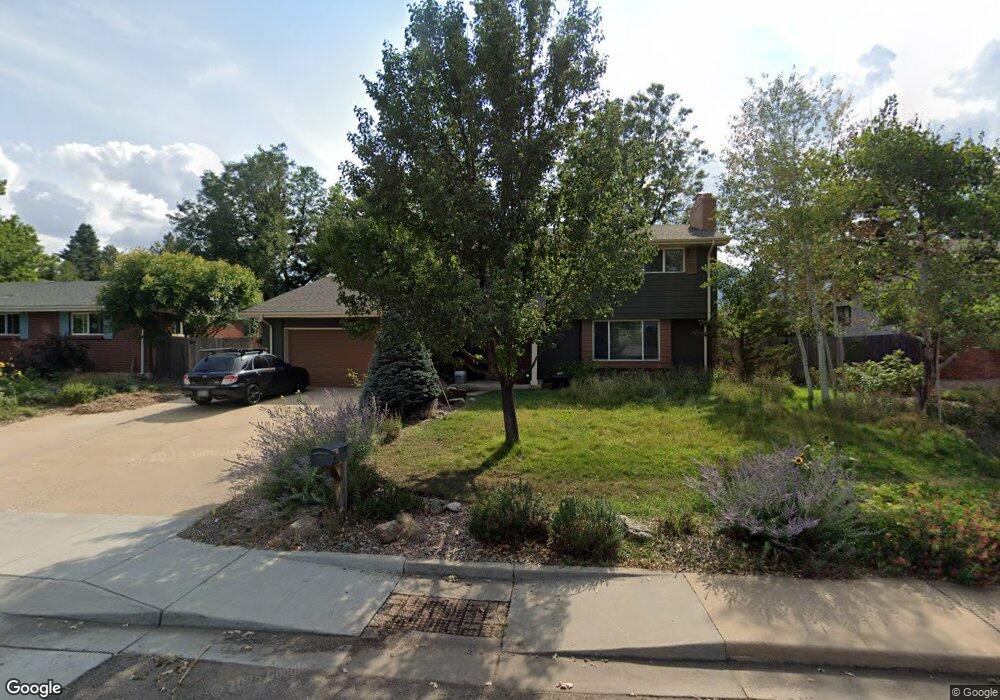
4200 Eutaw Dr Boulder, CO 80303
Southeast Boulder NeighborhoodEstimated Value: $1,242,621 - $1,594,000
4
Beds
3
Baths
3,021
Sq Ft
$471/Sq Ft
Est. Value
About This Home
This home is located at 4200 Eutaw Dr, Boulder, CO 80303 and is currently estimated at $1,423,155, approximately $471 per square foot. 4200 Eutaw Dr is a home located in Boulder County with nearby schools including Eisenhower Elementary School, Manhattan Middle School of the Arts & Academics, and Fairview High School.
Ownership History
Date
Name
Owned For
Owner Type
Purchase Details
Closed on
May 13, 2011
Sold by
Norris Yale F and Norris Maren K
Bought by
Rapp Timothy H
Current Estimated Value
Home Financials for this Owner
Home Financials are based on the most recent Mortgage that was taken out on this home.
Original Mortgage
$417,000
Outstanding Balance
$290,196
Interest Rate
4.91%
Mortgage Type
New Conventional
Estimated Equity
$1,132,959
Purchase Details
Closed on
May 10, 2007
Sold by
Skurnik Margaret F
Bought by
Norris Yale F and Norris Maren K
Home Financials for this Owner
Home Financials are based on the most recent Mortgage that was taken out on this home.
Original Mortgage
$360,000
Interest Rate
5.75%
Mortgage Type
Purchase Money Mortgage
Purchase Details
Closed on
Aug 30, 2002
Sold by
Skurnik W A E and Skurnik Margaret F
Bought by
Skurnik Margaret F
Purchase Details
Closed on
Nov 8, 1972
Bought by
Rapp Timothy H and Rapp Michele B
Create a Home Valuation Report for This Property
The Home Valuation Report is an in-depth analysis detailing your home's value as well as a comparison with similar homes in the area
Home Values in the Area
Average Home Value in this Area
Purchase History
| Date | Buyer | Sale Price | Title Company |
|---|---|---|---|
| Rapp Timothy H | $620,000 | Fidelity National Title Insu | |
| Norris Yale F | $450,000 | First Colorado Title | |
| Skurnik Margaret F | -- | -- | |
| Rapp Timothy H | $41,500 | -- |
Source: Public Records
Mortgage History
| Date | Status | Borrower | Loan Amount |
|---|---|---|---|
| Open | Rapp Timothy H | $417,000 | |
| Previous Owner | Norris Yale F | $360,000 |
Source: Public Records
Tax History Compared to Growth
Tax History
| Year | Tax Paid | Tax Assessment Tax Assessment Total Assessment is a certain percentage of the fair market value that is determined by local assessors to be the total taxable value of land and additions on the property. | Land | Improvement |
|---|---|---|---|---|
| 2025 | $7,582 | $77,388 | $43,850 | $33,538 |
| 2024 | $7,582 | $77,388 | $43,850 | $33,538 |
| 2023 | $7,451 | $86,276 | $53,366 | $36,595 |
| 2022 | $6,251 | $67,310 | $38,176 | $29,134 |
| 2021 | $5,961 | $69,248 | $39,275 | $29,973 |
| 2020 | $5,401 | $62,048 | $32,032 | $30,016 |
| 2019 | $5,318 | $62,048 | $32,032 | $30,016 |
| 2018 | $5,182 | $59,774 | $30,096 | $29,678 |
| 2017 | $5,020 | $66,084 | $33,273 | $32,811 |
| 2016 | $4,686 | $54,128 | $24,676 | $29,452 |
| 2015 | $4,437 | $45,006 | $20,704 | $24,302 |
| 2014 | $3,784 | $45,006 | $20,704 | $24,302 |
Source: Public Records
Map
Nearby Homes
- 4255 Apache Rd
- 4293 Graham Ct
- 15 Pawnee Dr
- 4755 Qualla Dr
- 510 S 46th St
- 3694 Chase Ct
- 530 S 46th St
- 3682 Chase Ct
- 450 S 41st St
- 611 Tantra Dr
- 500 Mohawk Dr Unit 510
- 219 Seminole Dr
- 650 S 45th St
- 560 Mohawk Dr Unit 35
- 4763 Tantra Dr Unit B
- 725 S 45th St
- 750 W Moorhead Cir Unit A
- 4500 Baseline Rd Unit 4104
- 4500 Baseline Rd Unit 2107
- 800 W Moorhead Cir Unit E