Estimated Value: $197,000 - $216,976
--
Bed
--
Bath
1,584
Sq Ft
$131/Sq Ft
Est. Value
About This Home
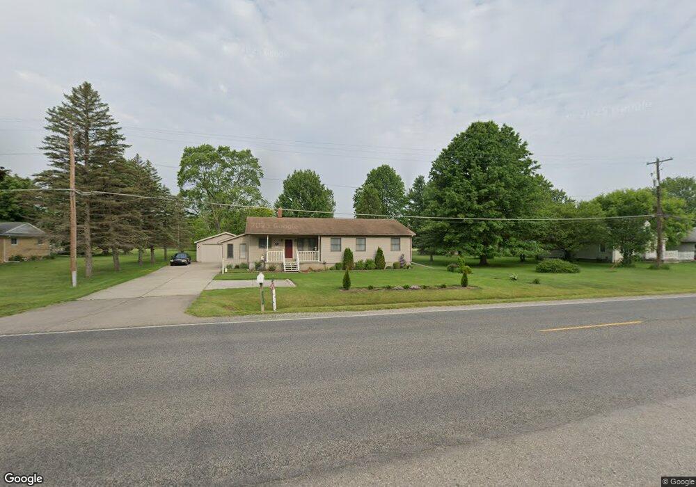
This home is located at 4203 N Belsay Rd, Flint, MI 48506 and is currently estimated at $207,494, approximately $130 per square foot. 4203 N Belsay Rd is a home located in Genesee County with nearby schools including Weston Elementary School, Leota Fiedler Elementary School, and Kate Dowdall Elementary School.
Ownership History
Date
Name
Owned For
Owner Type
Purchase Details
Closed on
Oct 9, 2020
Sold by
Cook Douglas L and Cook Patty L
Bought by
Cook Patty L and Cook Kim L
Current Estimated Value
Purchase Details
Closed on
Apr 21, 2004
Sold by
Marciszewski Paul D and Estate Of Helene S Roczek
Bought by
Gorney Raymond A and Gorney Deborah M
Home Financials for this Owner
Home Financials are based on the most recent Mortgage that was taken out on this home.
Original Mortgage
$85,000
Outstanding Balance
$39,189
Interest Rate
5.37%
Mortgage Type
Purchase Money Mortgage
Estimated Equity
$168,305
Purchase Details
Closed on
Aug 2, 2002
Sold by
Walker Michael D and Walker Rhonda
Bought by
Cook Douglas L and Cook Patty L
Create a Home Valuation Report for This Property
The Home Valuation Report is an in-depth analysis detailing your home's value as well as a comparison with similar homes in the area
Home Values in the Area
Average Home Value in this Area
Purchase History
| Date | Buyer | Sale Price | Title Company |
|---|---|---|---|
| Cook Patty L | -- | None Available | |
| Gorney Raymond A | $100,000 | Greco Title | |
| Cook Douglas L | $145,500 | Sargents Title Company |
Source: Public Records
Mortgage History
| Date | Status | Borrower | Loan Amount |
|---|---|---|---|
| Open | Gorney Raymond A | $85,000 |
Source: Public Records
Tax History Compared to Growth
Tax History
| Year | Tax Paid | Tax Assessment Tax Assessment Total Assessment is a certain percentage of the fair market value that is determined by local assessors to be the total taxable value of land and additions on the property. | Land | Improvement |
|---|---|---|---|---|
| 2025 | $1,977 | $93,100 | $0 | $0 |
| 2024 | $536 | $85,100 | $0 | $0 |
| 2023 | $511 | $77,800 | $0 | $0 |
| 2022 | $1,618 | $70,000 | $0 | $0 |
| 2021 | $1,604 | $63,200 | $0 | $0 |
| 2020 | $468 | $58,100 | $0 | $0 |
| 2019 | $460 | $52,200 | $0 | $0 |
| 2018 | $1,512 | $47,600 | $0 | $0 |
| 2017 | $1,427 | $46,300 | $0 | $0 |
| 2016 | $1,422 | $43,900 | $0 | $0 |
| 2015 | $1,272 | $41,400 | $0 | $0 |
| 2014 | $424 | $37,900 | $0 | $0 |
| 2012 | -- | $38,400 | $38,400 | $0 |
Source: Public Records
Map
Nearby Homes
- 6077 Crown Point
- 4062 N Belsay Rd
- 3454 Eastdale Dr
- 6298 Nightingale Dr
- 3389 Eastdale Dr
- 3365 Eastdale Dr
- 5142 Berneda Dr
- 6323 Bluejay Dr
- 6363 Bluejay Dr
- 5429 Hopkins Rd
- 4156 Bobwhite Dr
- 5111 Paro Dr
- 5467 Richfield Rd
- 5068 Roberts Dr
- 3280 Lynne Ave
- 6443 Richfield Rd
- 3247 Mills Acres St
- 3201 Gehring Dr
- 3251 Lynne Ave
- 4455 N Genesee Rd
- 4219 N Belsay Rd
- 4227 N Belsay Rd
- 4200 N Belsay Rd
- 4218 N Belsay Rd
- 4226 N Belsay Rd
- 4243 N Belsay Rd
- 4186 N Belsay Rd
- 4236 N Belsay Rd
- 4178 N Belsay Rd
- 6026 Beacon Hill St
- 4242 N Belsay Rd
- 6025 Beacon Hill St
- 4255 N Belsay Rd
- 6023 Concord Pass
- 6022 Bunker Hill St
- 6032 Beacon Hill St
- 6034 Bunker Hill St
- 6031 Beacon Hill St
- 4162 N Belsay Rd
- 4149 N Belsay Rd