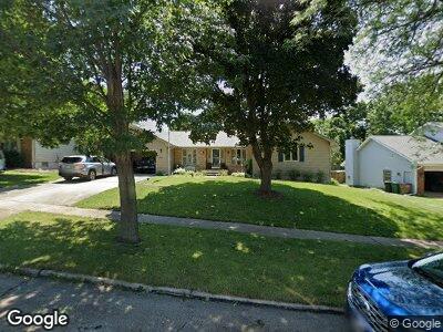
4204 Francrest Cir West Des Moines, IA 50266
Estimated Value: $356,000 - $385,000
4
Beds
3
Baths
1,829
Sq Ft
$201/Sq Ft
Est. Value
About This Home
This home is located at 4204 Francrest Cir, West Des Moines, IA 50266 and is currently estimated at $368,388, approximately $201 per square foot. 4204 Francrest Cir is a home located in Polk County with nearby schools including Crossroads Park Elementary School, Indian Hills Junior High School, and Valley Southwoods Freshman High School.
Ownership History
Date
Name
Owned For
Owner Type
Purchase Details
Closed on
Jun 15, 2000
Sold by
Wachenheim Lee G and Wachenheim Virginia P
Bought by
Embry Thomas L and Embry Susan K
Current Estimated Value
Home Financials for this Owner
Home Financials are based on the most recent Mortgage that was taken out on this home.
Original Mortgage
$138,300
Interest Rate
8.31%
Create a Home Valuation Report for This Property
The Home Valuation Report is an in-depth analysis detailing your home's value as well as a comparison with similar homes in the area
Home Values in the Area
Average Home Value in this Area
Purchase History
| Date | Buyer | Sale Price | Title Company |
|---|---|---|---|
| Embry Thomas L | $168,000 | -- |
Source: Public Records
Mortgage History
| Date | Status | Borrower | Loan Amount |
|---|---|---|---|
| Open | Embry Thomas L | $128,000 | |
| Closed | Embry Thomas L | $143,000 | |
| Closed | Embry Thomas L | $38,300 | |
| Closed | Embry Thomas L | $25,000 | |
| Closed | Embry Thomas L | $138,300 |
Source: Public Records
Tax History Compared to Growth
Tax History
| Year | Tax Paid | Tax Assessment Tax Assessment Total Assessment is a certain percentage of the fair market value that is determined by local assessors to be the total taxable value of land and additions on the property. | Land | Improvement |
|---|---|---|---|---|
| 2024 | $5,108 | $348,400 | $58,000 | $290,400 |
| 2023 | $5,124 | $348,400 | $58,000 | $290,400 |
| 2022 | $5,060 | $277,600 | $48,600 | $229,000 |
| 2021 | $4,820 | $277,600 | $48,600 | $229,000 |
| 2020 | $4,742 | $252,200 | $44,500 | $207,700 |
| 2019 | $4,506 | $252,200 | $44,500 | $207,700 |
| 2018 | $4,510 | $231,700 | $39,600 | $192,100 |
| 2017 | $4,220 | $231,700 | $39,600 | $192,100 |
| 2016 | $4,122 | $211,400 | $35,600 | $175,800 |
| 2015 | $4,122 | $211,400 | $35,600 | $175,800 |
| 2014 | $3,750 | $197,200 | $32,700 | $164,500 |
Source: Public Records
Map
Nearby Homes
- 1035 Belle Mar Dr
- 1112 Woodland Park Dr
- 1070 Woodland Park Dr
- 1062 Woodland Park Dr
- 1019 Maplenol Dr
- 4665 Woodland Ave Unit 3
- 1035 Clared Cir
- 4841 Woodland Ave Unit 6
- 4849 Woodland Ave Unit 3
- 4865 Woodland Ave Unit 1
- 1168 49th St Unit 1
- 4918 W Park Dr Unit G3
- 1240 49th St Unit 5
- 4801 Westbrooke Place
- 4900 Pleasant St Unit 16
- 4600 Aspen Dr
- 1100 50th St Unit 2106
- 1100 50th St Unit 2101
- 1100 50th St Unit 2207
- 1100 50th St Unit 2103
- 4204 Francrest Cir
- 4208 Francrest Cir
- 4200 Francrest Cir
- 4205 Marcourt Ln
- 4301 Marcourt Ln
- 4201 Marcourt Ln
- 4205 Francrest Cir
- 4305 Marcourt Ln
- 4201 Francrest Cir
- 4212 Francrest Cir
- 4209 Francrest Cir
- 4216 Francrest Cir
- 4309 Marcourt Ln
- 4213 Francrest Cir
- 1054 Belle Mar Dr
- 1060 Belle Mar Dr
- 1104 42nd St
- 1048 Belle Mar Dr
- 4204 Marcourt Ln
- 1066 Belle Mar Dr