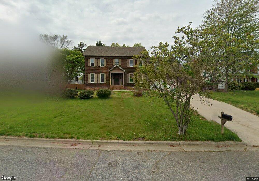
4205 Jeffrey Lane Point High Point, NC 27265
Deep River NeighborhoodEstimated Value: $429,000 - $507,000
4
Beds
3
Baths
2,800
Sq Ft
$167/Sq Ft
Est. Value
About This Home
This home is located at 4205 Jeffrey Lane Point, High Point, NC 27265 and is currently estimated at $466,656, approximately $166 per square foot. 4205 Jeffrey Lane Point is a home located in Guilford County with nearby schools including Southwest Elementary School, Welborn Academy of Science & Technology, and T.W. Andrews High School.
Ownership History
Date
Name
Owned For
Owner Type
Purchase Details
Closed on
May 18, 2022
Sold by
Chase Drm Llc
Bought by
Fkh Sfr Propco K Lp
Current Estimated Value
Purchase Details
Closed on
Oct 28, 2021
Sold by
Khan Iqbal G and Khan Karen R
Bought by
Chase Drm Llc
Home Financials for this Owner
Home Financials are based on the most recent Mortgage that was taken out on this home.
Original Mortgage
$500,000
Interest Rate
2.8%
Mortgage Type
Commercial
Purchase Details
Closed on
Dec 11, 1995
Bought by
Khan Iqbal G
Create a Home Valuation Report for This Property
The Home Valuation Report is an in-depth analysis detailing your home's value as well as a comparison with similar homes in the area
Home Values in the Area
Average Home Value in this Area
Purchase History
| Date | Buyer | Sale Price | Title Company |
|---|---|---|---|
| Fkh Sfr Propco K Lp | $455,000 | Paladin Law | |
| Chase Drm Llc | $273,000 | Investors Title Company | |
| Khan Iqbal G | $175,000 | -- |
Source: Public Records
Mortgage History
| Date | Status | Borrower | Loan Amount |
|---|---|---|---|
| Previous Owner | Chase Drm Llc | $500,000 |
Source: Public Records
Tax History Compared to Growth
Tax History
| Year | Tax Paid | Tax Assessment Tax Assessment Total Assessment is a certain percentage of the fair market value that is determined by local assessors to be the total taxable value of land and additions on the property. | Land | Improvement |
|---|---|---|---|---|
| 2025 | $3,451 | $250,400 | $52,000 | $198,400 |
| 2024 | $3,451 | $250,400 | $52,000 | $198,400 |
| 2023 | $3,451 | $250,400 | $52,000 | $198,400 |
| 2022 | $3,375 | $250,400 | $52,000 | $198,400 |
| 2021 | $2,902 | $210,600 | $48,000 | $162,600 |
| 2020 | $2,902 | $210,600 | $48,000 | $162,600 |
| 2019 | $2,902 | $210,600 | $0 | $0 |
| 2018 | $2,888 | $210,600 | $0 | $0 |
| 2017 | $2,902 | $210,600 | $0 | $0 |
| 2016 | $2,809 | $200,300 | $0 | $0 |
| 2015 | $2,824 | $200,300 | $0 | $0 |
| 2014 | $2,872 | $200,300 | $0 | $0 |
Source: Public Records
Map
Nearby Homes
- 4103 Quarterstaff Ct
- 3007 Maple Branch Dr
- 3924 Braddock Rd
- 3905 Wynne Brook Ct
- 4004 Baywater Point
- 1515 Skeet Club Rd
- Richmond Plan at Williard Place
- 3296 Alyssa Way
- Cameron Plan at Williard Place
- Southport Plan at Williard Place
- Columbia Plan at Williard Place
- Bailey Plan at Williard Place
- 3301 Alyssa Way
- 3753 Carvette Ct
- 3273 Alyssa Way
- 3171 Riley Ford Trail Unit Lot 38
- 4407 Oak Hollow Dr
- 3171 Riley Ford Trail
- 3199 Riley Ford Trail
- 3199 Riley Ford Trail Unit Lot 33
- 4207 Jeffrey Lane Point
- 4201 Jeffrey Lane Point
- 4206 Lauren Place
- 4204 Jeffrey Lane Point
- 4208 Lauren Place
- 4202 Jeffrey Lane Point
- 4206 Jeffrey Lane Point
- 4208 Jeffrey Lane Point
- 4209 Jeffrey Lane Point
- 4200 Jeffrey Lane Point
- 4210 Lauren Place
- 4210 Jeffrey Lane Point
- 4121 Jeffrey Lane Point
- 4205 Lauren Place
- 4122 Jeffrey Lane Point
- 4207 Lauren Place
- 4212 Lauren Place
- 4212 Jeffrey Lane Point
- 4213 Jeffrey Lane Point
- 4120 Jeffrey Lane Point