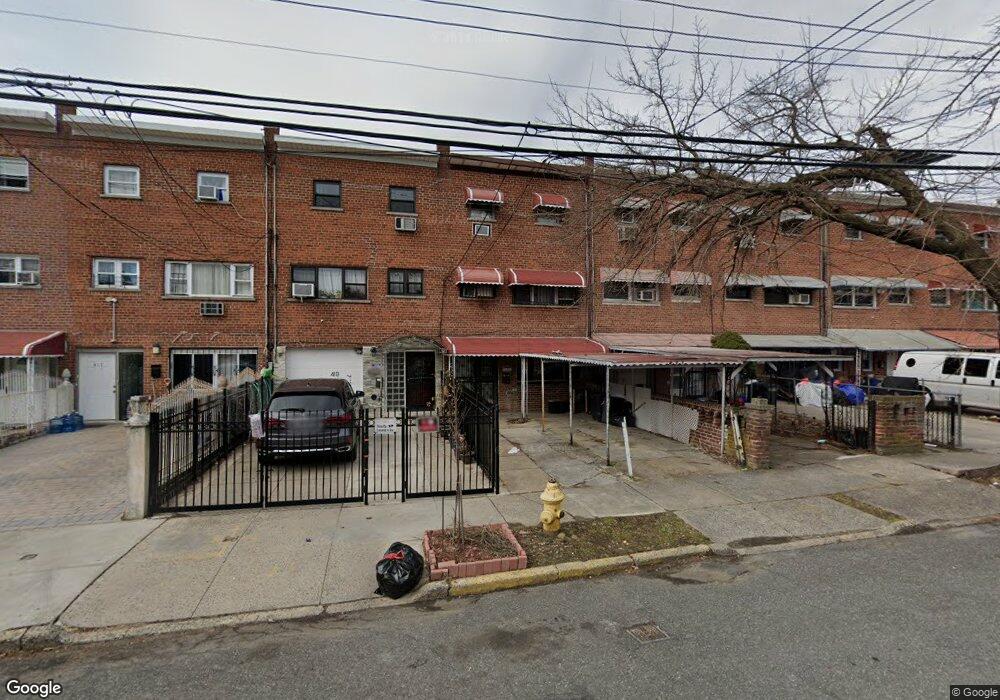
421 Olmstead Ave Bronx, NY 10473
Castle Hill NeighborhoodEstimated Value: $369,000 - $651,000
3
Beds
3
Baths
1,944
Sq Ft
$230/Sq Ft
Est. Value
About This Home
This home is located at 421 Olmstead Ave, Bronx, NY 10473 and is currently estimated at $446,622, approximately $229 per square foot. 421 Olmstead Ave is a home located in Bronx County with nearby schools including P.S. 182.
Ownership History
Date
Name
Owned For
Owner Type
Purchase Details
Closed on
Jul 3, 1996
Sold by
8900 Realty Corp
Bought by
Hamilton Marjorie and Hamilton Aston R
Current Estimated Value
Home Financials for this Owner
Home Financials are based on the most recent Mortgage that was taken out on this home.
Original Mortgage
$105,000
Interest Rate
8.11%
Purchase Details
Closed on
Feb 4, 1985
Sold by
Jamison James
Bought by
Jamison Sallie L
Create a Home Valuation Report for This Property
The Home Valuation Report is an in-depth analysis detailing your home's value as well as a comparison with similar homes in the area
Home Values in the Area
Average Home Value in this Area
Purchase History
| Date | Buyer | Sale Price | Title Company |
|---|---|---|---|
| Hamilton Marjorie | $135,000 | Chicago Title Insurance Co | |
| Jamison Sallie L | -- | -- |
Source: Public Records
Mortgage History
| Date | Status | Borrower | Loan Amount |
|---|---|---|---|
| Open | Hamilton Aston R | $5,237 | |
| Open | Hamilton Aston R | $270,900 | |
| Closed | Hamilton Marjorie | $104,000 | |
| Previous Owner | 8900 Realty Corp | $105,000 |
Source: Public Records
Tax History Compared to Growth
Tax History
| Year | Tax Paid | Tax Assessment Tax Assessment Total Assessment is a certain percentage of the fair market value that is determined by local assessors to be the total taxable value of land and additions on the property. | Land | Improvement |
|---|---|---|---|---|
| 2025 | $5,328 | $28,116 | $5,412 | $22,704 |
| 2024 | $5,328 | $26,525 | $5,082 | $21,443 |
| 2023 | $5,387 | $26,525 | $5,420 | $21,105 |
| 2022 | $5,255 | $33,000 | $7,380 | $25,620 |
| 2021 | $5,227 | $29,760 | $7,380 | $22,380 |
| 2020 | $4,959 | $31,380 | $7,380 | $24,000 |
| 2019 | $4,624 | $27,900 | $7,380 | $20,520 |
| 2018 | $4,506 | $22,104 | $5,748 | $16,356 |
| 2017 | $4,472 | $21,937 | $6,063 | $15,874 |
| 2016 | $4,137 | $20,696 | $5,879 | $14,817 |
| 2015 | $2,423 | $19,525 | $7,686 | $11,839 |
| 2014 | $2,423 | $18,420 | $8,220 | $10,200 |
Source: Public Records
Map
Nearby Homes
- 423 Olmstead Ave
- 437 Torry Ave
- 2080 Lacombe Ave
- 2114 Lacombe Ave
- 433 Howe Ave Unit A
- 404 Howe Ave
- 452 Howe Ave
- 417 Castle Hill Ave
- 303 Howe Ave
- 2037 Cicero Ave
- 595 Olmstead Ave
- 422 Castle Hill Ave
- 2049 Caesar Place
- 430 Turneur Ave
- 234 Betts Ave
- 502 White Plains Rd
- 250 Newman Ave
- 428 Bolton Ave
- 2286 Lacombe Ave
- 227 Stephens Ave
- 419 Olmstead Ave
- 417 Olmstead Ave
- 425 Olmstead Ave
- 415 Olmstead Ave
- 427 Olmstead Ave
- 413 Olmstead Ave
- 429 Olmstead Ave
- 411 Olmstead Ave
- 431 Olmstead Ave
- 416 Screvin Ave
- 418 Screvin Ave
- 414 Screvin Ave
- 420 Screvin Ave
- 407 Olmstead Ave
- 433 Olmstead Ave
- 412 Screvin Ave
- 410 Screvin Ave
- 435 Olmstead Ave
- 424 Screvin Ave
- 405 Olmstead Ave