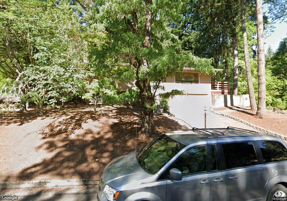
4210 Brae Burn Dr Eugene, OR 97405
Crest Drive NeighborhoodEstimated Value: $542,525 - $574,000
4
Beds
3
Baths
1,942
Sq Ft
$287/Sq Ft
Est. Value
About This Home
This home is located at 4210 Brae Burn Dr, Eugene, OR 97405 and is currently estimated at $556,631, approximately $286 per square foot. 4210 Brae Burn Dr is a home located in Lane County with nearby schools including Edgewood Community Elementary School, Spencer Butte Middle School, and South Eugene High School.
Ownership History
Date
Name
Owned For
Owner Type
Purchase Details
Closed on
Nov 17, 2005
Sold by
Hall William R and Hall Laurel
Bought by
Hall William Roger and Hall Laurel Elizabeth
Current Estimated Value
Purchase Details
Closed on
Nov 11, 2005
Sold by
Price Herbert G and Sutherland Sue Shelley
Bought by
Hall William R and Hall Laurel
Purchase Details
Closed on
Mar 16, 2000
Sold by
Chan Paula J and Carpenter Scott R
Bought by
Price Herbert G and Sutherland Sue Shelley
Home Financials for this Owner
Home Financials are based on the most recent Mortgage that was taken out on this home.
Original Mortgage
$163,400
Interest Rate
8.34%
Purchase Details
Closed on
Jun 30, 1999
Sold by
Carpenter Paula Chan and Chan Paula J
Bought by
Carpenter Scott R and Carpenter Paula Chan
Home Financials for this Owner
Home Financials are based on the most recent Mortgage that was taken out on this home.
Original Mortgage
$46,300
Interest Rate
7.24%
Mortgage Type
Credit Line Revolving
Create a Home Valuation Report for This Property
The Home Valuation Report is an in-depth analysis detailing your home's value as well as a comparison with similar homes in the area
Home Values in the Area
Average Home Value in this Area
Purchase History
| Date | Buyer | Sale Price | Title Company |
|---|---|---|---|
| Hall William Roger | -- | American Title Group | |
| Hall William R | $284,000 | American Title Group | |
| Price Herbert G | $172,000 | Cascade Title Co | |
| Carpenter Scott R | -- | Fidelity National Title Ins |
Source: Public Records
Mortgage History
| Date | Status | Borrower | Loan Amount |
|---|---|---|---|
| Previous Owner | Price Herbert G | $163,400 | |
| Previous Owner | Carpenter Scott R | $46,300 |
Source: Public Records
Tax History
| Year | Tax Paid | Tax Assessment Tax Assessment Total Assessment is a certain percentage of the fair market value that is determined by local assessors to be the total taxable value of land and additions on the property. | Land | Improvement |
|---|---|---|---|---|
| 2025 | $5,409 | $277,610 | -- | -- |
| 2024 | $5,342 | $269,525 | -- | -- |
| 2023 | $5,342 | $261,675 | $0 | $0 |
| 2022 | $5,004 | $254,054 | $0 | $0 |
| 2021 | $4,700 | $246,655 | $0 | $0 |
| 2020 | $4,717 | $239,471 | $0 | $0 |
| 2019 | $4,555 | $232,497 | $0 | $0 |
| 2018 | $4,288 | $219,151 | $0 | $0 |
| 2017 | $4,096 | $219,151 | $0 | $0 |
| 2016 | $3,948 | $212,768 | $0 | $0 |
| 2015 | $3,843 | $206,571 | $0 | $0 |
| 2014 | $3,784 | $200,554 | $0 | $0 |
Source: Public Records
Map
Nearby Homes
- 4103 Brae Burn Dr
- 396 Brae Burn Dr
- 0 Pine View Ct Unit 758820410
- 806 Sundance St
- 278 Rockridge Ct
- 3854 Monroe St
- 21 Westbrook Way
- 17 Westbrook Way
- 653 Brookside Dr
- 275 W 37th Ave
- 357 W 37th Ave
- 422 Stonewood Dr Unit 422
- 152 Treehill Loop Unit 152
- 143 Treehill Loop Unit 143
- 418 Stonewood Dr Unit 418
- 4020 Pearl St
- 170 E 40th Ave
- 223 Trailside Loop Unit 223
- 4344 Blanton Rd
- 605 Fulvue Dr
- 1268 Brookside Dr
- 1283 Brookside Dr
- 4190 Brae Burn Dr
- 1226 Brookside Dr
- 4207 Brae Burn Dr
- 1251 Brookside Dr
- 4235 Brae Burn Dr
- 4186 Normandy Way
- 4310 Inwood Ln
- 1212 Brookside Dr
- 4273 Brae Burn Dr
- 1205 Brookside Dr
- 4183 Brae Burn Dr
- 4320 Inwood Ln
- 4170 Normandy Way
- 4197 Normandy Way
- 4171 Brae Burn Dr
- 1192 Brookside Dr
- 415 Brae Burn Dr
- 4340 Inwood Ln
Your Personal Tour Guide
Ask me questions while you tour the home.