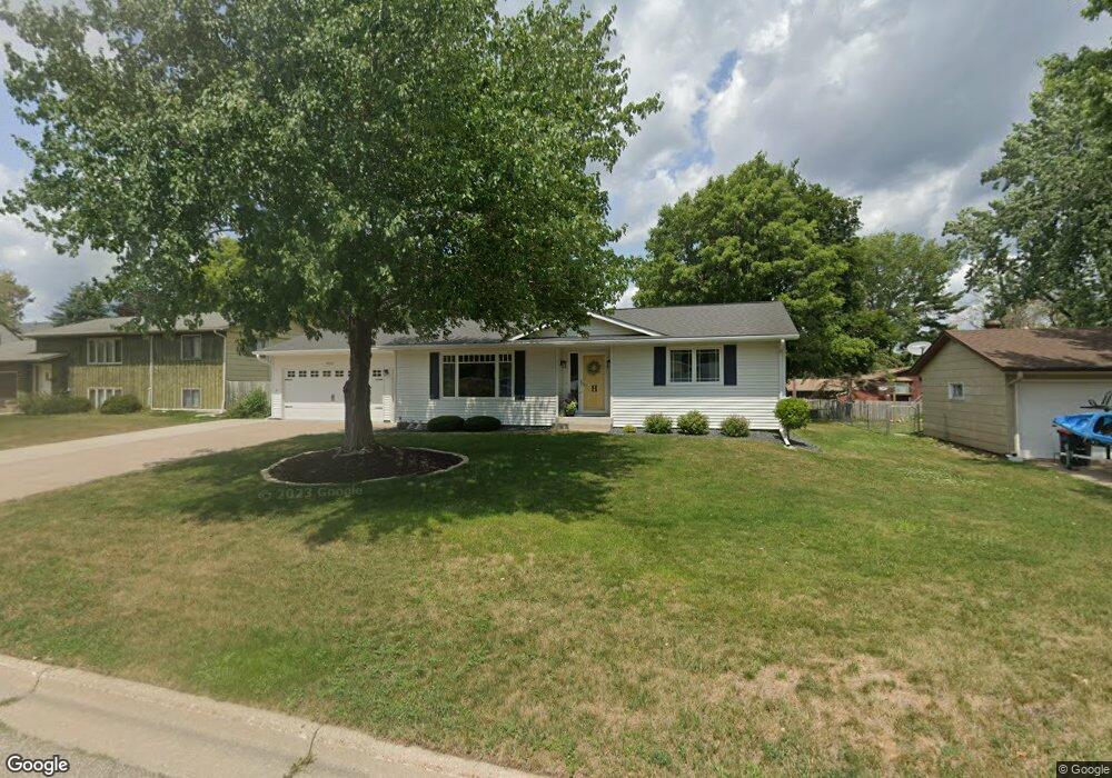
4210 Robert St Red Wing, MN 55066
Estimated Value: $280,146 - $312,000
2
Beds
3
Baths
1,356
Sq Ft
$216/Sq Ft
Est. Value
About This Home
This home is located at 4210 Robert St, Red Wing, MN 55066 and is currently estimated at $292,537, approximately $215 per square foot. 4210 Robert St is a home located in Goodhue County with nearby schools including Burnside Elementary School, Sunnyside Elementary School, and Twin Bluff Middle School.
Ownership History
Date
Name
Owned For
Owner Type
Purchase Details
Closed on
Jul 1, 2019
Sold by
Heitman Michael S
Bought by
Heitman Guy E and Heitman Debra J
Current Estimated Value
Purchase Details
Closed on
Sep 24, 2010
Sold by
Stumpf Earl W and Verneil Bodelson Revocable Tru
Bought by
Heitman Michael S
Create a Home Valuation Report for This Property
The Home Valuation Report is an in-depth analysis detailing your home's value as well as a comparison with similar homes in the area
Home Values in the Area
Average Home Value in this Area
Purchase History
| Date | Buyer | Sale Price | Title Company |
|---|---|---|---|
| Heitman Guy E | $180,000 | -- | |
| Heitman Michael S | $121,900 | -- |
Source: Public Records
Tax History
| Year | Tax Paid | Tax Assessment Tax Assessment Total Assessment is a certain percentage of the fair market value that is determined by local assessors to be the total taxable value of land and additions on the property. | Land | Improvement |
|---|---|---|---|---|
| 2025 | $3,054 | $251,900 | $52,100 | $199,800 |
| 2024 | -- | $246,600 | $52,100 | $194,500 |
| 2023 | $2,958 | $233,300 | $52,100 | $181,200 |
| 2022 | $2,740 | $232,000 | $52,100 | $179,900 |
| 2021 | $2,538 | $199,500 | $52,100 | $147,400 |
| 2020 | $2,518 | $188,800 | $52,100 | $136,700 |
| 2019 | $2,490 | $176,600 | $52,100 | $124,500 |
| 2018 | $2,006 | $176,700 | $50,100 | $126,600 |
| 2017 | $1,978 | $156,500 | $50,100 | $106,400 |
| 2016 | $1,794 | $156,200 | $50,100 | $106,100 |
| 2015 | $1,728 | $149,900 | $50,100 | $99,800 |
| 2014 | -- | $148,200 | $50,100 | $98,100 |
Source: Public Records
Map
Nearby Homes
- 127 Motel Ave
- 237 Butternut Ave
- 135 Kingswood Dr
- 133 Kingswood Dr
- 853 Aurora Cir
- 912 Aurora Cir
- 694 Aspen Ave
- 4739 Big Sky Ct
- 921 Snowbird Dr
- 1056 Birch Ave
- 910 Snowbird Dr
- 914 Snowbird Dr
- 4958 Chalet Ct
- 113 Burnside Ave S
- 2820 N Service Dr
- 5542 Cannon Dale Ct
- 1140 Hewitt Blvd
- 1125 Hewitt Blvd
- 1181 Hewitt Blvd
- 430 Harrison St
- 4204 Robert St
- 4218 Robert St
- 4209 Raymond St
- 4154 Robert St
- 4226 Robert St
- 4203 Raymond St
- 4219 Raymond St
- 208 Debra Ave
- 209 Motel Ave
- 4153 Raymond St
- 4225 Raymond St
- 4146 Robert St
- 209 Debra Ave
- 216 Debra Ave
- 4145 Raymond St
- 217 Motel Ave
- 4136 Robert St
- 4212 Raymond St
- 4222 Raymond St
- 219 Debra Ave
Your Personal Tour Guide
Ask me questions while you tour the home.