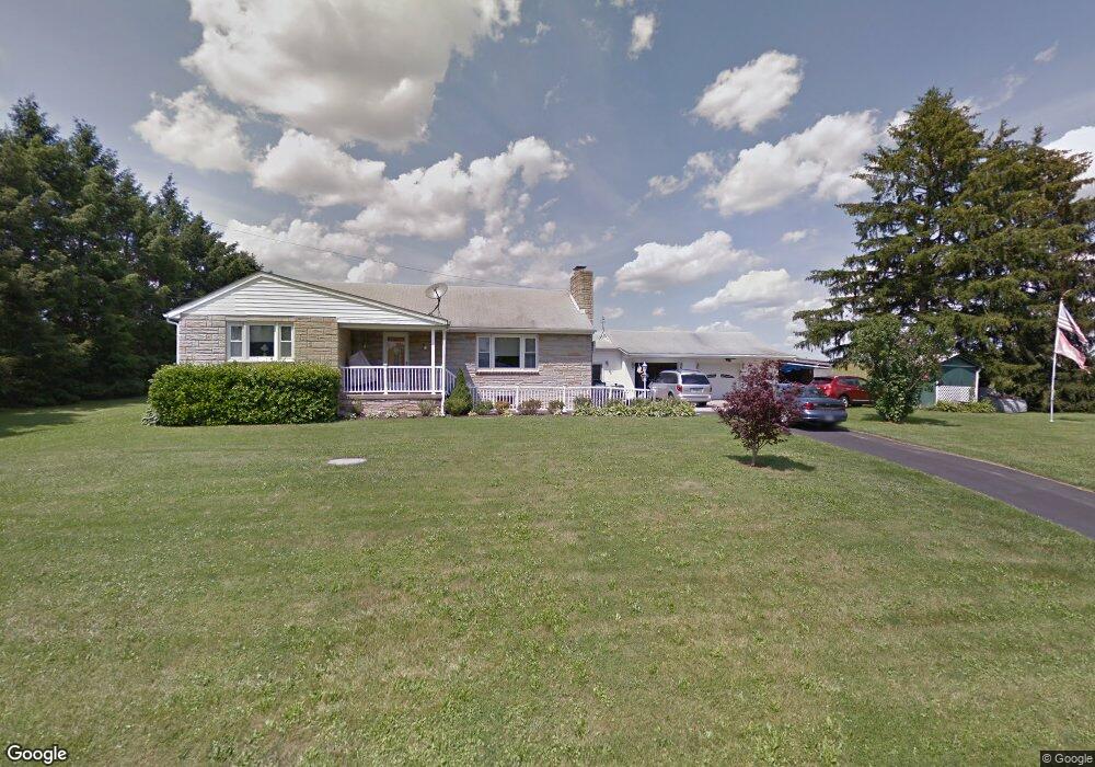
4210 Watson Ln Union Bridge, MD 21791
Estimated Value: $371,662 - $522,000
Studio
1
Bath
2,256
Sq Ft
$188/Sq Ft
Est. Value
About This Home
This home is located at 4210 Watson Ln, Union Bridge, MD 21791 and is currently estimated at $424,916, approximately $188 per square foot. 4210 Watson Ln is a home located in Carroll County with nearby schools including Elmer A. Wolfe Elementary School, Northwest Middle School, and Francis Scott Key High School.
Ownership History
Date
Name
Owned For
Owner Type
Purchase Details
Closed on
Dec 23, 2020
Sold by
Koontz Samantha Danielle and Koontz Brandon Russell
Bought by
Koontz Samantha Danielle
Current Estimated Value
Home Financials for this Owner
Home Financials are based on the most recent Mortgage that was taken out on this home.
Original Mortgage
$292,000
Outstanding Balance
$259,967
Interest Rate
2.7%
Mortgage Type
New Conventional
Estimated Equity
$164,949
Purchase Details
Closed on
Dec 11, 2015
Sold by
Fritz Daniel
Bought by
Shelton Samantha Danielle and Koontz Brandon Russell
Home Financials for this Owner
Home Financials are based on the most recent Mortgage that was taken out on this home.
Original Mortgage
$260,200
Interest Rate
3.62%
Mortgage Type
FHA
Purchase Details
Closed on
Nov 28, 2001
Sold by
Watson Francis E
Bought by
Watson Francis W L E and Watson Phylis B L E
Create a Home Valuation Report for This Property
The Home Valuation Report is an in-depth analysis detailing your home's value as well as a comparison with similar homes in the area
Purchase History
| Date | Buyer | Sale Price | Title Company |
|---|---|---|---|
| Koontz Samantha Danielle | -- | Strategic National Title | |
| Shelton Samantha Danielle | $265,000 | First American Title Ins Co | |
| Watson Francis W L E | -- | -- |
Source: Public Records
Mortgage History
| Date | Status | Borrower | Loan Amount |
|---|---|---|---|
| Open | Koontz Samantha Danielle | $292,000 | |
| Closed | Shelton Samantha Danielle | $260,200 |
Source: Public Records
Tax History
| Year | Tax Paid | Tax Assessment Tax Assessment Total Assessment is a certain percentage of the fair market value that is determined by local assessors to be the total taxable value of land and additions on the property. | Land | Improvement |
|---|---|---|---|---|
| 2025 | $3,556 | $327,100 | $0 | $0 |
| 2024 | $3,382 | $304,400 | $0 | $0 |
| 2023 | $3,215 | $281,700 | $85,000 | $196,700 |
| 2022 | $3,175 | $278,133 | $0 | $0 |
| 2021 | $6,445 | $274,567 | $0 | $0 |
| 2020 | $6,103 | $271,000 | $85,000 | $186,000 |
| 2019 | $2,621 | $257,467 | $0 | $0 |
| 2018 | $2,401 | $243,933 | $0 | $0 |
| 2017 | $2,630 | $230,400 | $0 | $0 |
| 2016 | -- | $229,500 | $0 | $0 |
| 2015 | -- | $228,600 | $0 | $0 |
| 2014 | -- | $227,700 | $0 | $0 |
Source: Public Records
Map
Nearby Homes
- 244 Stem Rd
- 285 Stem Rd
- 0 Stem Rd
- 57B Hoff Rd
- 118 S Clear Ridge Rd
- 101 Clear Ridge Rd
- 314 E Broadway St
- 312 E Broadway St
- 3875 Bark Hill Rd
- 100 George St
- 1038 Green Valley Rd
- 120 Water St
- 3190 Vista Ct
- 3348 Uniontown Rd
- 227 Main St
- 703 S Springdale Rd
- 414 High St
- 107 S Springdale Ave
- 2757 Town View Cir
- 2833 Town View Cir
- 4190 Watson Ln
- 4240 Watson Ln
- 4130 Watson Ln
- 4280 Watson Ln
- 414 Mckinstrys Mill Rd
- 416 Mckinstrys Mill Rd
- 4075 Watson Ln
- 418 Mckinstrys Mill Rd
- 417 Mckinstrys Mill Rd
- 426 Mckinstrys Mill Rd
- 421 Mckinstrys Mill Rd
- 283 Stem Rd
- 230 Stem Rd
- 279 Stem Rd
- 425 Mckinstrys Mill Rd
- 413 Mckinstrys Mill Rd
- 228 Stem Rd
- 275 Stem Rd
- LOT 3 Stem Rd
- 428 Mckinstrys Mill Rd
Your Personal Tour Guide
Ask me questions while you tour the home.